
Page 27: of Marine Technology Magazine (November 2005)
Seafloor Engineering
Read this page in Pdf, Flash or Html5 edition of November 2005 Marine Technology Magazine
 26
26
 28
28
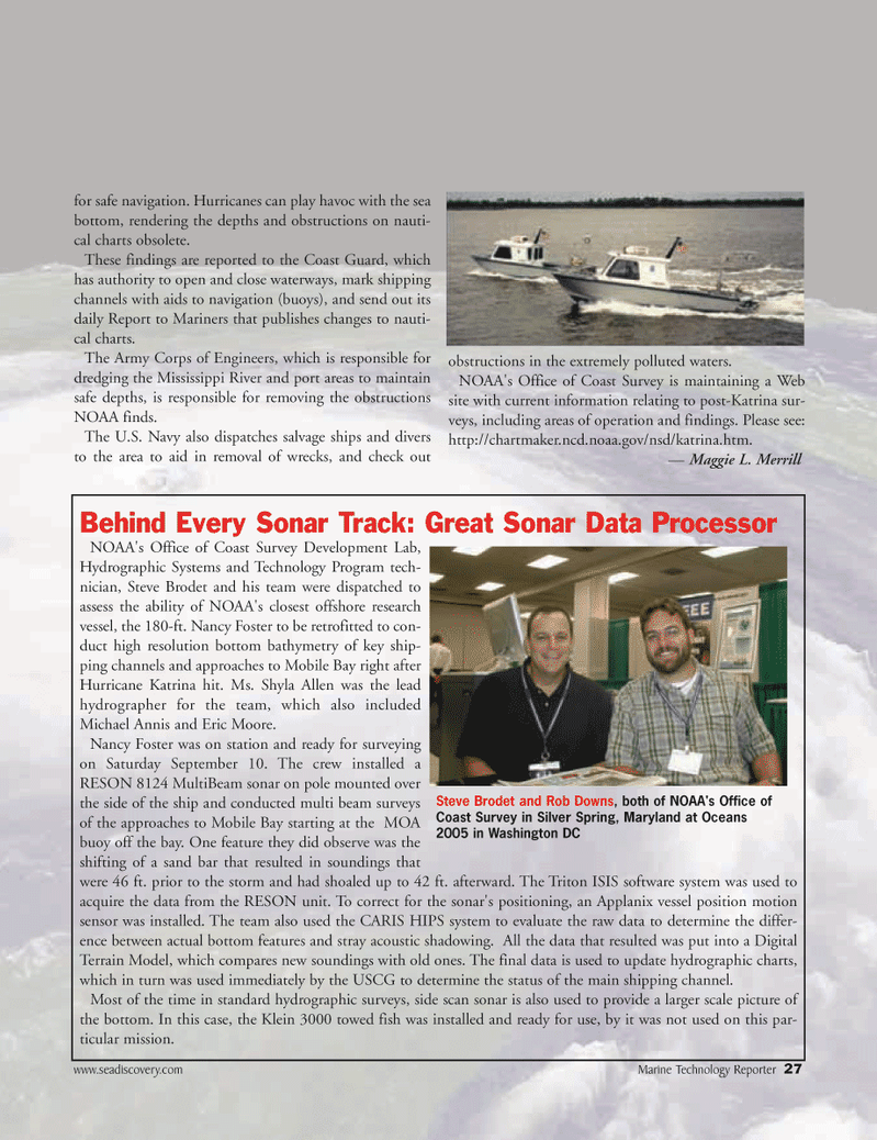
www.seadiscovery.com Marine Technology Reporter 27 for safe navigation. Hurricanes can play havoc with the sea bottom, rendering the depths and obstructions on nauti- cal charts obsolete.
These findings are reported to the Coast Guard, which has authority to open and close waterways, mark shipping channels with aids to navigation (buoys), and send out its daily Report to Mariners that publishes changes to nauti- cal charts.
The Army Corps of Engineers, which is responsible for dredging the Mississippi River and port areas to maintain safe depths, is responsible for removing the obstructions
NOAA finds.
The U.S. Navy also dispatches salvage ships and divers to the area to aid in removal of wrecks, and check out obstructions in the extremely polluted waters.
NOAA's Office of Coast Survey is maintaining a Web site with current information relating to post-Katrina sur- veys, including areas of operation and findings. Please see: http://chartmaker.ncd.noaa.gov/nsd/katrina.htm. — Maggie L. Merrill
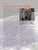
Behind Every Sonar Track: Great Sonar Data Processor
NOAA's Office of Coast Survey Development Lab,
Hydrographic Systems and Technology Program tech- nician, Steve Brodet and his team were dispatched to assess the ability of NOAA's closest offshore research vessel, the 180-ft. Nancy Foster to be retrofitted to con- duct high resolution bottom bathymetry of key ship- ping channels and approaches to Mobile Bay right after
Hurricane Katrina hit. Ms. Shyla Allen was the lead hydrographer for the team, which also included
Michael Annis and Eric Moore.
Nancy Foster was on station and ready for surveying on Saturday September 10. The crew installed a
RESON 8124 MultiBeam sonar on pole mounted over the side of the ship and conducted multi beam surveys of the approaches to Mobile Bay starting at the MOA buoy off the bay. One feature they did observe was the shifting of a sand bar that resulted in soundings that were 46 ft. prior to the storm and had shoaled up to 42 ft. afterward. The Triton ISIS software system was used to acquire the data from the RESON unit. To correct for the sonar's positioning, an Applanix vessel position motion sensor was installed. The team also used the CARIS HIPS system to evaluate the raw data to determine the differ- ence between actual bottom features and stray acoustic shadowing. All the data that resulted was put into a Digital
Terrain Model, which compares new soundings with old ones. The final data is used to update hydrographic charts, which in turn was used immediately by the USCG to determine the status of the main shipping channel.
Most of the time in standard hydrographic surveys, side scan sonar is also used to provide a larger scale picture of the bottom. In this case, the Klein 3000 towed fish was installed and ready for use, by it was not used on this par- ticular mission.
Steve Brodet and Rob Downs, both of NOAA's Office of
Coast Survey in Silver Spring, Maryland at Oceans 2005 in Washington DC
MTR#3 (17-32).qxd 11/14/2005 1:01 PM Page 27