Satellite Imagery
-
- Satellite Images Capture Tanker Pollution Marine Technology, Oct 2013 #21
At a hearing at Truro Magistrates Court, the owner of a tanker paid a total of $36,000 in fines and costs after pleading guilty to a breach of U.K. maritime pollution legislation. On February 25, 2012 a satellite operated by European Maritime Safety Agency (EMSA) detected a ship trailing a slick in the waters between Lands End and the Scilly Isles. A report was made to the MCA. The alert level was given as RED, i.e. high confidence. The ship was identified as the Singapore registered tanker Maersk Kiera. The slick itself was within 12 miles of land. The vessel was contacted by Falmouth Coastguard to query whether they were carrying out tank cleaning operations as they had satellite imagery of oil traces in the track of the Maersk Kiera. The Master confirmed to Falmouth Coastguard that tank cleaning and associated discharge following a cargo of palm oil was indeed being undertaken, but that they were complying with International requirements.
Under the Dangerous or Noxious Liquid Substances in Bulk Regulations 1996 (SI 3010) discharge of palm oil slops is permissible subject to certain conditions. One of those conditions is that the discharge is over 12 miles from the nearest land.
Communications between the operators of the Maersk Kiera and the MCA took place. Initial contact on May 11, 2012 with the owners Maersk stated that the vessel had been cleaning tanks, but had stopped before the vessel was within 13.5 miles of the coast. However, the satellite imagery clearly showed a slick trailing behind the vessel when she was within 12 miles of land. Eventually a breach of the U.K. Pollution Legislation was admitted by the owners on March 12, 2012.
The owners of the Maersk Kiera, Maersk Tankers Singapore Pte Limited, were fined £15,000 with a £120 victim surcharge and prosecution costs of £7404.88 were awarded.
Captain Jeremy Smart, Head of Enforcement at the Maritime & Coastguard Agency, said, “This is the first time satellite imagery has been successfully used as primary evidence in a maritime pollution prosecution brought by the Maritime and Coastguard Agency. The Agency will use all means available to identify and prosecute those carrying out illegal discharges within the U.K. Pollution Control Zone.”
(As published in the October 2013 edition of Marine Technology Reporter - www.seadiscovery.com) -
- MG3 & Satellite Derived Bathymetry Marine Technology, Apr 2018 #20
routinely incorporates satellite derived bathymetric data into multiple planning phases of its projects.The firm became acquainted with the uses of satellite imagery for marine applications about five years ago when it teamed on bathymetric survey bids with TCarta, a geospatial solutions company (then called
-
- Making the Great Barrier Reef’s 3D Habitat Map Marine Technology, May 2019 #14
in satellite-mapping technologies, environmental modelling and image classification methods.Using the European Space Agency Sentinel-2 platform satellite imagery, EOMAP applies its industry leading, proprietary technology to retrieve satellite-derived bathymetry (SDB) and sub-surface reflectance (SSR)
-
- Stand-Alone Mosaicking Module Introduced Marine Technology, Nov 2013 #59
mosaicking and logging of broadcast data; interactive control of track layering, processing and sensor offsets; background display of air photos, satellite imagery, raster and vector charts; and Pan, zoom, target marking and vessel track. www.oicinc.com (As published in the November/December 2013 edition
-
- OCEANS '77 Conference Set For October 17-18-19 Maritime Reporter, Oct 1977 #16
Pacific Basin Community, 1:30-4:30 p.m.; (6) Kindergarten to Grade 14 Programs; (7) Undersea Vehicles I; (8) Floating Industrial Complexes; (9) Satellite Imagery Data Acquisition, Processing and Availability; (10) Applications of Underwater Acoustics in the Ocean; 4 p.m.-6 p.m.—(11) Continuing Education
-
- Global Reef Expedition: Mission to Tonga Marine Technology, Mar 2020 #14
in Tonga, to gather the highest quality data. They completed more than 500 benthic coral reef and fish surveys on SCUBA, and over 2,200 km2 of satellite imagery was collected and interpreted into high-resolution habitat and bathymetry maps. The ultimate goal of the Foundation’s research in Tonga
-
- New Weather Satellite Unit Introduced By GPI —Literature Available Maritime Reporter, Oct 15, 1980 #46
equipment of its kind suitable for shipboard installation. "Now, for the first time, vessels can have their own onboard weather satellite imagery updated hour-by-hour throughout most of the Western Hemisphere and in many other high seas and coastal areas of the world," he said. "The
-
- AUV Mission in the Great Lakes Marine Technology, Nov 2016 #18
measured by Tethys actually are in the form of zooplankton abundances and chlorophyll distribution.” Tethys, used in conjunction with surface satellite imagery and vessel-based research, essentially expands the USGS datasets by providing a more accurate depiction of plankton from the surface down. Accordi
-
- Advanced Subsea Marine Technology, Jan 2013 #32
in on the pre-salt area. AS also developed eddies tracking techniques, which can be used either in PRESAL36 outputs or surface currents derived from satellite imagery observation and analysis for any place in the world, said Schoellkopf. The eddies evolution mapping made around the Frade oil field during the
-
- Is it a Ship or Iceberg? Maritime Reporter, Jul 2016 #32
average circulation patterns and the expected deterioration rate (iceberg melt rate) based on long-term weather forecasts. When RADARSAT-2 and other satellite imagery was used by an oil and gas operator off the Falkland Islands, the objective was to characterize iceberg frequency and the extent of downtimes
-
 )
March 2024 - Marine Technology Reporter page: 23
)
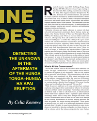
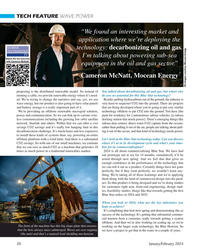
March 2024 - Marine Technology Reporter page: 23modern instrumentation. Booms were heard as far away as Yukon, Canada; widespread atmospheric shockwaves and intense lighting storms were recorded; and satellites captured stunning images of the eruption. This catastrophic event not only shook the world but catalyzed an urgency for understanding sub- marine
-
 )
March 2024 - Marine Technology Reporter page: 22
)
March 2024 - Marine Technology Reporter page: 22FEATURE OCEANOGRAPHIC INSTRUMENTATION & SENSORS Aerial view of HT-HH volcano, showing new multibeam depth data overlaid on islands satellite image. © SEA-KIT, NIWA-Nippon Foundation TESMaP 22 March/April 2024 MTR #3 (18-33).indd 22 4/4/2024 9:08:10 AM
-
 )
January 2024 - Marine Technology Reporter page: 20
)
January 2024 - Marine Technology Reporter page: 20. So we can link up to various wire- push for residency for ] autonomous subsea vehicles, [a subsea less communications including the growing low orbit satellite docking station that needs power]. There’s emerging things like network, Starlink and others. Within that we can offer a cost subsea data centers
-
 )
November 2023 - Marine Technology Reporter page: 25
)
November 2023 - Marine Technology Reporter page: 25site housed an active dam approach- transforming the way professionals nav- nology provides unparalleled precision ing the end of its lifespan and histori- igate and explore underwater environ- and ef? ciency. Elevate your operations cal remains of a previous dam from the ments. From military and governmen
-
 )
November 2023 - Maritime Reporter and Engineering News page: 73
)
November 2023 - Maritime Reporter and Engineering News page: 73liberation is well within reach with see what the market bares now that might meet our collective the only limiting factor being availability and full satellite needs. constellation deployment, which will occur sometime this The RDC has been evaluating and testing Starlink and re- year, depending on the
-
 )
November 2023 - Maritime Reporter and Engineering News page: 30
)
November 2023 - Maritime Reporter and Engineering News page: 30. This data comes from modelled data from global to several factors including material fatigue and the forces im- weather and marine models as well as satellite, lightning, weather posed on the hull as a result of the weather conditions. station, wave buoy, current meter, and tide gauge data. Some data Survey
-
 )
November 2023 - Maritime Reporter and Engineering News page: 22
)
November 2023 - Maritime Reporter and Engineering News page: 22Conference at this year’s London In- T ternational Shipping Week examined how the industry can move from talk to practical solutions that can ensure satellite technology plays a decisive role in shaping smarter and more sus- tainable shipping. Inmarsat Maritime presi- dent Ben Palmer provided the scene-settin
-
 )
November 2023 - Maritime Reporter and Engineering News page: 16
)
November 2023 - Maritime Reporter and Engineering News page: 16robots speci? cally designed to the operator and the robot, optimizing how limited radio or target microfouling (the early slime and algae that forms satellite bandwidth is used. A vessel’s crew merely needs on ship hulls), hull cleaning can be completed more eco- to communicate back to Greensea IQ that
-
 )
September 2023 - Marine Technology Reporter page: 75
)
September 2023 - Marine Technology Reporter page: 75Teledyne Marine Osprey Autonomous Underwater Vehicle Teledyne Marine is a leader in marine technology, special- Its maneuverability enables researchers to access remote or izing in providing a comprehensive suite of subsea solutions. complex underwater areas easily. With a history spanning decades,
-
 )
September 2023 - Marine Technology Reporter page: 70
)
September 2023 - Marine Technology Reporter page: 70MTR 100 RS AQUA RTSYS https://rsaqua.co.uk/ https://rtsys.eu/ RS Aqua provides sensors and systems RTsys is a French company special- for monitoring ocean environments. izing in underwater acoustics (passive Based in Portsmouth, England, it re- and active) and autonomous underwa- OSIL th cently celebrated
-
 )
September 2023 - Marine Technology Reporter page: 69
)
September 2023 - Marine Technology Reporter page: 69OCEAN ALPHA www.OceanAlpha.com OceanAlpha Group is a commer- cial unmanned surface vehicle (USV) company. It has grown from a single small offce in 2010 to a workforce of over 569 employees today, with more than 200 R&D engineers and 430+ pieces of USV related patents. Ocean- Alpha’s business involves
-
 )
September 2023 - Marine Technology Reporter page: 51
)
September 2023 - Marine Technology Reporter page: 51back in real time over the available redundant communi- cations methods including RF for line of sight, cellular for nearshore when available, and satellite for over the ho- rizon operations. The USV can also be equipped with custom communications www.marinetechnologynews.com 51 MTR #7 (50-65).indd
-
 )
September 2023 - Marine Technology Reporter page: 32
)
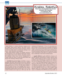
September 2023 - Marine Technology Reporter page: 32MTR 100 Kraken Robo ics Mount Pearl, Newfoundland and Labrador President/CEO: Greg Reid # of employees: 245 www.krakenrobotics.com Kraken Robotics is a marine technology company provid- simultaneous 3D bathymetry. *1.9 cm x 2.1 cm constant reso- ing complex subsea sensors, batteries, and robotic systems.
-
 )
September 2023 - Marine Technology Reporter page: 30
)
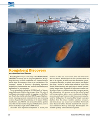
September 2023 - Marine Technology Reporter page: 30MTR 100 Kongsberg Discovery www.kongsberg.com/discovery Kongsberg Discovery is a new entity within KONGSBERG has been to make data access easier, faster and more secure GRUPPEN. Formerly part of Kongsberg Maritime, Kongs- than ever before. Blue Insight is the one system that binds all berg Discovery has
-
 )
September 2023 - Marine Technology Reporter page: 23
)
September 2023 - Marine Technology Reporter page: 23to provide a ground truth for the satel- lite. The four Wirewalker moorings are part of an overall 11 mooring array, situated directly under the satellite ? ight path to gather snapshots of steric height for comparison with the measurements gathered from space. The Cal/Val moor- ings are designed
-
 )
September 2023 - Marine Technology Reporter page: 18
)
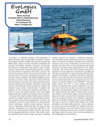
September 2023 - Marine Technology Reporter page: 18EvoLogics GmbH Berlin, Germany President/CEO: Dr. Rudolf Bannasch, Fabian Bannasch # of employees: 50 https://evologics.de/ EvoLogics is a high-tech enterprise with headquarters in complex processes by seamlessly combining communica- Berlin, Germany, and a US sales of? ce in Yorktown, Virginia. tion
-
 )
September 2023 - Marine Technology Reporter page: 9
)
September 2023 - Marine Technology Reporter page: 9drone-like experience for users, underwater. The result was allowing for data to be retrieved in real time, as the station Hydrus, a fully autonomous submersible vehicle transforming is wired to a communication modem. Researchers will have undersea research, inspection, detection and classi? cation by
-
 )
September 2023 - Maritime Reporter and Engineering News page: 21
)
September 2023 - Maritime Reporter and Engineering News page: 21a user onsite to capture monitoring. For remote operations, the technical experts onshore, more simul- and stream video, with two-way audio load on satellite communications is far taneous work can be undertaken more communication, with experts viewing higher due to the requirement for ex- ef? ciently
-
 )
September 2023 - Maritime Reporter and Engineering News page: 20
)
September 2023 - Maritime Reporter and Engineering News page: 20to effectively digitalize their operations. Additionally, the technology enables an inspector to carry Nonetheless, changes in the availability of satellite band- out remote audits and inspections on several vessels simulta- width and the ability to use technology to better utilize avail- neously, alongside
-
 )
June 2023 - Marine News page: 39
)
June 2023 - Marine News page: 39- Eliminates the hazards and time restrictions of sending Bayonet vehicles are built on OPENSEA from underwa- a person into the ocean for data collection. ter robotics software company Greensea Systems, based in - A platform that can perform multiple roles in an op- Richmond, Vt. OPENSEA provides Bayonet
-
 )
June 2023 - Marine News page: 19
)
June 2023 - Marine News page: 19mutu- ally recognizing and agreeing on new laws and regulations. As a maritime society, we have pro- gressed from sails to engines, from sex- tants to satellites, and from parallel rul- ers to GPS networks setting courses. As technology has advanced, the maritime industry has collaborated and met the challenges
-
 )
August 2023 - Marine News page: 45
)
August 2023 - Marine News page: 45? cient already commenced at the beginning OneWeb’s LEO Network mixed-? ow pump design, compact of 2023. MAN is currently planning a Flat panel satellite antenna company in-board footprint, narrow width for ? rst retro? t project based on an MAN Kymeta and low Earth orbit (LEO) compact driveline
-
 )
August 2023 - Marine News page: 20
)
August 2023 - Marine News page: 20solar powered “drifter” hull to track a voy- age across the Atlantic Ocean. Students in the program de- signed and built the boat, and then tracked it by satellite. The project allowed them to learn about ocean currents, weather, hull integrity and GPS technology. The ? rst drifter launched off the U.S. East
-
 )
May 2023 - Marine Technology Reporter page: 42
)
May 2023 - Marine Technology Reporter page: 42landing stations connected workforce and more ? exibility and reliability com- (CLS) – one located at Praia Grande, state of São Paulo and the pared to satellite connections that can be severely impacted by other at Praia da Macumba, state of Rio de Janeiro. weather and other natural events. Petrobras is