Trimble
-
- Trimble Navigation Introduces Integrated GPS Receiver And Antenna In One Unit Maritime Reporter, Apr 1991 #87
Trimble Navigation, Sunnyvale, Calif., has introduced another innovative GPS product: integrated GPS receiver and antenna in one unit.
The Acutis® GPS is a complete three-channel GPS (Global Positioning System) receiver and antenna, integrated into a rugged, weatherproof case that mounts like an antenna.
The Acutis uses the industry standard NMEA-0183 output so that it will interface with other plotters, chart plotters and SatNavs, and can be installed within minutes.
This versatility allows the Acutis to be moved from boat to boat. It is built around an advanced threechannel design that is capable of tracking up to eight satellites at once, even when subjected to severe acceleration.
The design guarantees more stable operation even under adverse receiving conditions and allows the Acutis to make very precise instantaneous velocity measurements. It performs a new velocity calculation once a second and updates the display every five seconds.
The Acutis GPS is an economical way to upgrade to GPS navigation equipment without requiring installation of additional instruments or learning a new system.
Trimble is one of the world leaders in the emerging commercial market for satellite-based navigation and position data products using the U.S. Government-funded Global Positioning System (GPS).
Trimble designs, manufactures, and markets electronic instruments and systems for determining precise geographic location. These products are sold in a variety of markets including survey and mapping, Geographic Information Systems (GIS), marine, aviation, vehicle tracking, military applications, and differential GPS systems. The company, founded in 1978 and located in the heart of Silicon Valley, Calif., has been selling GPS to the world market since 1984.
For a free copy of a 16-page fullcolor booklet describing Trimble GPS products, Circle 38 on Reader Service Card
-
- Trimble Introduces GPS With Integrated Loran And Electronic Charts On CDs Maritime Reporter, Apr 1989 #78
Trimble Navigation, a leader and innovator in GPS and Loran technology, recently introduced the NavGraphic II GPS-Loran with optional charts. Similar to the company's classic 10X GPS system, the NavGraphic II GPS is a dual channel, slow sequencing, high performance receiver. And like its predecessor
-
- Trimble Introduces NavGraphic Loran Track Plotter, And New Digital Version Of 10X Loran Maritime Reporter, Jun 1988 #90
Trimble Navigation of Sunnyvale, Calif., recently introduced a new product, the NavGraphic loran track plotter, as well as a new digital version of their 10X loran. The NavGraphic loran plotter enables a navigator to see at a single glance where he is relative to significant waypoints, hazards
-
- Trimble Introduces The New LorarrGPS 10X Maritime Reporter, Oct 15, 1985 #28
—Literature Available Trimble Navigation of Mountain View, Calif., recently introduced its newest navigation aid, the Loran*GPS 10X. The combined Loran-GPS (Global Positioning System) 10X provides among the most precise position, navigation, velocity and time systems available. According to the manu
-
- New Loran Introduced B\ Trimble Navigation- Literature Available Maritime Reporter, Apr 1983 #104
Trimble Navigation of Mountain View, Calif., recently introduced a new Loran receiver, the model 200. The 200 offers all the features of the 100A model and some new ones at a 40 percent reduction in price. A brochure is offered describing the capabilities of the receiver. The 200 Loran features
-
- Literature Published On Navigation Computer System From Trimble Maritime Reporter, Oct 1981 #13
Trimble Navigation recently introduced a powerful new navigation computer system, CS-1 that incorporates graphics display and printout capability. The CS-1 can be used for piloting, position monitoring, trip logging, trip planning, and a variety of special computations including true wind, set and
-
- Trimble Navigation Selects Tru-Chart Electronic Charts On CD-ROM Maritime Reporter, Nov 1991 #90
. has supplied nautical chart CD-ROM discs for the popular NavGraphic II GPS/LORAN Electronic Charting System. The NavGraphic II is manufactured by Trimble Navigation, Ltd. of Sunnyvale, Calif. The NavGraphic II is a fully selfcontained Loran-C/GPS navigation system which incorporates a highresolution
-
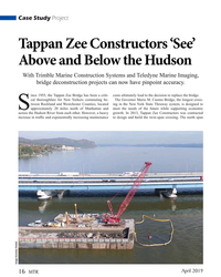
- Tappan Zee Constructors ‘See’ Below the Hudson Marine Technology, Mar 2019 #16
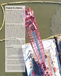
With Trimble Marine Construction Systems and Teledyne Marine Imaging, bridge deconstruction projects can now have pinpoint accuracy.The Project @ a GlanceCustomer Profile: Tappan Zee Constructors, LLC is a consortium – including Fluor Enterprises, Inc., American Bridge Company, Granite Construction
-
- New ‘Eyes’ on the Prize Maritime Logistics Professional, Jul/Aug 2019 #34
Tappan Zee Constructors ‘See’ Below Hudson River with Trimble Marine Construction Systems and Teledyne Marine Imaging.Since 1955, the Tappan Zee Bridge has been a critical thoroughfare for New Yorkers commuting between Rockland and Westchester Counties, located approximately 20 miles north of Manhattan and
-
- D-Day Mapping Mission Marine Technology, Mar 2014 #56
National) and Department of Underwater and Undersea Archeological Research (DRASSM) were involved as well. Involvement from Sherrell Ocean Services, Trimble Navigation, Ltd. and Measutronics Corporation, a Trimble authorized marine dealer, was also instrumental in making this expedition possible. Each
-
- T r i m b l e N a v i g a t i o n I n t r o d u c es The M o d e l 3 0 0 L O R A N C o m p u t er — L i t e r a t u r e A v a i l a b le Maritime Reporter, Apr 15, 1984 #51
The Trimble Navigation Model 300 LORAN Computer combines LORAN-C technology, state-of-the-art computer technology, and traditional dead-reckoning navigation in one small, easy to use package. It gives the navigational information rapidly and with accuracy. In its Dead Reckoning Mode it can compute dead
-
- Ocean Influencer: Mike Read, Teledyne Marine Marine Technology, Jun 2020 #39
new and exciting emerging markets. As experts in real-time underwater vision, we’re combining our technologies and partnering with organizations such as Trimble and DSC Dredge to provide operators of heavy machinery on barges and dredges with tools to improve their efficiency and effectiveness.”Challenges
-
 )
March 2023 - Marine Technology Reporter page: 59
)
March 2023 - Marine Technology Reporter page: 59map land and sea. T7 Teledyne Marine Teledyne Marine is a world class Marine Systems business that is part of Teledyne Technologies Incorporated. Trimble Applanix K13 Trimble Applanix is transforming the world of marine mobile mapping. It builds, delivers, and supports products and solutions designed
-
 )
July 2020 - Marine Technology Reporter page: 40
)
July 2020 - Marine Technology Reporter page: 40is a group of leading- table, and cost-effective package. The ity and improved range performance. edge subsea technology companies that combination of Trimble’s precise head- All M Series sonars operate while in are part of Teledyne Technologies Inc. ing and positioning/guidance paired motion or from
-
 )
April 2020 - Marine Technology Reporter page: 44
)
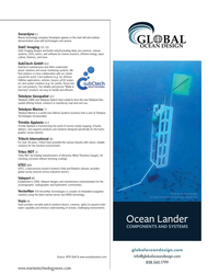
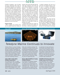
April 2020 - Marine Technology Reporter page: 44New Products Innovative new products, technologies and concepts Trimble Outfts New Teledyne Unmanned Survey Vessel Klein Marine Systems Teledyne Marine eledyne Marine released a new un- manned survey vessel – the Teledyne Z-Boat 1800-T. The survey vessel will be equipped with Trimble’s GNSS heading
-
 )
Jul/Aug 2019 - Maritime Logistics Professional page: 48
)
Jul/Aug 2019 - Maritime Logistics Professional page: 48Marine Terminal ............................................... 26 Nash, Lou .............................................................. 34, 35 Trimble Marine Construction Systems ................ 34, 35, 36 East Asiatic Company ................................................... 31 New Haven, Port
-
 )
Jul/Aug 2019 - Maritime Logistics Professional page: 36
)
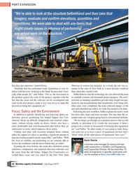
Jul/Aug 2019 - Maritime Logistics Professional page: 36before they go under.” is business area manager for marine and spe- Scanning the river bottom, the team also identi? ed eroded cialty construction in Trimble’s Civil Engineering structures, components and materials that had collected over and Construction Division. He has more than 15 years of experience
-
 )
Jul/Aug 2019 - Maritime Logistics Professional page: 35
)
Jul/Aug 2019 - Maritime Logistics Professional page: 35a crew would likely excavate in a grid-like pattern in the general location of the old pier, from one end to the other. In- stead, he was able to use the Trimble system on a Manitowoc 999 crawler crane with a clamshell tool to clean up the bottom of the river where the old pier was dismantled. The software
-
 )
Jul/Aug 2019 - Maritime Logistics Professional page: 34
)
Jul/Aug 2019 - Maritime Logistics Professional page: 34PORT EXPANSION New ‘Eyes’ on the Prize Tappan Zee Constructors ‘See’ Below Hudson River with Trimble Marine Construction Systems and Teledyne Marine Imaging. By Kevin Garcia ince 1955, the Tappan Zee Bridge has been a critical thoroughfare for New Yorkers commuting between Rockland and Westchester
-
 )
Jul/Aug 2019 - Maritime Logistics Professional page: 6
)
Jul/Aug 2019 - Maritime Logistics Professional page: 6segment, and then, there is “everything else.” By Barry Parker 34 New ‘Eyes’ on the Prize Tappan Zee Constructors ‘See’ Below Hudson River with Trimble Marine Construction Systems and Teledyne Marine Imaging. By Kevin Garcia 38 Offshore Wind: Close to Construction? The beginning of July
-
 )
Jul/Aug 2019 - Maritime Logistics Professional page: 4
)
Jul/Aug 2019 - Maritime Logistics Professional page: 4Kevin Garcia is business area manager for tect (CSSA). Mr. Mayger can be contacted at [email protected] marine and specialty construction in Trimble’s [email protected]. Civil Engineering and Construction Division. He has more than 15 years of experience in 5 John McLaurin is President
-
 )
April 2019 - Marine Technology Reporter page: 21
)
April 2019 - Marine Technology Reporter page: 21and emergency shoulders and with safely demolishing the old bridge. Tappan Zee Constructors reached out to the Measutron- ics Corporation and the Trimble Marine Con- struction team to improve productivity across the removal of the old bridge. Solution: Trimble Marine Construction Software (TMC), Trimble
-
 )
April 2019 - Marine Technology Reporter page: 20
)
April 2019 - Marine Technology Reporter page: 20Case Study Project Image Courtesy Trimble cab Teese can see precisely on the ground under the water ers. Divers also have a more predictable and well-document- where his boom point is compared to the terrain. ed plan before they go underwater to work, which improves The software follows a ‘traf
-
 )
April 2019 - Marine Technology Reporter page: 19
)
April 2019 - Marine Technology Reporter page: 19Teese, a machine operator COST-EFFECTIVE with the International Union of Oper- NAVIGATION CORE ating Engineers 825 in New York, said using Trimble’s positioning equip- IDEAL WHERE ment has been a signi? cant advance- SPACE IS AT A ment compared to conventional ‘hunt- PREMIUM ing and pecking’
-
 )
April 2019 - Marine Technology Reporter page: 18
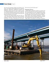
)
April 2019 - Marine Technology Reporter page: 18for subsurface applications. Measutronics calibrated the equipment and Eliminating Unknowns installed the systems and all the sensors. Once the system Trimble Marine Construction software was used on all was calibrated, Measutronics was able to check against the tools across the project for excavation
-
 )
April 2019 - Marine Technology Reporter page: 17
)
April 2019 - Marine Technology Reporter page: 17accommo- see it, so you really don’t know what’s happening,” said Lou date commuter rail. Nash, president of Measutronics Corporation, an integrator of Trimble Marine technology. Challenges Tappan Zee Constructors consulted with Nash, the Mea- When it began in 2013, the Governor Mario M. Cuomo sutronics
-
 )
April 2019 - Marine Technology Reporter page: 16
)
April 2019 - Marine Technology Reporter page: 16Case Study Project Tappan Zee Constructors ‘See’ Above and Below the Hudson With Trimble Marine Construction Systems and Teledyne Marine Imaging, bridge deconstruction projects can now have pinpoint accuracy. ince 1955, the Tappan Zee Bridge has been a criti- costs ultimately lead to the decision to
-
 )
April 2019 - Marine Technology Reporter page: 2
)
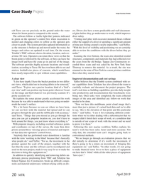
April 2019 - Marine Technology Reporter page: 2April 2019 Case Study Contents Volume 62 • Number 3 16 The Tappen Zee With Trimble Marine Construction Systems and Teledyne Marine Imaging, bridge deconstruction projects can now have pinpoint accuracy. Business 24 The Subsea Model While tech takes center stage, the author contends that the real
-
 )
July 2018 - Maritime Reporter and Engineering News page: 56
)
July 2018 - Maritime Reporter and Engineering News page: 56high-quality repair. also exist and are available on annual www.truepropsoftware.com subscription packages. Major players in this area include Fugro, Trimble and The enhanced Fleet Management features of Hemisphere GNSS. The implementation The Portable Pilot Unit cost is lower than that of a dedicated
-
 )
May 2017 - Marine News page: 33
)
May 2017 - Marine News page: 3399 miles east and west (about 198 miles total) up and down river from Cincin- nati and Covington. PCNK now runs from Scioto County, OH, to the east to Trimble County, KY, downriver, about halfway to Louisville. Obviously, an almost ten-fold en- www.marinelink.com MN 3
-
 )
November 2016 - Marine Technology Reporter page: 26
)
November 2016 - Marine Technology Reporter page: 26quantities of men and equipment 2013 Hydrographic Survey quickly from ship to shore, without the need for established The survey was conducted using Trimble RTK with a CODA harbors. His various boats included the LCVPs (Land Craft, F-175 motion reference unit and advanced multi-beam, pole- Vehicle, Personnel)
-
 )
December 2016 - Marine News page: 55
)
December 2016 - Marine News page: 55PEOPLE & COMPANY NEWS Guerra Ayotte Trimble Allegretti Parker Watts AMP Names Senator Ayotte ‘Champion of Maritime’ The American Maritime Partnership (AMP), the voice of the domestic maritime industry, recognized U.S. Senator Kelly Ayotte (R-NH) in Oc- tober with the 2016 Champion of Maritime Award.
-
 )
June 2016 - Marine Technology Reporter page: 29
)
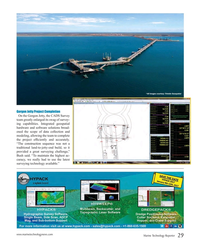
June 2016 - Marine Technology Reporter page: 29*All images courtesy: Trimble Geospatial Gorgon Jetty Project Completion On the Gorgon Jetty, the CADS Survey team greatly enlarged its swag of survey- ing capabilities. Integrated geospatial hardware and software solutions broad- ened the scope of data collection and modeling, allowing the team to
-
 )
June 2016 - Marine Technology Reporter page: 26
)
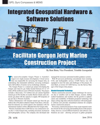
June 2016 - Marine Technology Reporter page: 26Compasses & MEMS Integrated Geospatial Hardware & Software Solutions Facilitate Gorgon Jetty Marine Construction Project By Ron Bisio, Vice President, Trimble Geospatial he soon-to-be-complete Gorgon Project is Australia’s managed the necessary automated module guidance systems. largest ever single-resource
-
 )
November 2015 - Marine Technology Reporter page: 47
)
November 2015 - Marine Technology Reporter page: 47in Aberdeen, Md. The company introduced pilot trainees when securing employment.” the Hydrolite-TM portable survey system in 2005, which in- corporated a Trimble GeoXT handheld with a survey grade Ocean Energy Committee Members Selected echosounder integrated to a small vessel mountable mounting The Bureau
-
 )
May 1977 - Maritime Reporter and Engineering News page: 10
)
May 1977 - Maritime Reporter and Engineering News page: 10de- signs include cost, environmental impact, safety, sea motions and demand for product. T5-4 "Engineering Aspects of OTEC Systems" by L.C. Trimble. SYNOPSIS—The plant described is a closed-loop thermodynamic cycle with ammonia as the work- ing fluid. Considered are the en- gineering aspects