Image Processing
-
- Mapping the Abyss with AUV Photography Marine Technology, Mar 2015 #32
Despite being one of the largest habitats on Earth occupying around 60% of the surface, the deep-sea environment remains largely enigmatic. It was only in the late 1960’s that the abyssal plains were recognized to contain rich, complex habitats and play an important role in global carbon cycling. The technological and operational challenges that come with studying deep-sea environments have previously restricted research into the inhabiting species and ecosystem structure. The development of a novel photographic method for deep-diving Autonomous Underwater Vehicles (AUV), hails major advancements in deep-sea research, enabling scientists to map entire communities of benthic megafauna on remarkable scales.
The evolution of underwater vehicles and imaging technology has amplified efforts in seafloor mapping over the last decade. Only in recent years has more significance been placed on the location of species and the factors that influence ecosystem dynamics and biodiversity.
The intensification of industrial movements within the deep-sea setting creates the potential for loss in species abundance and many ecosystem services. Additionally, climate change can cause unexpectedly large changes to the deep-sea environment. As such, research into how these factors will impact deep-sea ecosystems has become a priority for many scientists. This can only be achieved however by understanding how these habitats work at present, which is critical for the ability to manage and conserve deep-sea environments in the future.
“If we wish to understand how the oceans work and what impact climate change may have on the function of the oceans, it is vital we understand the abundance, distribution and biodiversity of animals in the deep-sea,” said Dr. Kirsty Morris, Seabed Image Analyst at the UK’s National Oceanography Center (NOC) and the lead author of this research, published in ‘Limnology and Oceanography: Methods.’ “Only by knowing this, will we be able to begin to understand what impact climate change may have on the oceans productivity and carbon sequestration ability as a whole. It will also allow us to assess the impact of human activities such as deep-sea mining, oil and gas exploration, and the increasing presence of litter.”
Deepsea Survey Methods
Conventional methods for the study of deep-sea megafauna include trawl sampling and photographic and video surveys. Deep-sea trawling has often been used to assess diversity and density of species, but this method poses some technical issues and can only be used over a relatively small area. Scientific trawling can also be time consuming and does not provide spatial information on how the individuals were distributed. Furthermore, some species can be destroyed altogether in the process and often considerably under represented.
Towed cameras have much the same issues. While off-bottom towed cameras are able to provide within-transect spatial data, the tethered systems can be effected by swell causing difficulties in controlling the position, altitude, and speed of the camera. On-bottom towed camera sleds do have better stability but can damage the seabed and consequently the induced turbidity can cause issues with the image quality.
Remote Operated Vehicles (ROVs) are seeing an increasing use in deep-sea underwater exploration, and can now reach depths of up to 6,000 meters. ROVs are valuable in deep-sea studies as they are able to retrieve samples and provide researchers with high resolution imagery. The limitations however are that they once again cannot be used for large survey areas and require a lot of dedicated ship time, limiting the other science that can occur in conjunction.
AUVs can act as stable imaging platforms and cover large survey areas with little environmental impact in the form of noise pollution and disturbance. Additionally, AUVs do not require continuous lighting and can also collect large volumes of data efficiently without consuming ship resources. The species that are regularly under represented by other sampling methods can be observed and identified. At the same time, local environmental data such as habitat and resource availability can be recorded along with spatial and quantitative data. As such, it is recognized that AUVs have the potential to unlock previously inaccessible areas and rapidly increase our knowledge of species distribution across survey areas reaching up to landscape scales.
New Method for Deepsea Mapping
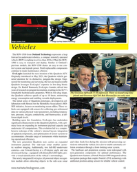
A new photographic processing technique developed by scientists at the National Oceanography Centre (UK), used a camera on the Autosub6000 AUV to enable them to take a continuous stream of high resolution photographs of life on the sea floor. This method was developed and tested as part of the NERC funded AESA (Autonomous Ecological Surveying of the Abyss) project and revealed a tenfold increase in the precision of deep-sea ecosystem diversity estimates, relative to the use of scientific trawling.
“We have developed a method where we are able to take a continuous image of the seafloor over scales not previously achieved. This was done by using an AUV to take images every 0.87 seconds with an overlap between each of the images,” said Dr. Morris. “This data can then be used to create maps of the seabed, detailing how many animals are present, where they are present in relation to one another and in relation to any features on the sea-bed, such as hills.”
Dr. Kirsty Morris was part of the team of scientists who developed an automated program where each of the images were corrected for non-uniform illumination (where one side of the image is darker than the other). A color correction also had to be applied where the red, blue and green light was ‘lost’ through the water column from the AUV to the seafloor. Each image was then geo-referenced using the heading, pitch and roll, recorded from the vehicle and re-scaled so that each pixel within each image represented the same area.
Using the positions of the images, it was then possible to work out the overlap and place them together in 10 image segments called tiles. Once these tiles were annotated for the presence and size of animals, the positions, length and identification of individual animals were recorded, creating a map of biodiversity on the seafloor.
“This technology is important because it allows us to create an image of the deep-sea over large areas, almost like a google street view. This is done in a cost effective manner using the AUV, meaning that the ship can be collecting other samples at the same time,” Dr. Morris said. “From these images, we get an insight into the deep-sea environment on scales not previously possible, which will enhance our understanding of that environment and our impact on it.”
The Future of AUV Photography
As climate change and growing human activity intensifies the pressure on seafloor resources, it is increasingly important to better document deep sea marine biodiversity and ecosystems. Technological advances such as deep-sea ROV and AUV systems have allowed us to begin accessing areas which were previously not possible. As these systems advance, there is an increased ability to cover even larger areas and develop more advanced mapping tools.
“It is hoped that there will be an increase in automation both in the image processing and in the image annotation. Automated annotation is something that would allow us to process the images and obtain results quicker; this is currently being worked on by some colleagues in Germany,” said Dr. Morris.
While this technique was developed to map the distribution and biodiversity of remote deep-sea communities, there are many applications which would benefit from AUV photography, with the potential to increase along with improved automation.
“I am currently working on a system to automatically detect and measure phytodetritus (organic particulate matter resulting from phytoplankton and other organic material in surface waters falling to the seabed) aggregation on the seabed using these images,” said Dr. Morris, “This will allow us to discern any link between the distribution of these aggregates with the topography of the seafloor and the animals that are in that area.”
The distribution, abundance and biodiversity of communities within any habitat is particularly important when establishing marine conservation areas. The method developed by NOC is currently being used to assess changes within community structure over a three year period within a marine conservation zone, Haig-Fras, in the Celtic sea.
A project called Shelfseas Biogeochemistry (SSB), will also utilize this technique to map out four different transect areas with various seafloor substrate (mud versus sand), assessing species composition in each area and if this changes following the plankton bloom in the spring.
In the future, advancements in automated technology and image processing will allow larger areas of the deep-sea to be mapped, increasing our understanding of the distribution of species, their abundance and biodiversity. This will allow researchers to better predict the impacts of climate change and ocean acidification and the consequent implications this would have for carbon sequestration, impacting the ocean ecosystem as a whole. Accurate environmental assessments of the impacts of human activities, such as deep-sea mining and oil exploration, will also become increasingly vital over the coming years. Not only can this technology accurately assess impacts in the direct vicinity of the activity, it will also be able to assess impacts over areas far larger, which is not economically viable with conventional deep-sea survey methods.
(As published in the March 2015 edition of Marine Technology Reporter - http://www.marinetechnologynews.com/Magazine)
-
- Shipboard Computer Distributed By Magnavox Displays Detailed Charts, Automates Navigation Maritime Reporter, Apr 1985 #125
. Its high-resolution graphics are shown on a highpersistance, anti-glare screen for ready viewing in marine environments. Through computer image processing, Geonav automatically performs the complete range of navigation operations. These include scanning the chart, reading coordinates from navigation r
-
- Lockheed Martin’s Revolutionary AUV Marine Technology, Jan 2014 #30
that results in a 3D image of the desired objects. The Marlin’s software geo-registers each image pixel and constructs a 3D model using advanced image processing techniques. The result is a high-resolution 3D model of the target structure. According to McLeod, “Introduction of new sensors support even more
-
- The 93rd SNAME Annual Meeting— A Special Report Maritime Reporter, Jan 1986 #56
presented to Vassilios E. Theodoracatos for his paper, "An Experimental Study of Elastohydrodynamics of Towed Flexible Cylinders Aided by Video Image Processing." The Graduate Paper Award for 1985 was given to Charles H. Goddard and Udo H. Rowley for their paper, "Implementation of a Computer-Supported
-
- Seabed Imaging Re-imagined Marine Technology, Aug 2020 #44
for a crewed research vessel on hand, with shore based launch and recovery. The next steps for BioCam include the possibility of real-time, in situ image processing and remote awareness of this processed information.BioCam system installation on NOC Autosub6000. Image: Sonardyn
-
- 3D Imagining: Real-time with SAS Marine Technology, Mar 2014 #62
imagery and to generate the corresponding high resolution bathymetry. However, with advances in parallel computing technology and fast algorithms for image processing, it is now practical to perform 3D imaging in real-time using low cost, off-the-shelf Graphics Processing Unit (GPU) technology. One of the
-
- Getting Defensive Marine Technology, Jul 2014 #44
Information Systems and Security; Non-Tactical Enterprise Applications; Undersea & Surface Systems; Research and Technology Development; Biometrics & Image Processing; Acoustics & Acoustic Signal Processing; Undersea Systems, incl. Robotics & Control Systems; Precision Navigation & Timing (PNT); Full-Scale Manufactur
-
- Bringing Magic to the Cruise Experience — the Role of Technology Maritime Reporter, Dec 2002 #24
. For example innovations in projection systems, which utilize the possibilities of laser technology to overcome projector focusing problems because the images look perfect on any surface. In conjunction with image processing computers, it is possible to project via six screens on to a dome without any
-
- All Eyes on Ireland Marine Technology, May 2017 #34
capacity in areas such as biosensors, analytical science, remote sensing, high-speed separations, optical sensors, biochip platforms, video imaging, image processing and information extraction. A number of follow-up investments have since been made by the Marine Institute through both joint national and EU
-
- Klein's Side Scan Sonar, Then and Now Marine Technology, Sep 2017 #16
. So there’s huge changes in the use of combination of computers and navigation with the side scan. There has also been a lot of work on the image processing. You improve the sonar data to expand and enhance the data, and also make the equipment easier to operate. Outside of your own technology
-
 )
March 2024 - Marine Technology Reporter page: 46
)
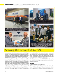
March 2024 - Marine Technology Reporter page: 46put the new eM1-7 electric manipulator through its paces (below); and SMDs Chairman Mike Jones, just after signing a deal with Jan de Nul on its stand. Images courtesy MTR 46 March/April 2024 MTR #3 (34-47).indd 46 4/4/2024 2:39:04 P
-
 )
March 2024 - Marine Technology Reporter page: 44
)
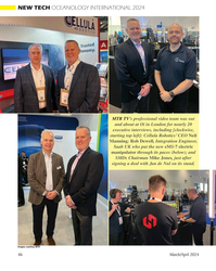
March 2024 - Marine Technology Reporter page: 44NEW TECH OCEANOLOGY INTERNATIONAL 2024 Image courtesy Metron/Cellula Teledyne Marine acquires Valeport: Matt Quartley, MD, Valeport and Ole Søe-Pedersen, VP & Image courtesy Teledyne Marine GM Teledyne Marine announce the deal in London. Pictured (L-R): Cellula Robotics, President, Eric Jackson, Metron
-
 )
March 2024 - Marine Technology Reporter page: 43
)
March 2024 - Marine Technology Reporter page: 43Image courtesy Kongsberg Discovery Image courtesy Teledyne Marine New Products Teledyne Marine had its traditional mega-booth at Oi, busy start to ? nish. Image courtesy Greg Trauthwein offers quality sub-bottom pro? ling capability without the need tion of offshore windfarms. GeoPulse 2 introduces new
-
 )
March 2024 - Marine Technology Reporter page: 42
)
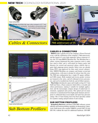
March 2024 - Marine Technology Reporter page: 42NEW TECH OCEANOLOGY INTERNATIONAL 2024 Image courtesy Greg Trauthwein Image courtesy BIRNS MacArtney launches the new ultra-compact ø12.7 mm SubConn Nano connector. Innovative connectivity built on 45 years of ? eld-proven and market-trusted design. Image courtesy MacArtney Birns celebrated its 70th
-
 )
March 2024 - Marine Technology Reporter page: 41
)
March 2024 - Marine Technology Reporter page: 41Image courtesy Outland Technology Image courtesy Exail Image courtesy Submaris and EvoLogics Vehicles The ROV-1500 from Outland Technology represents a leap forward in underwater robotics, a compact remotely operated vehicle (ROV) weighing in at less than 40 lbs (19kg) the ROV- 1500 is easy to transport
-
 )
March 2024 - Marine Technology Reporter page: 37
)
March 2024 - Marine Technology Reporter page: 37miscible barrier ? uid heavier than seawater (sg=1.026) and lighter than the battery electrolyte (sg=1.265). The original cell vent cap was screwed into the top of the riser pipe to vent the gases associated with charging. Wires were soldered to the lead (Pb) posts. The lead-acid battery was additionall
-
 )
March 2024 - Marine Technology Reporter page: 34
)
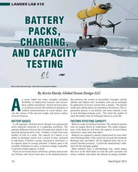
March 2024 - Marine Technology Reporter page: 34LANDER LAB #10 BATTERY PACKS, CHARGING, AND CAPACITY TESTING Photo Credit: Hanumant Singh / Woods Hole Oceanographic Institution. By Kevin Hardy, Global Ocean Design LLC n ocean lander has many strengths including that produces the current is irreversible. Examples include ? exibility of deployment
-
 )
March 2024 - Marine Technology Reporter page: 33
)
March 2024 - Marine Technology Reporter page: 33with visible life present. A second-generation collector, Eureka II, is currently being tested off the US east coast. It has three arms, but the Images courtesy of GSR much larger Eureka III will have 16 arms. Gunasekara estimates that a ? eet of around 16 of these autonomous col- lectors would
-
 )
March 2024 - Marine Technology Reporter page: 32
)
March 2024 - Marine Technology Reporter page: 32Clipperton NORI uplifted 3,000 tons of nodules from depths of four km and Zone of the Paci? c Ocean. transferred them to the hold of the Hidden Gem. All images this page courtesy of TMC Engineers attach ? oat sections to the ? exible jumper hose that connects the four-km-long airlift riser pipe to the
-
 )
March 2024 - Marine Technology Reporter page: 31
)
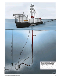
March 2024 - Marine Technology Reporter page: 31of the Hidden Gem production vessel at the surface, an airlift riser system and jumper hose, and the pilot nodule collector vehicle at the sea? oor. Image courtesy of Allseas www.marinetechnologynews.com 31 MTR #3 (18-33).indd 31 4/4/2024 2:12:41 P
-
 )
March 2024 - Marine Technology Reporter page: 30
)
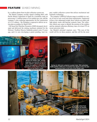
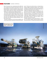
March 2024 - Marine Technology Reporter page: 30and Ken- to be present and alive 12 months after having been in? uenced SMD developed the mining machinery planned for the Solwari 1 sul? des project. Image courtesy of SMD 30 March/April 2024 MTR #3 (18-33).indd 30 4/4/2024 9:15:02 A
-
 )
March 2024 - Marine Technology Reporter page: 28
)
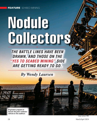
March 2024 - Marine Technology Reporter page: 28ON THE “YES TO SEABED MINING” SIDE ARE GETTING READY TO GO. By Wendy Laursen Engineers prepare to launch the pilot collector vehicle to the sea? oor. Image courtesy of TMC 28 March/April 2024 MTR #3 (18-33).indd 28 4/4/2024 2:10:10 P
-
 )
March 2024 - Marine Technology Reporter page: 25
)
March 2024 - Marine Technology Reporter page: 25was also evidence to the oceans around HT-HH and collecting (formerly known as Lo`ihi, the youngest suggest the volcano was still erupting, video images of the eruption’s impact. volcano in Hawai`i) and West Mata vol- with a dense ash layer found in the up- Equipment on board included a deep- cano
-
 )
March 2024 - Marine Technology Reporter page: 24
)
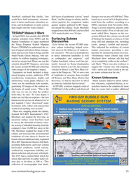
March 2024 - Marine Technology Reporter page: 24tow over the summit of New Volcano 1. This area is roughly 50km from Tongatapu and representative of how Hunga-Tonga Hunga Ha’apai would have looked. Image courtesy NIWA-Nippon Foundation TESMaP / Rebekah Parsons-King 24 March/April 2024 MTR #3 (18-33).indd 24 4/4/2024 1:59:03 P
-
 )
March 2024 - Marine Technology Reporter page: 23
)
March 2024 - Marine Technology Reporter page: 23were heard as far away as Yukon, Canada; widespread atmospheric shockwaves and intense lighting storms were recorded; and satellites captured stunning images of the eruption. This catastrophic event not only shook the world but catalyzed an urgency for understanding sub- marine volcanoes, inspiring new
-
 )
March 2024 - Marine Technology Reporter page: 22
)
March 2024 - Marine Technology Reporter page: 22FEATURE OCEANOGRAPHIC INSTRUMENTATION & SENSORS Aerial view of HT-HH volcano, showing new multibeam depth data overlaid on islands satellite image. © SEA-KIT, NIWA-Nippon Foundation TESMaP 22 March/April 2024 MTR #3 (18-33).indd 22 4/4/2024 9:08:10 AM
-
 )
March 2024 - Marine Technology Reporter page: 18
)
March 2024 - Marine Technology Reporter page: 18TSS440) as the signals from the tracker do not affect the sen- cell ? eld gradient surveys. sor readings. This feature reduces offshore time as a pre-sur- Images courtesy FORCE Technology New version of FiGS in the inspection arm. 18 MTR #3 (18-33).indd 18 4/4/2024 8:59:50 A
-
 )
March 2024 - Marine Technology Reporter page: 16
)
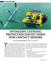
March 2024 - Marine Technology Reporter page: 16TECH FEATURE IMR Image courtesy FORCE Technology OPTIMIZING CATHODIC PROTECTION SURVEY USING NON-CONTACT SENSORS By Svenn Magen Wigen, FORCE Technology he principle behind sacri? cial anodes, which are water structures, reducing the need for frequent repairs and used to safeguard underwater pipelines
-
 )
March 2024 - Marine Technology Reporter page: 15
)
March 2024 - Marine Technology Reporter page: 15sensor options for longer mission periods. About the Author For glider users working in ? sheries and conservation, Shea Quinn is the Product Line Manager the Sentinel can run several high-energy passive and active of the Slocum Glider at Teledyne Webb acoustic sensors, on-board processing, and imaging
-
 )
March 2024 - Marine Technology Reporter page: 14
)
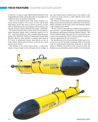
March 2024 - Marine Technology Reporter page: 14TECH FEATURE TELEDYNE SLOCUM GLIDERS to hold over 3.5 times as many lithium primary batteries as the the water column and its thrusters give it the ability to stay standard Slocum Glider, and to physically accommodate up to on track in strong currents or other dif? cult ocean condi- 8 different sensor
-
 )
March 2024 - Marine Technology Reporter page: 11
)
March 2024 - Marine Technology Reporter page: 11assist in identifying mines and act as a neutralization device. About the Author Bottom mines pose even greater chal- David R. Strachan is a defense analyst and founder of lenges. Unlike contact mines, bottom Strikepod Systems, a research and strategic advisory mines utilize a range of sensors to
-
 )
March 2024 - Marine Technology Reporter page: 3
)
March 2024 - Marine Technology Reporter page: 3EMPOWERING World leading electric underwater robotics Seaeye eM1-7 Electric Manipulator • Seven function work class manipulator • Compatible with most work class ROVs • Maximum reach 1,990mm • Lift capacity 122kg/454kg (max/min reach) • Precise position and force feedback • Modular self-contained
-
 )
March 2024 - Marine Technology Reporter page: 2
)
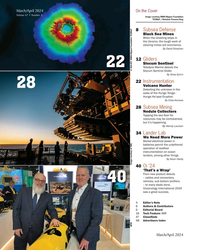
March 2024 - Marine Technology Reporter page: 2March/April 2024 On the Cover Volume 67 • Number 3 Image courtesy NIWA-Nippon Foundation TESMaP / Rebekah Parsons-King 8 Subsea Defense Black Sea Mines When the shooting stops in the Ukraine, the tough work of clearing mines will commence. By David Strachan 12 Gliders Slocum Sentinel 22 Teledyne
-
 )
April 2024 - Maritime Reporter and Engineering News page: 43
)
April 2024 - Maritime Reporter and Engineering News page: 43, research institutes and class societies: all of them are crucial,” – Eero Lehtovaara, Head of Regulatory & Public Affairs, ABB Marine & Ports All images courtesy ABB Marine and Ports providers on developing standards and print and accelerate the commercialized tection. The work would also demand