
Page 17: of Offshore Engineer Magazine (Jan/Feb 2014)
Read this page in Pdf, Flash or Html5 edition of Jan/Feb 2014 Offshore Engineer Magazine
 16
16
 18
18
Analysis
Disputed territory
Several Caribbean countries are embroiled in bitter maritime border disputes.
Sarah Parker Musarra examines the history behind two of Latin America’s most-monitored maritime clashes.
Maps courtesy of Sebastián Machado.
esearch vessel RV Teknik Perdana was conducting a in nature. multibeam seabed survey on the deepwater Roraima The statement continued, calling the action “a serious threat
R exploration block offshore Guyana on Oct. 10, 2013. to the peace of the sub-region.” The strong move made by the
Contracted by Texas-based independent Anadarko, on behalf Venezuelan government was the result of hundreds of years of of the Guyana government as part of their 2012 agreement, the strained relations between the two countries. vessel soon found itself in unfriendly waters when an armed The disputed area is known as Guyana Esequiba, and its
Venezuelan Navy vessel, the Yekuana, “obstructed the research boundaries have been contentious since the mid-1800s, when vessel’s passage, requested them to change course and stop Great Britain set out to delineate the borders of then-British surveying,” according to a statement issued by the Republic of Guyana. The government presented the newly-defned boundar-
Guyana’s Ministry of Foreign Affairs. ies to Brazil and Venezuela.
The Teknik Perdana’s crew insisted that it was within the In 1840, German surveyor and geographer Robert boundaries of Guyana’s economic zone; the Venezuelan Navy, Schomburgk investigated and created the Schomburgk Line as however, did not agree. It maintained that the vessel was within a starting point for the neighboring governments to begin talks.
Venezuela’s economic zone. He saw the Essequibo River as a natural boundary, and the UK “One point is clear and that is that the RV Teknik Perdana claimed all territory west of this boundary. According to the US was in Guyana’s waters when this incident took place,” Department of State Offce of the Historian, Guyana’s territory
Guyana’s Ministry of Foreign Affairs maintained. The crew was augmented an additional 300,000sq mi as a result of the was ordered to pick up speed and sail to Venezuela’s Margarita Schomburgk Line.
Island. The 285-ft survey ship’s 36 crew members were held The government of Venezuela protested, wanting control of onboard while Venezuelan authorities investigated. A state- the mouth of the Orinoco River. Their protests went ignored ment was later released by the Venezuelan government saying by the British; in turn, Venezuela swiftly severed diplomatic that the vessel was performing unauthorized work on the dis- puted waters.
According to Guyana’s
Ministry of Foreign Affairs, “[it] was then clear that the vessel and its crew were not only being escorted out of
Guyana’s waters, but were under arrest. These actions by the Venezuelan naval vessel are unprecedented in Guyana-
Venezuela relations.”
The Guyanese government held fast to its position that there were still many more steps involved before hydrocar- bon production can begin, and
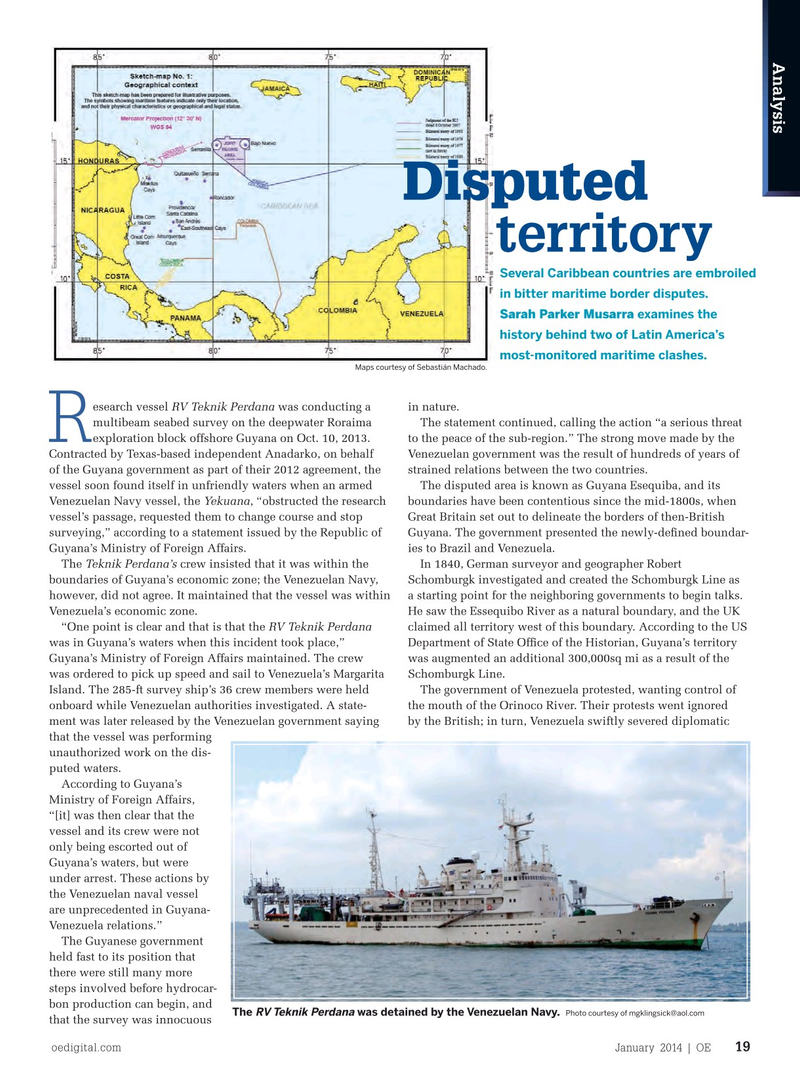
The was detained by the Venezuelan Navy. RV Teknik Perdana Photo courtesy of [email protected] that the survey was innocuous oedigital.com January 2014 | OE 19 019_OE0114_Analysis.indd 19 12/19/13 6:10 PM