
Page 45: of Offshore Engineer Magazine (Mar/Apr 2019)
Deepwater: The Big New Horizon
Read this page in Pdf, Flash or Html5 edition of Mar/Apr 2019 Offshore Engineer Magazine
 44
44
 46
46
FEATURE TECH Seabed Surveillance
All images courtesy Sonardyne
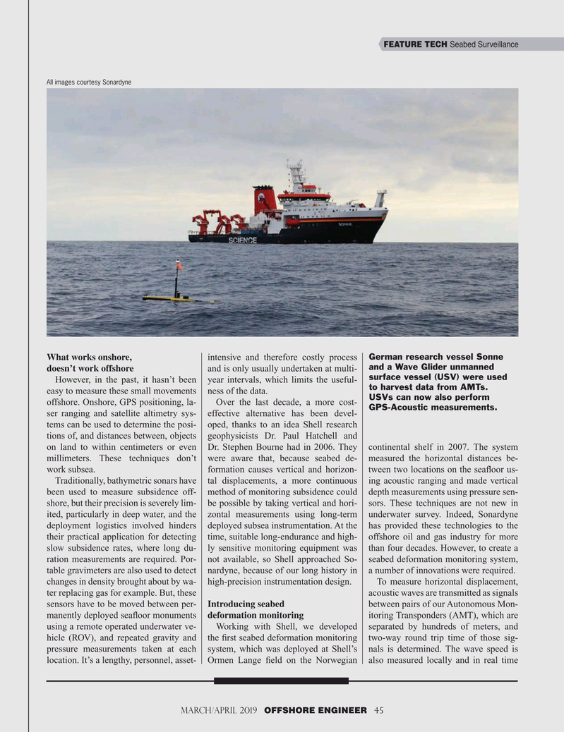
German research vessel Sonne
What works onshore, intensive and therefore costly process and a Wave Glider unmanned doesn’t work offshore and is only usually undertaken at multi- surface vessel (USV) were used
However, in the past, it hasn’t been year intervals, which limits the useful- to harvest data from AMTs. easy to measure these small movements ness of the data.
USVs can now also perform offshore. Onshore, GPS positioning, la- Over the last decade, a more cost-
GPS-Acoustic measurements.
ser ranging and satellite altimetry sys- effective alternative has been devel- tems can be used to determine the posi- oped, thanks to an idea Shell research tions of, and distances between, objects geophysicists Dr. Paul Hatchell and on land to within centimeters or even Dr. Stephen Bourne had in 2006. They continental shelf in 2007. The system millimeters. These techniques don’t were aware that, because seabed de- measured the horizontal distances be- work subsea. formation causes vertical and horizon- tween two locations on the sea? oor us-
Traditionally, bathymetric sonars have tal displacements, a more continuous ing acoustic ranging and made vertical been used to measure subsidence off- method of monitoring subsidence could depth measurements using pressure sen- shore, but their precision is severely lim- be possible by taking vertical and hori- sors. These techniques are not new in ited, particularly in deep water, and the zontal measurements using long-term underwater survey. Indeed, Sonardyne deployment logistics involved hinders deployed subsea instrumentation. At the has provided these technologies to the their practical application for detecting time, suitable long-endurance and high- offshore oil and gas industry for more slow subsidence rates, where long du- ly sensitive monitoring equipment was than four decades. However, to create a ration measurements are required. Por- not available, so Shell approached So- seabed deformation monitoring system, table gravimeters are also used to detect nardyne, because of our long history in a number of innovations were required.
changes in density brought about by wa- high-precision instrumentation design. To measure horizontal displacement, ter replacing gas for example. But, these acoustic waves are transmitted as signals sensors have to be moved between per- Introducing seabed between pairs of our Autonomous Mon- manently deployed sea? oor monuments deformation monitoring itoring Transponders (AMT), which are using a remote operated underwater ve- Working with Shell, we developed separated by hundreds of meters, and hicle (ROV), and repeated gravity and the ? rst seabed deformation monitoring two-way round trip time of those sig- pressure measurements taken at each system, which was deployed at Shell’s nals is determined. The wave speed is location. It’s a lengthy, personnel, asset- Ormen Lange ? eld on the Norwegian also measured locally and in real time
March/April 2019 OFFSHORE ENGINEER 45 32-49 OE 2019.indd 45 4/15/2019 10:59:38 AM