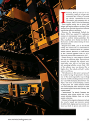
World Heritage Committee
-
- D-Day Mapping Mission Marine Technology, Mar 2014 #56
It’s been almost 70 years since the invasion of Normandy, France when 156,000 Allied troops landed and began their march across Europe to defeat Hitler. And, while these soldiers’ collective destinies could not have been known at the time, their will to fight was unmistakable. General Dwight D. Eisenhower called the D-Day operation a crusade in which “we will accept nothing less than full victory.” The allied troops heard this charge and proved their resolve. The D-Day cost was high — more than 9,000 Allied soldiers were killed or wounded — but on Tuesday, June 6, 1944 more than 100,000 soldiers gained a crucial foothold in Normandy. (Source: D-Day - June 6, 1944 - the United States Army).
On D-Day and the days following, a 50-mile stretch of French coastline was overtaken by man and machine. In total there were 170,000 vehicles and 5,000-plus ships, including 702 war ships. The beaches of Normandy no doubt have a story to tell.
To honor those who served, a massive survey and archeological effort is underway sponsored by France Televisions, 13 other broadcasters and the Normandy region. The French Navy (Marine National) and Department of Underwater and Undersea Archeological Research (DRASSM) were involved as well. Involvement from Sherrell Ocean Services, Trimble Navigation, Ltd. and Measutronics Corporation, a Trimble authorized marine dealer, was also instrumental in making this expedition possible. Each company involved is committed to the effort and is graciously donating their time, equipment and expertise to the project. Covering approximately 500 square kilometers, this will be the largest continuous survey of this type ever completed in the region. Together, these groups are building a complete GIS database of the area based around the five invasion beaches of D-Day. The volunteers are sharing their professional expertise to preserve the Normandy beaches’ history as well as capture 3D images of the historic assets.
Through their survey and mapping work, the team is working to have the Normandy D-Day invasion coastline designated as a UNESCO World Heritage Site by the World Heritage Committee. A UNESCO World Heritage Site is a location that is identified as having special cultural or physical significance, not to a single nation, but to the world.
Beaches of Normandy - Survey
The Discovery Phase of the mapping expedition started in July 2013 with a catamaran and crew leaving from Port of Saint-Malo, France. The total survey effort took nearly seven weeks and involved bathymetric mapping with an EdgeTech interferometric multibeam / side scan sonar combined with the Trimble SPS855/555H GNSS modular heading bundle and an inertial motion reference unit (MRU). The Trimble SPS heading bundle outputs the position, heading and timing synchronization data to the multibeam data collection and processing software. Here it is stored and time-tagged to the sonar data. Geo-referenced point cloud and side scan data are displayed real time for review by the system operator as well as logged for further data editing, processing and mapping.
The Trimble SPS series heading bundle antenna array was mounted on center with the transducer mount pole near the bow of the catamaran vessel. A custom mount was developed and built to allow the entire survey sensor package to be retracted when entering or departing local ports, which have limited hull clearances, dependent upon tides. The interferometric sonar system afforded wide swath “point cloud” coverage for three-dimensional modeling and also provided side scan planimetric imagery to aid in target identification.
Measutronics Corporation, Trimble’s leading U.S. Marine dealer, was chosen for this project because of its experience in the field of marine guidance, mapping, imaging and equipment holdings. Lou Nash, Measutronic’s founder, explains that the GNSS heading bundle is critical to the bathymetric systems because, “without accurate positioning, you essentially don’t have a reference point or know where you are in relation to anything else; as a result you can’t accurately and efficiently trace back to targets in the water. In addition, the ‘motion of the ocean’ must be accounted for as all the sounding and image data collected are done so from a constantly moving platform – subject to the effects of vessel heave, pitch and roll.”
The Trimble SPS855 site positioning heading bundle was selected because of its accuracy and it’s interoperability with Fugro Marinestar satellite-based correction signals as well as shore-based reference stations. The SPS series heading bundle is also interoperable with a number of motion reference units (MRU). With inputs from the heading bundle receivers, the MRU provided a blended GNSS / inertial solution, compensating for the effects of heave, pitch and roll. The Marinestar correction service was chosen over land-based correction transmission stations as typical UHF radio transmission would have required increased logistics and would not have provided adequate coverage for a large portion of the offshore due to the extreme distances involved.
“We chose the Trimble receiver because it’s really the only modular receiver that delivers the flexibility, accuracy and performance that we needed on a marine mapping expedition as significant as this,” said Nash. “It tracks the full GNSS constellation, giving better positioning availability and high precision, plus our crew knows the equipment inside and out.”
Target Identification Phase
In mid-August the crew began to focus on further development of targets of interest identified during the previous weeks of surveying. Now mobilizing from Cherbourg, France, efforts included the use of SeaBotix remotely operated vehicles (ROVs) fitted with Tritech acoustic tracking devices and sonar. These efforts were used to prioritize those targets to be further developed / examined with a higher resolution multibeam sonar system. For the remainder of the survey, crews use the SeaBotix ROVs and a video camera along while continuing to collect multibeam data.
High-Interest Targets
For high resolution point cloud data collection, an R2Sonic 2024 Ultra High Resolution (UHR) mulitibeam sonar was used. With the ultra-high resolution sonar system, the crew collected high-resolution point cloud data for about 20 historic assets of particular interest.
As a further effort in providing the most accurate point cloud data possible, GNSS phase data and inertial data were collected and logged with an Applanix POS MV motion reference unit. Data were then post processed with Applanix’s POSPac MMS software providing a “true heave” blended GNSS / inertial solution. The post processed data files were then read into a hydrographic survey software package. Martin de Kievit, business development manager for Trimble Marine in the Heavy Civil Construction division, explains that the survey software grabs input from the GNSS receiver where it allows for display and editing of track lines, sounding profiles and text data. The software system correlates time-tagged tide, vessel position, motion and sound velocity correction data which are used to accurately plot and record locations.
“Our surveys reported some 300 targets [artifacts] and about 20 ‘new’ wreckage sites were more fully developed,” said Nash.
As submerged targets of interest were more fully developed and accurately located, crews also launched small manned submarines to capture film footage of various high-profile wreckage sites. Led by Andy Sherrell of Sherrell Ocean Services, the crew filmed sites in order to capture color and details of what the servicemen may have faced on that fateful June day. Using video, sonar, 3D imagery and 3D visualizations, the crew is essentially “peeling back the water to bring these stories to life,” Nash added.
With higher resolution images and precise point cloud data, the crew is hoping to determine the actual ship, aircraft or vehicle name of the artifacts revealed. With this information, historians will also endeavor to derive names, ranks and associations of the crewmembers that were aboard the vessels or vehicles when they were sunk and destroyed.
Updating the GIS Database
During the months to come, teams will continue to work with the massive 11TB data set. The United Kingdom Hydrographic Office (UKHO) and the French nautical charting authority (SHOM) are collaborating in an effort to update the international wreck database for the area. Because a large percentage of these identified artifacts are newly discovered or were inaccurately positioned previously, the team is working to make these corrections before they deliver the complete survey data to the UNESCO World Heritage Committee for review. To commemorate the event, MC4 and LCL Production are producing a 90-minute documentary for the international market. PBS/Nova will broadcast an adaptation in North America, both to be aired memorializing the 70th anniversary.
Honoring Those Who Were There on “The Longest Day”
During the official 70th Anniversary D-Day ceremony scheduled for June 2014, veterans, dignitaries and archeologists will meet along this historic coast to honor those who have served and sacrificed. Led by the French Department of Underwater Archeological Research, manned submarines will also escort a handful of WWII veterans and historians underwater to investigate a few of the high-profile identified wrecks.
“Nearly everyone we approached about providing support for this historic mapping expedition, by means of donating equipment or personnel, was extremely supportive and enthusiastic about the project,” said Nash. “Everyone has considered it an honor to be involved in this effort, and I know I feel that way, as do our guys.”
(As published in the March 2014 edition of Marine Technology Reporter - www.seadiscovery.com)
-
 )
March 2024 - Marine Technology Reporter page: 45
)
March 2024 - Marine Technology Reporter page: 45family-owned business, which was established in 1969, designs and manufactures instrumentation for the oceanographic and hydrographic communities with a world- wide customer base that includes: subsea, hydrographic, metrological and positioning, oceanographic, ports, har- bours, dredging, energy and scienti
-
 )
March 2024 - Marine Technology Reporter page: 35
)
March 2024 - Marine Technology Reporter page: 35dioxide): These prima- ry cells are available in the widest number of standard sizes, in oil-? lled bags and are commonly available around the world. This is handy to pressures of 20,000psi without if you are in a remote port and need to cobble together a spare damage. Their battery pack.
-
 )
March 2024 - Marine Technology Reporter page: 33
)
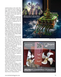
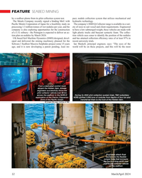
March 2024 - Marine Technology Reporter page: 33regulated industry in the world.” How- ever, commercial success depends on many factors, not least a predictable OPEX. Over the past four years, SMD has worked with Oil States Industries to calculate cost per tonne ? gures for prospective customers. Patania II uses jet water pumps to Oil States’
-
 )
March 2024 - Marine Technology Reporter page: 32
)
March 2024 - Marine Technology Reporter page: 32Massive Sulphides project some 15 years Ian Maskell, principal engineer, says: “The eyes of the ago, and it is now developing a patent pending, least im- world will be on these projects, and this will be the most From a dedicated control room aboard the Hidden Gem, Allseas engineers successfully drove the
-
 )
March 2024 - Marine Technology Reporter page: 29
)
March 2024 - Marine Technology Reporter page: 29several hours. “All indications to date point to polymetal- lic nodules having the potential to become one of the most responsible ways to help meet the world’s spiraling demand for met- als,” says GSR managing director Kris Van Nijen. “Our focus is on developing a source of high grade, low carbon minerals
-
 )
March 2024 - Marine Technology Reporter page: 23
)
March 2024 - Marine Technology Reporter page: 23and intense lighting storms were recorded; and satellites captured stunning images of the eruption. This catastrophic event not only shook the world but catalyzed an urgency for understanding sub- marine volcanoes, inspiring new research initiatives and highlighting ongoing scienti? c developments
-
 )
March 2024 - Marine Technology Reporter page: 21
)
March 2024 - Marine Technology Reporter page: 21Connect with colleagues around the world by joining the industry’s largest Linkedin Group. 218,774 members http://www.linkedin.com/group/44626 MTR #3 (18-33).indd 21 4/4/2024 3:37:21 PM
-
 )
March 2024 - Marine Technology Reporter page: 15
)
March 2024 - Marine Technology Reporter page: 15continue to grow – and the Sentinel is big enough to and Clayton Jones from Oceanology International 2024 in London. take on the challenge. Welcome to the World of ROS Positioners The Most Complete Line of Reliable and Accurate Positioners in the Industry Remote Ocean Systems offers the most complete line of
-
 )
March 2024 - Marine Technology Reporter page: 14
)
March 2024 - Marine Technology Reporter page: 14cases for the glider community. With an increased speed of up to 3 knots. need for environmental monitoring, especially to track the “The Sentinel is the world’s fastest glider – its buoyancy impact of offshore construction on the ocean ecosystem, the engine is large enough to deal with large density changes
-
 )
March 2024 - Marine Technology Reporter page: 13
)
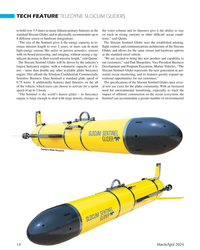
March 2024 - Marine Technology Reporter page: 13. Since its inception as the ? rst-ever gliding autonomous underwater vehicle, the Slocum Glider has grown to be the most-used glider platform in the world. These vehicles have been designed to be very ef? cient and can persistently gather oceanographic data for months or even a year at a time, communicati
-
 )
March 2024 - Marine Technology Reporter page: 11
)
March 2024 - Marine Technology Reporter page: 11. Further complicating matters will be the count- less natural and unnatural “mine-like objects” (MLOs) littering the Black Sea, including thousands of World War II-era unexploded mines and artillery shells. Post-con? ict mine clearance in the Black Sea will be critical to the safety and security of
-
 )
March 2024 - Marine Technology Reporter page: 4
)
March 2024 - Marine Technology Reporter page: 4YORK 118 E. 25th St., New York, NY 10010 return of Oceanology Interna- Tel: (212) 477-6700; Fax: (212) 254-6271 tional in London, perennially one Lof the world’s most important Justin Zuure CEO events serving the global subsea market. John C. O’Malley [email protected] Personally, it was my ? rst
-
 )
March 2024 - Marine Technology Reporter page: 3
)
March 2024 - Marine Technology Reporter page: 3EMPOWERING World leading electric underwater robotics Seaeye eM1-7 Electric Manipulator • Seven function work class manipulator • Compatible with most work class ROVs • Maximum reach 1,990mm • Lift capacity 122kg/454kg (max/min reach) • Precise position and force feedback • Modular self-contained
-
 )
April 2024 - Maritime Reporter and Engineering News page: 43
)
April 2024 - Maritime Reporter and Engineering News page: 43advisory products which proving understanding of the relation- the EU is adding €530 million through support better decision-making aren’t ships of the world’s population, GDP the Horizon Europe program. governed by speci? c rules or third-party and trade, and the global shipping in- In November-December
-
 )
April 2024 - Maritime Reporter and Engineering News page: 42
)
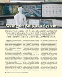
April 2024 - Maritime Reporter and Engineering News page: 42decarbonization realities that lie ahead by changing the way it crafts maritime legislation to re? ect its place in the interconnected, interdependent world economy, said Eero Lehtovaara, ABB Marine & Ports. ABB Marine & Ports Head of Regula- transporting goods, whether considered eters, for example: a
-
 )
April 2024 - Maritime Reporter and Engineering News page: 41
)
April 2024 - Maritime Reporter and Engineering News page: 41and customer satisfaction. Our expertise has made us a preferred supplier to coastal stations, FPSO, oil platforms, and major defence contractors worldwide. – Juha Rokka, nautelnav.com | email: [email protected] CEO and co-founder, Groke Technologies nologies: Mitsubishi Corporation, Japan’s Asia and
-
 )
April 2024 - Maritime Reporter and Engineering News page: 40
)
April 2024 - Maritime Reporter and Engineering News page: 40of the vessel surround- the screen and how they correlate with where they are in the ings even during night-time operations or other low-visibility real world? It can take around 20 seconds for bridge systems situations such as fog, heavy rain or highly re? ective situations. to update, and this naturally
-
 )
April 2024 - Maritime Reporter and Engineering News page: 38
)
April 2024 - Maritime Reporter and Engineering News page: 38Mooring Service of a Tanker Consulmar achieved a milestone by executing what it calls ing boat Castalia, which operates on full electric propulsion. the world's ? rst zero-emissions mooring service for a tanker. Equipped with two 150 kW engines and a lithium battery ca- This took place at an offshore multiple
-
 )
April 2024 - Maritime Reporter and Engineering News page: 31
)
April 2024 - Maritime Reporter and Engineering News page: 31turbines at a height of Heavy Lift Projects (HLP) is developing what it claims is up to 158m with a maximum safe working load of 1,250t. This the world’s biggest ring crane, one capable of 6,000t lifts. “It’s means it is suitable for installing both foundations and towers. an ambitious outlay for
-
 )
April 2024 - Maritime Reporter and Engineering News page: 28
)
April 2024 - Maritime Reporter and Engineering News page: 28deliver petro- 8) during an underway replenishment at sea in the Atlantic Ocean, July 17. leum products to our storage and distri- bution sites around the world. The MSC The San Antonio-class amphibious transport dock ship USS Arlington (LPD contracting team and the skill set of con- 24) sails alongside the
-
 )
April 2024 - Maritime Reporter and Engineering News page: 27
)
April 2024 - Maritime Reporter and Engineering News page: 27us about your ? eet? license can pretty much sail on any of our ships and can be The Combat Logistics Force will be familiar to our Surface detailed world-wide, although some ships like EPF require Force Sailors. We have 14 Henry J. Kaiser-class ? eet replen- high-speed craft (HSC) training. So, MyMSC
-
 )
April 2024 - Maritime Reporter and Engineering News page: 25
)
April 2024 - Maritime Reporter and Engineering News page: 25makes MSC so vital to the we’ve learned a lot about dealing with Navy’s ? eet and our military disruptions. COVID delivered a big forces around the world? wake-up call to the world’s supply When we look at the history of chain. Manpower was disrupted; contested logistics in World War ships were delayed
-
![MR Apr-24#22 JV where Equinor
from other [world] regions.” takes the Empire](https://images.marinelink.com/images/magazines/w200h250c/MaritimeReporter-202404-page24.png) )
April 2024 - Maritime Reporter and Engineering News page: 22
)
April 2024 - Maritime Reporter and Engineering News page: 22a key player in the U.S.” could provide a short-term solution and enable better support “Equinor and BP obviously split the JV where Equinor from other [world] regions.” takes the Empire Wind development and BP continues Bea- con Wind,” said Langford. “New Jersey awarded a combined 3.7MW of offshore wind
-
 )
April 2024 - Maritime Reporter and Engineering News page: 21
)
April 2024 - Maritime Reporter and Engineering News page: 21a de? nitive – became ‘mobile and global’, working with SBM in the ? oat- number on ‘how fast, how far’ this business will grow. “It is ing offshore world with FPSOs and the turret business, then dif? cult to provide quantitative ? gures as this is driven by the moving to New Orleans to work on Gulf