Page 41: of Marine Technology Magazine (Jan/Feb 2006)
Marine Science Institutions
Read this page in Pdf, Flash or Html5 edition of Jan/Feb 2006 Marine Technology Magazine
 40
40
 42
42
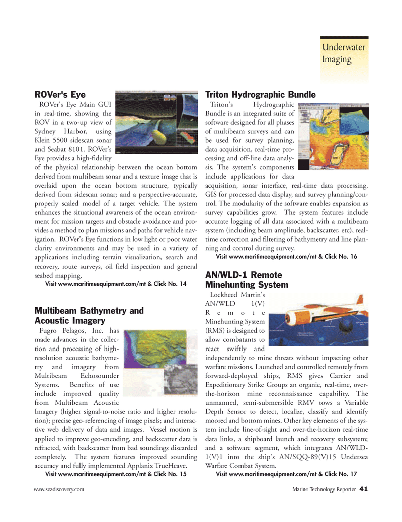
ROVer's Eye
ROVer's Eye Main GUI in real-time, showing the
ROV in a two-up view of
Sydney Harbor, using
Klein 5500 sidescan sonar and Seabat 8101. ROVer's
Eye provides a high-fidelity of the physical relationship between the ocean bottom derived from multibeam sonar and a texture image that is overlaid upon the ocean bottom structure, typically derived from sidescan sonar; and a perspective-accurate, properly scaled model of a target vehicle. The system enhances the situational awareness of the ocean environ- ment for mission targets and obstacle avoidance and pro- vides a method to plan missions and paths for vehicle nav- igation. ROVer's Eye functions in low light or poor water clarity environments and may be used in a variety of applications including terrain visualization, search and recovery, route surveys, oil field inspection and general seabed mapping.
Visit www.maritimeequipment.com/mt & Click No. 14
Multibeam Bathymetry and
Acoustic Imagery
Fugro Pelagos, Inc. has made advances in the collec- tion and processing of high- resolution acoustic bathyme- try and imagery from
Multibeam Echosounder
Systems. Benefits of use include improved quality from Multibeam Acoustic
Imagery (higher signal-to-noise ratio and higher resolu- tion); precise geo-referencing of image pixels; and interac- tive web delivery of data and images. Vessel motion is applied to improve geo-encoding, and backscatter data is refracted, with backscatter from bad soundings discarded completely. The system features improved sounding accuracy and fully implemented Applanix TrueHeave.
Visit www.maritimeequipment.com/mt & Click No. 15
Triton Hydrographic Bundle
Triton's Hydrographic
Bundle is an integrated suite of software designed for all phases of multibeam surveys and can be used for survey planning, data acquisition, real-time pro- cessing and off-line data analy- sis. The system's components include applications for data acquisition, sonar interface, real-time data processing,
GIS for processed data display, and survey planning/con- trol. The modularity of the software enables expansion as survey capabilities grow. The system features include accurate logging of all data associated with a multibeam system (including beam amplitude, backscatter, etc), real- time correction and filtering of bathymetry and line plan- ning and control during survey.
Visit www.maritimeequipment.com/mt & Click No. 16
AN/WLD-1 Remote
Minehunting System
Lockheed Martin's
AN/WLD 1(V)
Remote
Minehunting System (RMS) is designed to allow combatants to react swiftly and independently to mine threats without impacting other warfare missions. Launched and controlled remotely from forward-deployed ships, RMS gives Carrier and
Expeditionary Strike Groups an organic, real-time, over- the-horizon mine reconnaissance capability. The unmanned, semi-submersible RMV tows a Variable
Depth Sensor to detect, localize, classify and identify moored and bottom mines. Other key elements of the sys- tem include line-of-sight and over-the-horizon real-time data links, a shipboard launch and recovery subsystem; and a software segment, which integrates AN/WLD- 1(V)1 into the ship's AN/SQQ-89(V)15 Undersea
Warfare Combat System.
Visit www.maritimeequipment.com/mt & Click No. 17 www.seadiscovery.com Marine Technology Reporter 41
Underwater
Imaging
MTR#1 (33-48).qxd 1/9/2006 3:34 PM Page 41