Page 34: of Marine Technology Magazine (Sep/Oct 2010)
Ocean Observation
Read this page in Pdf, Flash or Html5 edition of Sep/Oct 2010 Marine Technology Magazine
 33
33
 35
35
Rivers flowing into the salt lake continued depositing sediments and organic matter over the sediments already present at the lakebed, forming various layers of sedi- ments composed of stones of various sizes, sediments and organic matter, such as plankton. The lake slowly grew as the land masses continued drifting apart and as more sea water began seeping in, the high salt content of the lake began to form layers of salt deposits on the bottom over the deposited sediments, steadily growing in thickness.
As sea water continued seeping into the lake and the landmasses continued drifting apart the salt lake between the landmasses grew larger. This sea water deposited even more salt over the organic matter, much of which was made up of planktons, which over time turned into a vis- cous mass and after tens of millions of years turned into hydrocarbons. As the landmasses steadily drifted apart, the salt lake first took on the dimensions of a sea and along many millions of years of drifting it turned into what is now known as the Atlantic Ocean.
The formation of the pre-salt structure the Gulf of
Mexico is quite different from the structures in Brazil and
WA since the pre-salt reserves in the Gulf of Mexico are from a younger reservoir that initially formed over the salt, in time the salt moved and eventually settled over the hydrocarbon reservoirs, which have a different source rock composition than found in Brazil and WA. The source rocks found in the South Atlantic pre-salt reser- voirs are carbonate rocks.
Along these tens of millions of years the salt deposits at the bottom on both sides of the drifting landmasses grew in thickness and now in some parts this salt crust is over 2,000 meters (6,561 feet) thick, while in other parts it may be only around 200 meters (656 feet) thick.
The salt crusts effectively work as a seal over the pre-salt reservoirs, forming a barrier for the reservoirs underneath them, in such a way that the hydrocarbons contained in the reservoirs cannot seep to the surface. The pre-salt plays in Brazil were not explored earlier mainly due to high E&P costs. Efforts were concentrated on the post- salt plays, which do not involve drilling through salt crusts, therefore being more easily accessible and involv- ing less capital investment.
In Brazil, the pre-salt reservoirs are known to be present up to and beyond 300 km from the coast, however many geologists believe that hydrocarbons may be found under salt layers even further away from shore than that. Exactly how far from shore these pre-salt reservoirs can be found is unknown and it may take decades for the full extent of these reservoirs to be mapped. The same is true on the
West African side of the Atlantic Ocean, where explo- ration has not reached the more advanced stage it has in
Brazil. In WA, onshore and deepwater offshore pre-salt reservoirs have been discovered and some geologists believe that onshore reservoirs may eventually also be dis- covered in Brazil.
The pre-salt regions in Brazil are officially recognized as being present in an area roughly 800km (497 miles) long and 200km (124 miles) wide, ranging from the north of
State of Santa Catarina to the State of Espirito Santo, with some of the most important plays being found off the
States of Rio de Janeiro and São Paulo, where the Tupi,
Iara, Franco, Libra and Guara fields are located. This area 34 MTR September 2010
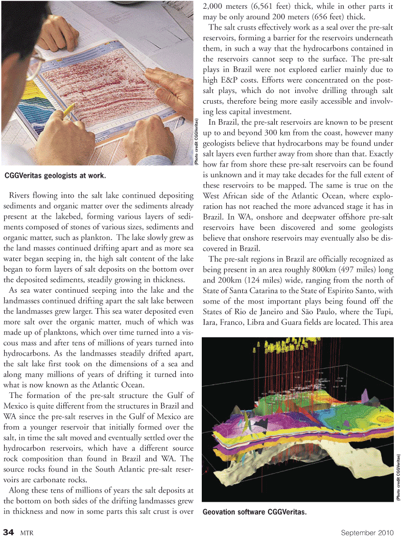
CGGVeritas geologists at work. (Photo cr edit CGGV eritas)
Geovation software CGGVeritas. (Photo cr edit CGGV eritas)