
Page 57: of Marine Technology Magazine (Jun/Jul 2011)
Hydrographic Survey
Read this page in Pdf, Flash or Html5 edition of Jun/Jul 2011 Marine Technology Magazine
 56
56
 58
58
www.seadiscovery.com Marine Technology Reporter 57 sor, and can be retrofitted to existing platforms. Data is pre- sented on a dedicated website with a password access, using secure servers, and can interface with existing data gatherer and
SCADA systems. Multiple sites can be displayed on one screen, with inputs from multiple sen- sors. Applications can be devel- oped in short timescales and at low cost to enable tailored soft- ware solutions. Data can also be integrated easily into the
Google Earth program. Any web enabled device can be used to view the data, which can also be transmitted via text, including alarms, or a stand alone receiving terminal can be set up. The on site equipment can be reconfigured or controlled through the 2 way communication link, or a voice menu system.
Email: sales@ osil.co.uk www.osil.co.uk
ROV Servicable Subsea Strain
Sensor Assembly
BMT Scientific Marine Services launched a fully-quali- fied ROV-Serviceable Subsea Strain Sensor Assembly (SSSA) for monitoring the structural integrity of subsea structures (tendons, production risers, steel catenary ris- ers, platform legs and braces, etc). With the
ROV-serviceable
SSSA, Floating pro- duction storage and offloading (FPSO) and platform opera- tors have the opportu- nity to benefit from an increased degree of system reliability and quicker, simpler replacement operations. BMT Scientific
Marine Services (BMT) has developed its existing diver serviceable strain sensor into one that is serviceable by
ROV. This has been achieved by designing a special ROV
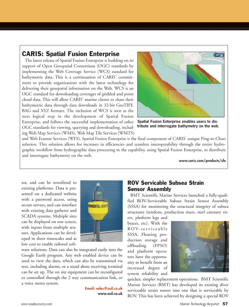
CARIS: Spatial Fusion Enterprise
The latest release of Spatial Fusion Enterprise is building on its support of Open Geospatial Consortium (OGC) standards by implementing the Web Coverage Service (WCS) standard for bathymetric data. This is a continuation of CARIS’ commit- ment to provide organizations with the latest technology for delivering their geospatial information on the Web. WCS is an
OGC standard for downloading coverages of gridded and point cloud data. This will allow CARIS’ marine clients to share their bathymetric data through data downloads in 32-bit GeoTIFF,
BAG and XYZ formats. The inclusion of WCS is seen as the next logical step in the development of Spatial Fusion
Enterprise, and follows the successful implementation of other
OGC standards for viewing, querying and downloading, includ- ing Web Map Services (WMS), Web Map Tile Services (WMTS) and Web Feature Services (WFS). Spatial Fusion Enterprise is the final component of CARIS’ unique Ping-to-Chart solution. This solution allows for increases in efficiencies and seamless interoperability through the entire hydro- graphic workflow from hydrographic data processing to the capability, using Spatial Fusion Enterprise, to distribute and interrogate bathymetry on the web. www.caris.com/products/sfe
Spatial Fusion Enterprise enables users to dis- tribute and interrogate bathymetry on the web.