
Page 20: of Marine Technology Magazine (Oct/Nov 2011)
Ocean Engineering & Design
Read this page in Pdf, Flash or Html5 edition of Oct/Nov 2011 Marine Technology Magazine
 19
19
 21
21
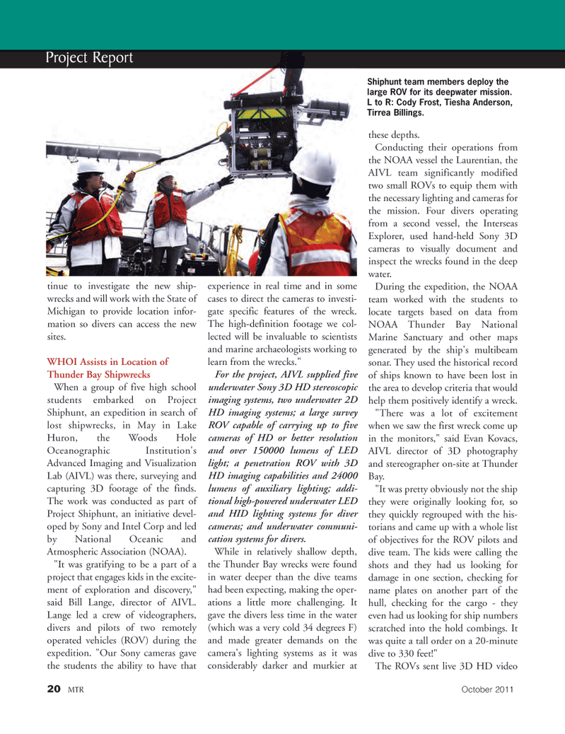
tinue to investigate the new ship- wrecks and will work with the State of Michigan to provide location infor- mation so divers can access the new sites.WHOI Assists in Location ofThunder Bay Shipwrecks When a group of five high school students embarked on Project Shiphunt, an expedition in search of lost shipwrecks, in May in Lake Huron, the Woods Hole Oceanographic Institution's Advanced Imaging and Visualization Lab (AIVL) was there, surveying and capturing 3D footage of the finds.The work was conducted as part of Project Shiphunt, an initiative devel- oped by Sony and Intel Corp and led by National Oceanic and Atmospheric Association (NOAA). "It was gratifying to be a part of a project that engages kids in the excite- ment of exploration and discovery," said Bill Lange, director of AIVL. Lange led a crew of videographers, divers and pilots of two remotely operated vehicles (ROV) during the expedition. "Our Sony cameras gave the students the ability to have that experience in real time and in some cases to direct the cameras to investi- gate specific features of the wreck. The high-definition footage we col- lected will be invaluable to scientists and marine archaeologists working to learn from the wrecks." For the project, AIVL supplied five underwater Sony 3D HD stereoscopic imaging systems, two underwater 2D HD imaging systems; a large survey ROV capable of carrying up to five cameras of HD or better resolution and over 150000 lumens of LED light; a penetration ROV with 3D HD imaging capabilities and 24000lumens of auxiliary lighting; addi- tional high-powered underwater LED and HID lighting systems for diver cameras; and underwater communi- cation systems for divers. While in relatively shallow depth, the Thunder Bay wrecks were found in water deeper than the dive teams had been expecting, making the oper-ations a little more challenging. It gave the divers less time in the water (which was a very cold 34 degrees F) and made greater demands on the camera's lighting systems as it wasconsiderably darker and murkier at these depths. Conducting their operations from the NOAA vessel the Laurentian, the AIVL team significantly modifiedtwo small ROVs to equip them with the necessary lighting and cameras for the mission. Four divers operating from a second vessel, the Interseas Explorer, used hand-held Sony 3D cameras to visually document andinspect the wrecks found in the deep water. During the expedition, the NOAA team worked with the students to locate targets based on data from NOAA Thunder Bay National Marine Sanctuary and other maps generated by the ship's multibeam sonar. They used the historical record of ships known to have been lost in the area to develop criteria that would help them positively identify a wreck. "There was a lot of excitement when we saw the first wreck come up in the monitors," said Evan Kovacs, AIVL director of 3D photography and stereographer on-site at Thunder Bay. "It was pretty obviously not the ship they were originally looking for, so they quickly regrouped with the his- torians and came up with a whole listof objectives for the ROV pilots and dive team. The kids were calling the shots and they had us looking fordamage in one section, checking forname plates on another part of the hull, checking for the cargo - theyeven had us looking for ship numbers scratched into the hold combings. It was quite a tall order on a 20-minute dive to 330 feet!" The ROVs sent live 3D HD video 20MTROctober2011 Project Report Shiphunt team members deploy thelarge ROV for its deepwater mission. L to R: Cody Frost, Tiesha Anderson, Tirrea Billings. MTR#8 (18-33):MTR Layouts 10/10/2011 2:00 PM Page 20