
Page 59: of Marine Technology Magazine (Oct/Nov 2011)
Ocean Engineering & Design
Read this page in Pdf, Flash or Html5 edition of Oct/Nov 2011 Marine Technology Magazine
 58
58
 60
60
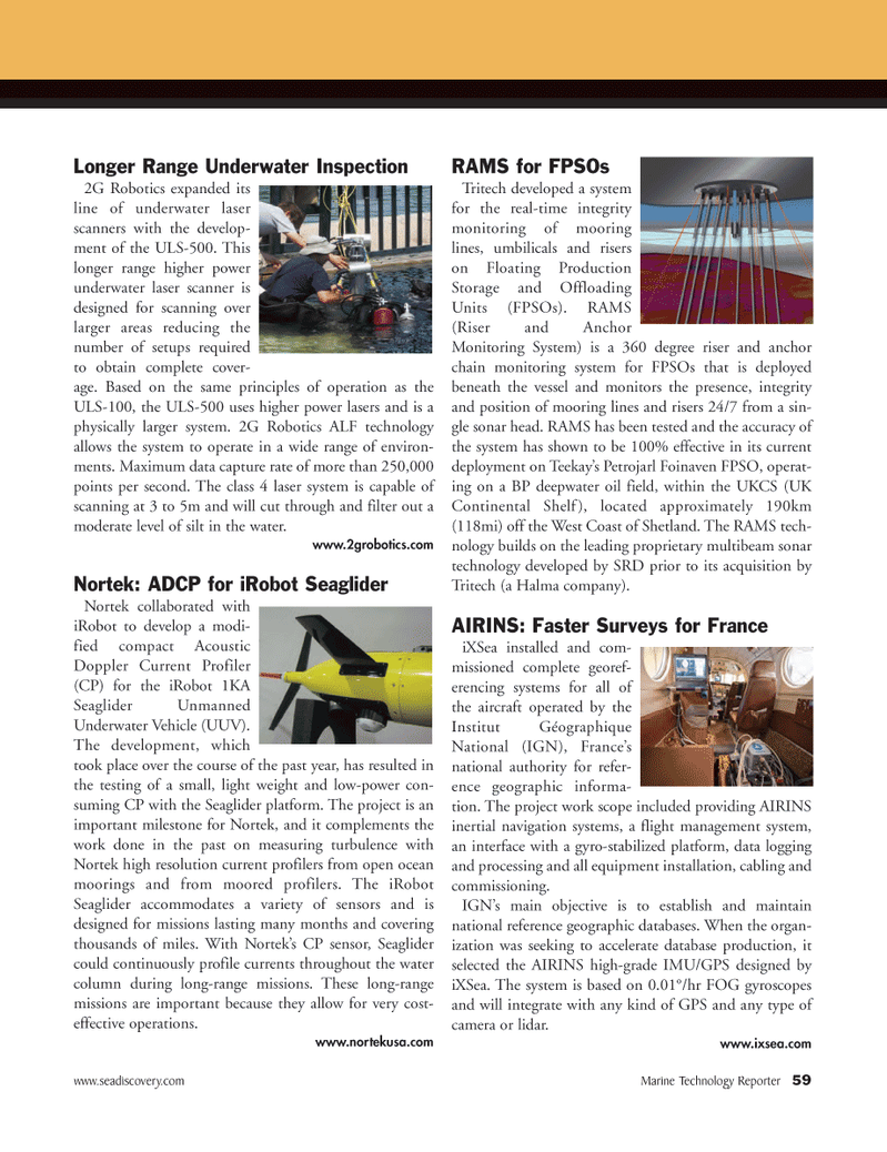
www.seadiscovery.com Marine Technology Reporter 59Longer Range Underwater Inspection2G Robotics expanded its line of underwater laser scanners with the develop- ment of the ULS-500. This longer range higher power underwater laser scanner is designed for scanning over larger areas reducing the number of setups required to obtain complete cover- age. Based on the same principles of operation as the ULS-100, the ULS-500 uses higher power lasers and is a physically larger system. 2G Robotics ALF technology allows the system to operate in a wide range of environ- ments. Maximum data capture rate of more than 250,000 points per second. The class 4 laser system is capable of scanning at 3 to 5m and will cut through and filter out a moderate level of silt in the water. www.2grobotics.com Nortek: ADCP for iRobot Seaglider Nortek collaborated with iRobot to develop a modi- fied compact Acoustic Doppler Current Profiler (CP) for the iRobot 1KA Seaglider Unmanned Underwater Vehicle (UUV). The development, which took place over the course of the past year, has resulted in the testing of a small, light weight and low-power con- suming CP with the Seaglider platform. The project is an important milestone for Nortek, and it complements the work done in the past on measuring turbulence with Nortek high resolution current profilers from open ocean moorings and from moored profilers. The iRobot Seaglider accommodates a variety of sensors and is designed for missions lasting many months and covering thousands of miles. With Nortek?s CP sensor, Seaglider could continuously profile currents throughout the water column during long-range missions. These long-range missions are important because they allow for very cost- effective operations. www.nortekusa.com RAMS for FPSOs Tritech developed a system for the real-time integrity monitoring of mooringlines, umbilicals and riserson Floating Production Storage and Offloading Units (FPSOs). RAMS (Riser and AnchorMonitoring System) is a 360 degree riser and anchor chain monitoring system for FPSOs that is deployed beneath the vessel and monitors the presence, integrity and position of mooring lines and risers 24/7 from a sin- gle sonar head. RAMS has been tested and the accuracy ofthe system has shown to be 100% effective in its current deployment on Teekay?s Petrojarl Foinaven FPSO, operat- ing on a BP deepwater oil field, within the UKCS (UK Continental Shelf), located approximately 190km (118mi) off the West Coast of Shetland. The RAMS tech- nology builds on the leading proprietary multibeam sonar technology developed by SRD prior to its acquisition by Tritech (a Halma company). AIRINS: Faster Surveys for FranceiXSea installed and com- missioned complete georef- erencing systems for all of the aircraft operated by the Institut Géographique National (IGN), France?s national authority for refer- ence geographic informa-tion. The project work scope included providing AIRINS inertial navigation systems, a flight management system, an interface with a gyro-stabilized platform, data logging and processing and all equipment installation, cabling and commissioning.IGN?s main objective is to establish and maintain national reference geographic databases. When the organ- ization was seeking to accelerate database production, it selected the AIRINS high-grade IMU/GPS designed by iXSea. The system is based on 0.01°/hr FOG gyroscopes and will integrate with any kind of GPS and any type ofcamera or lidar. www.ixsea.com MTR#8 (50-64):MTR Layouts 10/11/2011 9:14 AM Page 59