
Page 62: of Marine Technology Magazine (Mar/Apr 2014)
Instrumentation: Measurement, Process & Analysis
Read this page in Pdf, Flash or Html5 edition of Mar/Apr 2014 Marine Technology Magazine
 61
61
 63
63
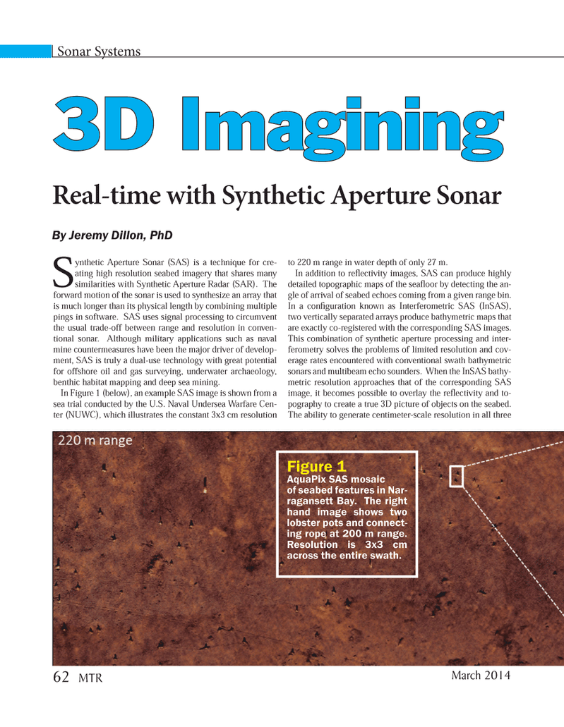
Sonar Systems Synthetic Aperture Sonar (SAS) is a technique for cre- ating high resolution seabed imagery that shares many similarities with Synthetic Aperture Radar (SAR). The forward motion of the sonar is used to synthesize an array that is much longer than its physical length by combining multiple pings in software. SAS uses signal processing to circumvent the usual trade-off between range and resolution in conven- tional sonar. Although military applications such as naval mine countermeasures have been the major driver of develop- ment, SAS is truly a dual-use technology with great potential for offshore oil and gas surveying, underwater archaeology, benthic habitat mapping and deep sea mining. In Figure 1 (below), an example SAS image is shown from a sea trial conducted by the U.S. Naval Undersea Warfare Cen- ter (NUWC), which illustrates the constant 3x3 cm resolution to 220 m range in water depth of only 27 m. In addition to reß ectivity images, SAS can produce highly detailed topographic maps of the seaß oor by detecting the an- gle of arrival of seabed echoes coming from a given range bin. In a conÞ guration known as Interferometric SAS (InSAS), two vertically separated arrays produce bathymetric maps that are exactly co-registered with the corresponding SAS images. This combination of synthetic aperture processing and inter- ferometry solves the problems of limited resolution and cov- erage rates encountered with conventional swath bathymetric sonars and multibeam echo sounders. When the InSAS bathy- metric resolution approaches that of the corresponding SAS image, it becomes possible to overlay the reß ectivity and to- pography to create a true 3D picture of objects on the seabed. The ability to generate centimeter-scale resolution in all three 3D Imagining 3D ImaginingReal-time with Synthetic Aperture Sonar Figure 1AquaPix SAS mosaic of seabed features in Nar- ragansett Bay. The right hand image shows two lobster pots and connect- ing rope at 200 m range. Resolution is 3x3 cm across the entire swath. By Jeremy Dillon, PhD March 2014 62 MTRMTR #2 (50-65).indd 62MTR #2 (50-65).indd 622/21/2014 11:40:00 AM2/21/2014 11:40:00 AM