
Page 16: of Marine Technology Magazine (Sep/Oct 2016)
Ocean Observation: Gliders, Buoys & Sub-Surface Networks
Read this page in Pdf, Flash or Html5 edition of Sep/Oct 2016 Marine Technology Magazine
 15
15
 17
17
Research Vessel
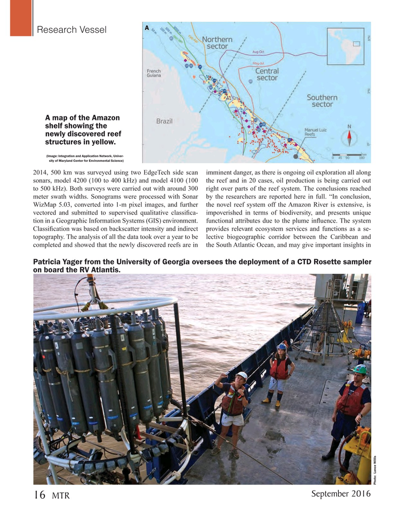
A map of the Amazon shelf showing the newly discovered reef structures in yellow. (Image: Integration and Application Network, Univer- sity of Maryland Center for Environmental Science) 2014, 500 km was surveyed using two EdgeTech side scan imminent danger, as there is ongoing oil exploration all along sonars, model 4200 (100 to 400 kHz) and model 4100 (100 the reef and in 20 cases, oil production is being carried out to 500 kHz). Both surveys were carried out with around 300 right over parts of the reef system. The conclusions reached meter swath widths. Sonograms were processed with Sonar by the researchers are reported here in full. “In conclusion,
WizMap 5.03, converted into 1-m pixel images, and further the novel reef system off the Amazon River is extensive, is vectored and submitted to supervised qualitative classi? ca- impoverished in terms of biodiversity, and presents unique tion in a Geographic Information Systems (GIS) environment. functional attributes due to the plume in? uence. The system
Classi? cation was based on backscatter intensity and indirect provides relevant ecosystem services and functions as a se- topography. The analysis of all the data took over a year to be lective biogeographic corridor between the Caribbean and completed and showed that the newly discovered reefs are in the South Atlantic Ocean, and may give important insights in
Patricia Yager from the University of Georgia oversees the deployment of a CTD Rosette sampler on board the RV Atlantis.
Photo: Lance Willis
September 2016
MTR 16
MTR #7 (1-17).indd 16 8/24/2016 11:32:09 AM