
Page 45: of Marine Technology Magazine (Sep/Oct 2016)
Ocean Observation: Gliders, Buoys & Sub-Surface Networks
Read this page in Pdf, Flash or Html5 edition of Sep/Oct 2016 Marine Technology Magazine
 44
44
 46
46
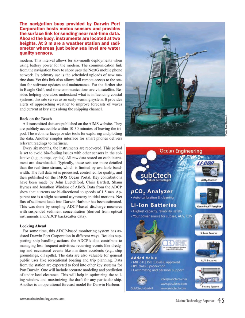
The navigation buoy provided by Darwin Port
Corporation hosts metoc sensors and provides the surface link for sending near real-time data.
Aboard the buoy, instruments are located at two heights. At 3 m are a weather station and radi- ometer whereas just below sea level are water quality sensors. modem. This interval allows for six-month deployments when using battery power for the modem. The communication link from the navigation buoy to shore uses the NextG mobile phone network. Its primary use is the scheduled uploads of new ma- rine data. Yet this link also allows full remote access to the sta- tion for software updates and maintenance. For the farther site in Beagle Gulf, real-time communications are via satellite. Be- sides helping operators understand what is in? uencing coastal systems, this site serves as an early warning system. It provides alerts of approaching weather to improve forecasts of waves and current at key sites along the shipping channel.
Back on the Beach
All transmitted data are published on the AIMS website. They are publicly accessible within 10-30 minutes of leaving the tri- pod. The web interface provides tools for exploring and plotting (Photo: Craig Steinberg) the data. Another simpler interface for smart phones delivers relevant readings to mariners.
Every six months, the instruments are recovered. This period is set to avoid bio-fouling issues with other sensors in the col- lective (e.g., pumps, optics). All raw data stored on each instru- ment are downloaded. Typically, these sets are more detailed than the real-time stream, which is limited by available band- width. The full data set is processed, controlled for quality, and then published on the IMOS Ocean Portal. Key contributions have been made by John Luetchford, Chris Bartlett, Shaun
Byrnes and Jonathon Windsor of AIMS. Data from the ADCP show that currents are bi-directional to speeds of 1.5 m/s. Ap- parent too is a slight seasonal asymmetry in tidal motions. Net ? ux of sediment loads into Darwin Harbour has been estimated.
This was done by coupling ADCP-based discharge measures with suspended sediment concentration (derived from optical instruments and ADCP backscatter data).
Looking Ahead
For some time, this ADCP-based monitoring system has as- sisted Darwin Port Corporation in different ways. Besides sup- porting ship handling actions, the ADCP’s data contribute to managing less frequent activities: recurring events like dredg- ing and occasional events like maritime accidents (e.g., ship groundings, oil spills). The data are also valuable for general public uses like recreational boating and trip planning. Data from the station are expected to feed into other key systems for
Port Darwin. One will include accurate modeling and prediction of under keel clearance. This will help in optimizing the sail- ing window and maximizing the draft for any particular ship.
Another is an operational forecast model for Darwin Harbour.
www.marinetechnologynews.com
Marine Technology Reporter 45
MTR #7 (34-49).indd 45 8/25/2016 2:51:19 PM