
Page 58: of Marine Technology Magazine (Jan/Feb 2018)
Underwater Vehicle Annual: ROVs, AUVs and UUVs
Read this page in Pdf, Flash or Html5 edition of Jan/Feb 2018 Marine Technology Magazine
 57
57
 59
59
New Products
Rovco Trials 3D Visualization Technology
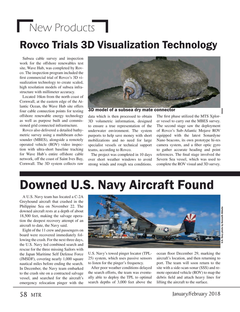
Subsea cable survey and inspection work for the offshore renewables test site, Wave Hub, was completed by Rov- co. The inspection program included the ? rst commercial trial of Rovco’s 3D vi- sualization technology to create scaled, high resolution models of subsea infra- structure with millimeter accuracy.
Located 16km from the north coast of
Cornwall, at the eastern edge of the At- lantic Ocean, the Wave Hub site offers 3D model of a subsea dry mate connector four cable connection points for testing offshore renewable energy technology data which is then processed to obtain The ? rst phase utilized the MTS Xplor- as well as purpose built and commis- 3D volumetric information, designed er vessel to carry out the MBES survey. sioned grid connected infrastructure. to ensure a true representation of the The second stage saw the deployment
Rovco also delivered a detailed bathy- underwater environment. The system of Rovco’s Sub-Atlantic Mojave ROV metric survey using a multibeam echo- purports to help save money with short equipped with the latest Sonardyne sounder (MBES), alongside a remotely mobilizations and no need for large Nano beacons, its own prototype hi-res operated vehicle (ROV) video inspec- specialist vessels or technical support camera system, and a ? ber optic gyro tion with ultra-short baseline tracking teams, according to Rovco. to gather accurate heading and point for Wave Hub’s entire offshore cable The project was completed in 10 days references. The ? nal stage involved the network, off the coast of Saint Ives Bay, over short weather windows to avoid Severn Sea vessel, which was used to
Cornwall. The 3D system collects raw strong winds and rough sea conditions. complete the ROV visual and 3D survey.
Downed U.S. Navy Aircraft Found
A U.S. Navy team has located a C-2A
Greyhound aircraft that crashed in the
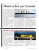
Philippine Sea on November 22. The downed aircraft rests at a depth of about 18,500 feet, making the salvage opera- tion the deepest recovery attempt of an aircraft to date, the Navy said.
Eight of the 11 crew and passengers on board were recovered immediately fol- lowing the crash. For the next three days,
U.S. Navy photo by Kenneth Abbate rovco the U.S. Navy led combined search and rescue for the three missing Sailors with the Japan Maritime Self Defense Force U.S. Navy’s towed pinger locator (TPL- ocean ? oor December 29, marking the (JMSDF), covering nearly 1,000 square 25) system, which uses passive sensors aircraft’s location, and then returning to to listen for the pinger’s frequency. port. The team will soon return to the nautical miles before ending the search.
After poor weather conditions delayed site with a side-scan-sonar (SSS) and re-
In December, the Navy team embarked to the crash site on a contracted salvage the search efforts, the team was eventu- mote operated vehicle (ROV) to map the vessel, and searched for the aircraft’s ally able to deploy the TPL to optimal debris ? eld and attach heavy lines for emergency relocation pinger with the search depths of 3,000 feet above the lifting the aircraft to the surface.
January/February 2018 58
MTR
MTR #1 (50-63).indd 58 MTR #1 (50-63).indd 58 1/25/2018 10:58:58 AM1/25/2018 10:58:58 AM