Page 31: of Marine Technology Magazine (Mar/Apr 2018)
Oceanographic Instrumentation: Measurement, Process & Analysis
Read this page in Pdf, Flash or Html5 edition of Mar/Apr 2018 Marine Technology Magazine
 30
30
 32
32
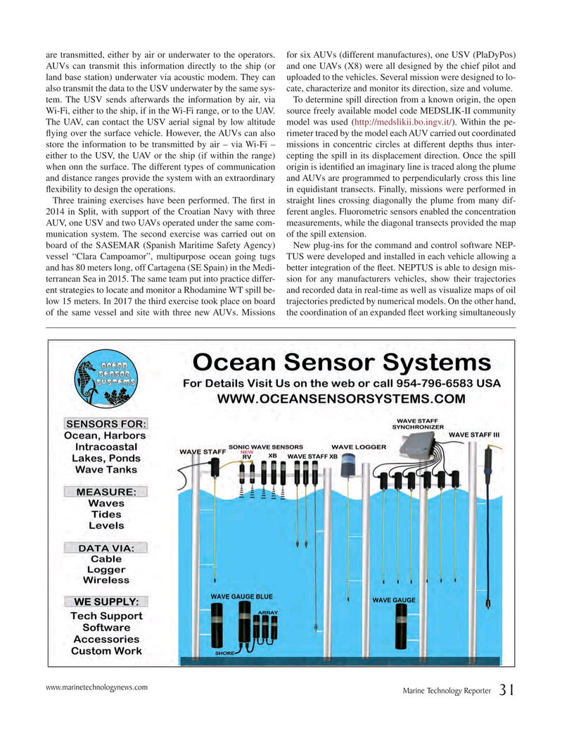
are transmitted, either by air or underwater to the operators. for six AUVs (different manufactures), one USV (PlaDyPos)
AUVs can transmit this information directly to the ship (or and one UAVs (X8) were all designed by the chief pilot and land base station) underwater via acoustic modem. They can uploaded to the vehicles. Several mission were designed to lo- also transmit the data to the USV underwater by the same sys- cate, characterize and monitor its direction, size and volume. tem. The USV sends afterwards the information by air, via To determine spill direction from a known origin, the open
Wi-Fi, either to the ship, if in the Wi-Fi range, or to the UAV. source freely available model code MEDSLIK-II community
The UAV, can contact the USV aerial signal by low altitude model was used (http://medslikii.bo.ingv.it/). Within the pe- ? ying over the surface vehicle. However, the AUVs can also rimeter traced by the model each AUV carried out coordinated store the information to be transmitted by air – via Wi-Fi – missions in concentric circles at different depths thus inter- either to the USV, the UAV or the ship (if within the range) cepting the spill in its displacement direction. Once the spill when onn the surface. The different types of communication origin is identi? ed an imaginary line is traced along the plume and distance ranges provide the system with an extraordinary and AUVs are programmed to perpendicularly cross this line ? exibility to design the operations. in equidistant transects. Finally, missions were performed in
Three training exercises have been performed. The ? rst in straight lines crossing diagonally the plume from many dif- 2014 in Split, with support of the Croatian Navy with three ferent angles. Fluorometric sensors enabled the concentration
AUV, one USV and two UAVs operated under the same com- measurements, while the diagonal transects provided the map munication system. The second exercise was carried out on of the spill extension.
board of the SASEMAR (Spanish Maritime Safety Agency) New plug-ins for the command and control software NEP- vessel “Clara Campoamor”, multipurpose ocean going tugs TUS were developed and installed in each vehicle allowing a and has 80 meters long, off Cartagena (SE Spain) in the Medi- better integration of the ? eet. NEPTUS is able to design mis- terranean Sea in 2015. The same team put into practice differ- sion for any manufacturers vehicles, show their trajectories ent strategies to locate and monitor a Rhodamine WT spill be- and recorded data in real-time as well as visualize maps of oil low 15 meters. In 2017 the third exercise took place on board trajectories predicted by numerical models. On the other hand, of the same vessel and site with three new AUVs. Missions the coordination of an expanded ? eet working simultaneously www.marinetechnologynews.com
Marine Technology Reporter 31
MTR #2 (18-33).indd 31 MTR #2 (18-33).indd 31 2/20/2018 3:42:00 PM2/20/2018 3:42:00 PM