
Page 52: of Marine Technology Magazine (Mar/Apr 2019)
Oceanographic Instrumentation: Measurement, Process & Analysis
Read this page in Pdf, Flash or Html5 edition of Mar/Apr 2019 Marine Technology Magazine
 51
51
 53
53
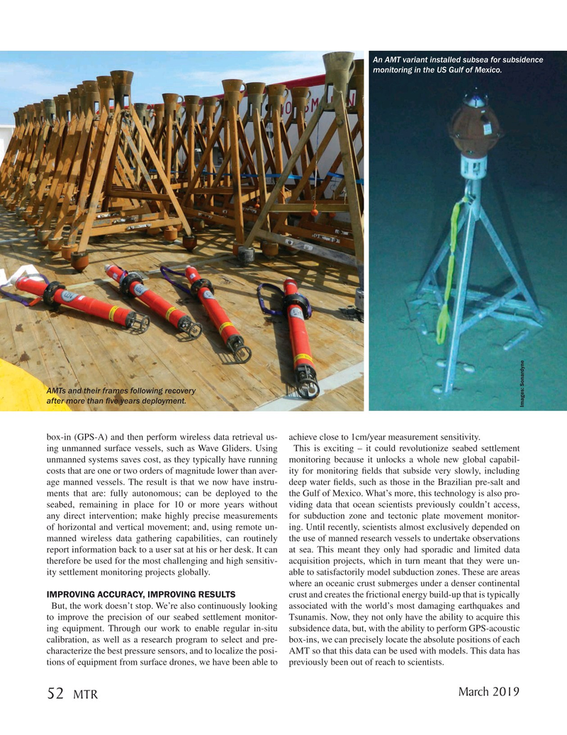
An AMT variant installed subsea for subsidence monitoring in the US Gulf of Mexico.
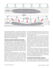
AMTs and their frames following recovery after more than ? ve years deployment.
Images: Sonardyne box-in (GPS-A) and then perform wireless data retrieval us- achieve close to 1cm/year measurement sensitivity.
ing unmanned surface vessels, such as Wave Gliders. Using This is exciting – it could revolutionize seabed settlement unmanned systems saves cost, as they typically have running monitoring because it unlocks a whole new global capabil- costs that are one or two orders of magnitude lower than aver- ity for monitoring ? elds that subside very slowly, including age manned vessels. The result is that we now have instru- deep water ? elds, such as those in the Brazilian pre-salt and ments that are: fully autonomous; can be deployed to the the Gulf of Mexico. What’s more, this technology is also pro- seabed, remaining in place for 10 or more years without viding data that ocean scientists previously couldn’t access, any direct intervention; make highly precise measurements for subduction zone and tectonic plate movement monitor- of horizontal and vertical movement; and, using remote un- ing. Until recently, scientists almost exclusively depended on manned wireless data gathering capabilities, can routinely the use of manned research vessels to undertake observations report information back to a user sat at his or her desk. It can at sea. This meant they only had sporadic and limited data therefore be used for the most challenging and high sensitiv- acquisition projects, which in turn meant that they were un- ity settlement monitoring projects globally. able to satisfactorily model subduction zones. These are areas where an oceanic crust submerges under a denser continental
IMPROVING ACCURACY, IMPROVING RESULTS crust and creates the frictional energy build-up that is typically
But, the work doesn’t stop. We’re also continuously looking associated with the world’s most damaging earthquakes and to improve the precision of our seabed settlement monitor- Tsunamis. Now, they not only have the ability to acquire this ing equipment. Through our work to enable regular in-situ subsidence data, but, with the ability to perform GPS-acoustic calibration, as well as a research program to select and pre- box-ins, we can precisely locate the absolute positions of each characterize the best pressure sensors, and to localize the posi- AMT so that this data can be used with models. This data has tions of equipment from surface drones, we have been able to previously been out of reach to scientists.
March 2019 52
MTR
MTR #2 (50-65).indd 52 3/11/2019 12:16:37 PM