Page 61: of Marine Technology Magazine (Mar/Apr 2019)
Oceanographic Instrumentation: Measurement, Process & Analysis
Read this page in Pdf, Flash or Html5 edition of Mar/Apr 2019 Marine Technology Magazine
 60
60
 62
62
UAS. and tracking, monitoring of human/animal interactions, water
The ? rst day of the workshop featured ? eld demonstrations quality monitoring, pollutant tracking, and monitoring tidal of three types of UAS: quadcopter, ? xed wing, and hexacop- marsh stability. ter. . Managers are eager to use drones, but how to use
The second and third days were panel sessions with presen- them is not always well understood. It is important to begin by tations covering topics such as: asking, “What is the management question or problem?” This • Drones to survey habitats will determine what data are needed and how they should be • Drones for harmful algal bloom (HAB) detection and collected, which may be drones. monitoring in Florida . As with any data, drone data need to be translated • Drones as a tool for surveying tidal marshes at three into information, which can then be used for management. sites on the East Coast, Gulf Coast, and West Coast . Using drones to acquire accurate quantitative geo- • Using drones for coastal/offshore transects and other spatial data is challenging and requires advanced technical research in Monterey Bay skills and knowledge. Hiring experts in drone operations and • Development of drones that operate in the air and sea data processing is typically necessary. environments . Best practices for using drones to collect geospatial
Each panel session was followed by breakout group discus- data are well established. Guidance on best practices is avail- sions. Plenary sessions included report-outs from the breakout able in publications such as the PrecisionHawk e-book Be- groups and large-group discussions of the panel and breakout yond the Edge, and the USGS Unmanned Aircraft Systems topics. Among the key takeaway messages from the presenta- tions and discussions were the following: . While UAS are a new tool for coastal management,
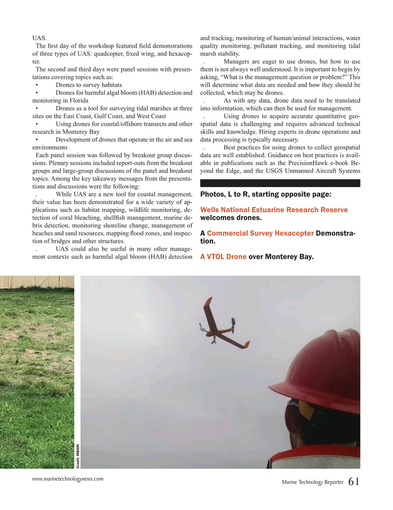
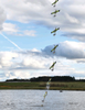
Photos, L to R, starting opposite page: their value has been demonstrated for a wide variety of ap- plications such as habitat mapping, wildlife monitoring, de-
Wells National Estuarine Research Reserve tection of coral bleaching, shell? sh management, marine de- welcomes drones. bris detection, monitoring shoreline change, management of beaches and sand resources, mapping ? ood zones, and inspec-
A Commercial Survey Hexacopter Demonstra- tion of bridges and other structures. tion. . UAS could also be useful in many other manage- ment contexts such as harmful algal bloom (HAB) detection
A VTOL Drone over Monterey Bay.
Credit: MBARI www.marinetechnologynews.com
Marine Technology Reporter 61
MTR #2 (50-65).indd 61 3/11/2019 12:25:57 PM