
Page 3: of Marine Technology Magazine (Jun/Jul 2019)
Hydrographic Survey: Single & Multibeam Sonar
Read this page in Pdf, Flash or Html5 edition of Jun/Jul 2019 Marine Technology Magazine
 2
2
 4
4
The Next-generation INS/GNSS
Post-processing Software
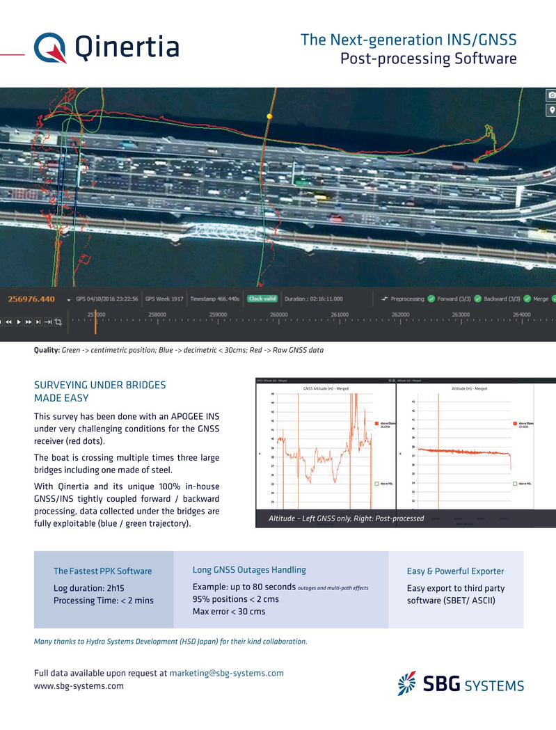
Quality: Green -> centimetric position; Blue -> decimetric < 30cms; Red -> Raw GNSS data
SURVEYING UNDER BRIDGES Å GNSS Altitude (m) - Merged Å Altitude (m) - Merged
MADE EASY
This survey has been done with an APOGEE INS under very challenging conditions for the GNSS receiver (red dots).
The boat is crossing multiple times three large bridges including one made of steel.
With Qinertia and its unique 100% in-house
GNSS/INS tightly coupled forward / backward processing, data collected under the bridges are
Altitude – Left GNSS only, Right: Post-processed fully exploitable (blue / green trajectory).
Long GNSS Outages Handling
The Fastest PPK Software Easy & Powerful Exporter outages and multi-path ef ects
Example: up to 80 seconds
Log duration: 2h15 Easy export to third party 95% positions < 2 cms
Processing Time: < 2 mins software (SBET/ ASCII)
Max error < 30 cms
Many thanks to Hydro Systems Development (HSD Japan) for their kind collaboration.
Full data available upon request at [email protected] www.sbg-systems.com
MTR #7 (1-17).indd 1 9/10/2018 10:11:02 AM