Page 51: of Marine Technology Magazine (Jun/Jul 2019)
Hydrographic Survey: Single & Multibeam Sonar
Read this page in Pdf, Flash or Html5 edition of Jun/Jul 2019 Marine Technology Magazine
 50
50
 52
52
Khaled bin Sultan Living Oceans Foundation and the University of
Miami Rosenstiel School of Marine and Atmospheric Science
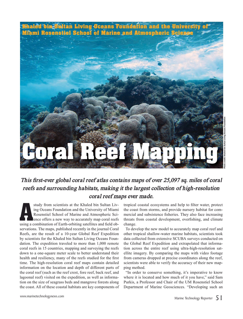
Coral Reef Mapping
Photo credit: Khaled bin Sultan Living Oceans Foundation
This ? rst-ever global coral reef atlas contains maps of over 25,097 sq. miles of coral reefs and surrounding habitats, making it the largest collection of high-resolution coral reef maps ever made.
study from scientists at the Khaled bin Sultan Liv- tropical coastal ecosystems and help to ? lter water, protect ing Oceans Foundation and the University of Miami the coast from storms, and provide nursery habitat for com-
Rosenstiel School of Marine and Atmospheric Sci- mercial and subsistence ? sheries. They also face increasing
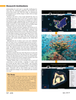
A ence offers a new way to accurately map coral reefs threats from coastal development, over? shing, and climate using a combination of Earth-orbiting satellites and ? eld ob- change. servations. The maps, published recently in the journal Coral To develop the new model to accurately map coral reef and
Reefs, are the result of a 10-year Global Reef Expedition other tropical shallow-water marine habitats, scientists took by scientists for the Khaled bin Sultan Living Oceans Foun- data collected from extensive SCUBA surveys conducted on dation. The expedition traveled to more than 1,000 remote the Global Reef Expedition and extrapolated that informa- coral reefs in 15 countries, mapping and surveying the reefs tion across the entire reef using ultra-high-resolution sat- down to a one-square meter scale to better understand their ellite imagery. By comparing the maps with video footage health and resiliency, many of the reefs studied for the ? rst from cameras dropped at precise coordinates along the reef, time. The high-resolution coral reef maps contain detailed scientists were able to verify the accuracy of their new map- information on the location and depth of different parts of ping method. the coral reef (such as the reef crest, fore reef, back reef, and “In order to conserve something, it’s imperative to know lagoonal reef) visited on the expedition, as well as informa- where it is located and how much of it you have,” said Sam tion on the size of seagrass beds and mangrove forests along Purkis, a Professor and Chair of the UM Rosenstiel School the coast. All of these coastal habitats are key components of Department of Marine Geosciences. “Developing such an www.marinetechnologynews.com
Marine Technology Reporter 51
MTR #5 (50-63).indd 51 5/28/2019 9:47:42 AM