
Page 44: of Marine Technology Magazine (May/Jun 2021)
Hydrographic Survey Sonar
Read this page in Pdf, Flash or Html5 edition of May/Jun 2021 Marine Technology Magazine
 43
43
 45
45
WEATHER SPOTTING
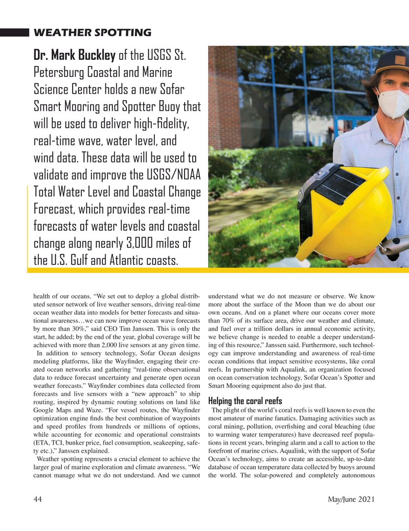
Dr. Mark Buckley of the USGS St.
Petersburg Coastal and Marine
Science Center holds a new Sofar
Smart Mooring and Spotter Buoy that will be used to deliver high-? delity, real-time wave, water level, and wind data. These data will be used to validate and improve the USGS/NOAA
Total Water Level and Coastal Change
Forecast, which provides real-time forecasts of water levels and coastal change along nearly 3,000 miles of the U.S. Gulf and Atlantic coasts. health of our oceans. “We set out to deploy a global distrib- understand what we do not measure or observe. We know uted sensor network of live weather sensors, driving real-time more about the surface of the Moon than we do about our ocean weather data into models for better forecasts and situa- own oceans. And on a planet where our oceans cover more tional awareness…we can now improve ocean wave forecasts than 70% of its surface area, drive our weather and climate, by more than 30%,” said CEO Tim Janssen. This is only the and fuel over a trillion dollars in annual economic activity, start, he added; by the end of the year, global coverage will be we believe change is needed to enable a deeper understand- achieved with more than 2,000 live sensors at any given time. ing of this resource,” Janssen said. Furthermore, such technol-
In addition to sensory technology, Sofar Ocean designs ogy can improve understanding and awareness of real-time modeling platforms, like the Way? nder, engaging their cre- ocean conditions that impact sensitive ecosystems, like coral ated ocean networks and gathering “real-time observational reefs. In partnership with Aqualink, an organization focused data to reduce forecast uncertainty and generate open ocean on ocean conservation technology, Sofar Ocean’s Spotter and weather forecasts.” Way? nder combines data collected from Smart Mooring equipment also do just that. forecasts and live sensors with a “new approach” to ship routing, inspired by dynamic routing solutions on land like Helping the coral reefs
Google Maps and Waze. “For vessel routes, the Way? nder The plight of the world’s coral reefs is well known to even the optimization engine ? nds the best combination of waypoints most amateur of marine fanatics. Damaging activities such as and speed pro? les from hundreds or millions of options, coral mining, pollution, over? shing and coral bleaching (due while accounting for economic and operational constraints to warming water temperatures) have decreased reef popula- (ETA, TCI, bunker price, fuel consumption, seakeeping, safe- tions in recent years, bringing alarm and a call to action to the ty etc.),” Janssen explained. forefront of marine crises. Aqualink, with the support of Sofar
Weather spotting represents a crucial element to achieve the Ocean’s technology, aims to create an accessible, up-to-date larger goal of marine exploration and climate awareness. “We database of ocean temperature data collected by buoys around cannot manage what we do not understand. And we cannot the world. The solar-powered and completely autonomous 44 May/June 2021
MTR #4 (34-49).indd 44 5/27/2021 1:17:51 PM