
Page 37: of Marine Technology Magazine (May/Jun 2024)
Read this page in Pdf, Flash or Html5 edition of May/Jun 2024 Marine Technology Magazine
 36
36
 38
38
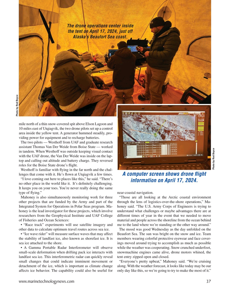
The drone operations center inside the tent on April 17, 2024, just off
Alaska’s Beaufort Sea coast.
Photo by Rod Boyce mile north of a thin snow-covered spit above Elson Lagoon and 10 miles east of Utqiagvik, the two drone pilots set up a control area inside the yellow tent. A generator hummed steadily, pro- viding power for equipment and to recharge batteries.
The two pilots — Westhoff from UAF and graduate research assistant Thomas Van Der Weide from Boise State — worked in tandem. When Westhoff was outside keeping visual contact with the UAF drone, the Van Der Weide was inside on the lap- top and calling out altitude and battery charge. They reversed roles for the Boise State drone’s ? ight.
Photo by Rod Boyce
Westhoff is familiar with ? ying in the far north and the chal- lenges that come with it. He’s ? own at Utqiagvik a few times.
A computer screen shows drone ? ight “I love coming out here to places like this,” he said. “There’s information on April 17, 2024. no other place in the world like it. It’s de? nitely challenging.
It keeps you on your toes. You’re never really doing the same type of ? ying.” near-coastal navigation.
Mahoney is also simultaneously monitoring work for three “Those are all looking at the Arctic coastal environment other projects that are funded by the Army and part of the through the lens of logistics-over-the-shore operations,” Ma-
Integrated System for Operations in Polar Seas program. Ma- honey said. “The U.S. Army Corps of Engineers is trying to honey is the lead investigator for these projects, which involve understand what challenges or maybe advantages there are at researchers from the Geophysical Institute and UAF College different times of year in the event that we needed to move of Fisheries and Ocean Sciences: material and people across the shoreline from the ocean behind • “Race track” experiments will use satellite imagery and me to the land where we’re standing or the other way around.” other data to calculate optimum travel routes across sea ice. The mood was good Wednesday as the day unfolded on the • “Ice wave rider” will measure surface waves that may affect Beaufort Sea. The sun was bright on the snow and ice. Team the stability of landfast ice, also known as shorefast ice. It is members wearing colorful protective eyewear and face cover- sea ice attached to the shore. ings moved around trying to accomplish as much as possible • A Gamma Portable Radar Interferometer will observe while the weather was cooperating. Snow crunched underfoot, small-scale deformation when drifting pack ice interacts with snowmachine engines came alive, drone motors whined, the landfast sea ice. This interferometric radar can quickly reveal tent entry zipped open and closed.
small changes that could indicate imminent movement or “Everyone’s pretty upbeat,” Mahoney said. “We’re cruising detachment of the ice, which is important as climate change along. With the weather forecast, it looks like today may be our affects ice behavior. The capability could also be useful for only day like this, so we’re going to try to make the most of it.” www.marinetechnologynews.com 37
MTR #4 (34-47).indd 37 6/2/2024 11:46:22 AM