
Page 12: of Maritime Reporter Magazine (December 2011)
Great Ships of 2011
Read this page in Pdf, Flash or Html5 edition of December 2011 Maritime Reporter Magazine
 11
11
 13
13
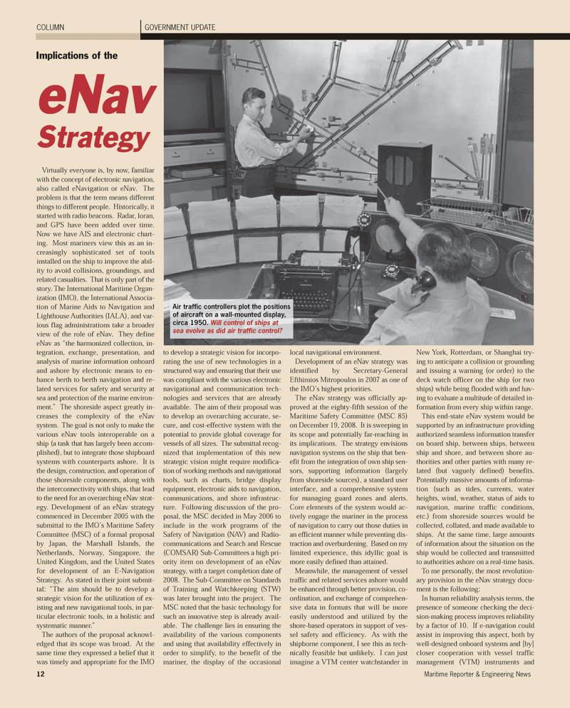
Virtually everyone is, by now, familiar with the concept of electronic navigation, also called eNavigation or eNav. The problem is that the term means different things to different people. Historically, it started with radio beacons. Radar, loran, and GPS have been added over time. Now we have AIS and electronic chart- ing. Most mariners view this as an in- creasingly sophisticated set of toolsinstalled on the ship to improve the abil- ity to avoid collisions, groundings, and related casualties. That is only part of the story. The International Maritime Organ- ization (IMO), the International Associa- tion of Marine Aids to Navigation and Lighthouse Authorities (IALA), and var- ious flag administrations take a broader view of the role of eNav. They define eNav as ?the harmonized collection, in- tegration, exchange, presentation, and analysis of marine information onboardand ashore by electronic means to en-hance berth to berth navigation and re- lated services for safety and security atsea and protection of the marine environ- ment.? The shoreside aspect greatly in- creases the complexity of the eNav system. The goal is not only to make the various eNav tools interoperable on a ship (a task that has largely been accom- plished), but to integrate those shipboard systems with counterparts ashore. It isthe design, construction, and operation ofthose shoreside components, along withthe interconnectivity with ships, that lead to the need for an overarching eNav strat- egy. Development of an eNav strategy commenced in December 2005 with thesubmittal to the IMO?s Maritime Safety Committee (MSC) of a formal proposalby Japan, the Marshall Islands, theNetherlands, Norway, Singapore, the United Kingdom, and the United Statesfor development of an E-Navigation Strategy. As stated in their joint submit- tal: ?The aim should be to develop a strategic vision for the utilization of ex- isting and new navigational tools, in par- ticular electronic tools, in a holistic andsystematic manner.? The authors of the proposal acknowl- edged that its scope was broad. At the same time they expressed a belief that it was timely and appropriate for the IMO to develop a strategic vision for incorpo- rating the use of new technologies in a structured way and ensuring that their use was compliant with the various electronic navigational and communication tech- nologies and services that are alreadyavailable. The aim of their proposal was to develop an overarching accurate, se- cure, and cost-effective system with the potential to provide global coverage for vessels of all sizes. The submittal recog- nized that implementation of this new strategic vision might require modifica- tion of working methods and navigational tools, such as charts, bridge displayequipment, electronic aids to navigation, communications, and shore infrastruc-ture. Following discussion of the pro- posal, the MSC decided in May 2006 toinclude in the work programs of the Safety of Navigation (NAV) and Radio- communications and Search and Rescue(COMSAR) Sub-Committees a high pri-ority item on development of an eNav strategy, with a target completion date of 2008. The Sub-Committee on Standards of Training and Watchkeeping (STW) was later brought into the project. The MSC noted that the basic technology forsuch an innovative step is already avail- able. The challenge lies in ensuring the availability of the various components and using that availability effectively in order to simplify, to the benefit of the mariner, the display of the occasional local navigational environment. Development of an eNav strategy was identified by Secretary-General Efthimios Mitropoulos in 2007 as one ofthe IMO?s highest priorities. The eNav strategy was officially ap- proved at the eighty-fifth session of the Maritime Safety Committee (MSC 85)on December 19, 2008. It is sweeping inits scope and potentially far-reaching in its implications. The strategy envisions navigation systems on the ship that ben- efit from the integration of own ship sen- sors, supporting information (largely from shoreside sources), a standard userinterface, and a comprehensive system for managing guard zones and alerts.Core elements of the system would ac- tively engage the mariner in the process of navigation to carry out those duties in an efficient manner while preventing dis- traction and overburdening. Based on my limited experience, this idyllic goal is more easily defined than attained. Meanwhile, the management of vessel traffic and related services ashore would be enhanced through better provision, co- ordination, and exchange of comprehen- sive data in formats that will be more easily understood and utilized by theshore-based operators in support of ves- sel safety and efficiency. As with the shipborne component, I see this as tech-nically feasible but unlikely. I can just imagine a VTM center watchstander in New York, Rotterdam, or Shanghai try- ing to anticipate a collision or groundingand issuing a warning (or order) to the deck watch officer on the ship (or two ships) while being flooded with and hav- ing to evaluate a multitude of detailed in- formation from every ship within range. This end-state eNav system would be supported by an infrastructure providing authorized seamless information transferon board ship, between ships, betweenship and shore, and between shore au-thorities and other parties with many re- lated (but vaguely defined) benefits. Potentially massive amounts of informa- tion (such as tides, currents, water heights, wind, weather, status of aids to navigation, marine traffic conditions, etc.) from shoreside sources would be collected, collated, and made available to ships. At the same time, large amounts of information about the situation on theship would be collected and transmitted to authorities ashore on a real-time basis. To me personally, the most revolution- ary provision in the eNav strategy docu- ment is the following: In human reliability analysis terms, thepresence of someone checking the deci-sion-making process improves reliability by a factor of 10. If e-navigation could assist in improving this aspect, both by well-designed onboard systems and [by]closer cooperation with vessel traffic management (VTM) instruments and12Maritime Reporter & Engineering News GOVERNMENT UPDATE COLUMNImplications of theeNavStrategyAir traffic controllers plot the positions of aircraft on a wall-mounted display, circa 1950. Will control of ships at sea evolve as did air traffic control? MR Dec.11 # 2 (10-17):MR Template 12/6/2011 9:19 AM Page 12
