
Page 34: of Maritime Reporter Magazine (July 2016)
Marine Communications Edition
Read this page in Pdf, Flash or Html5 edition of July 2016 Maritime Reporter Magazine
 33
33
 35
35
MARITIME COMMUNICATIONS: SATELLITE
The Advantage of Cross-Polarization was launched with greater capabilities, in a horizontal electric ? eld orientation an example of the bene? t of cross po-
When the Canadian Space Agency not the least of which is cross-polariza- and receive them in a vertical electric larization. Since re? ected light becomes launched RADARSAT-1 in 1995, among tion. “We noticed that cross-polarization ? eld orientation, or vice versa, explains horizontally polarized, sunglasses are its functions was to provide ice monitor- did a much better job differentiating be- Dr. Paris Vachon, Defense Research vertically polarized to ? lter out the hori- ing for the Canadian Ice Service and Ca- tween an iceberg and a ship,” observes and Development Canada’s (DRDC’s) zontally polarized light, thereby reduc- nadian Coast Guard, but it wasn’t used Power. Cross-polarization provides the scienti? c and technical advisor to Polar ing glare. One of RADARSAT-2’s two for surveillance. In 2007 RADARSAT-2 ability to transmit electromagnetic waves Epsilon-2. Polarized sunglasses provide channels ? lters out the glare, and RCM will have additional polarization chan- nels. Whereas RADARSAT-1 produced
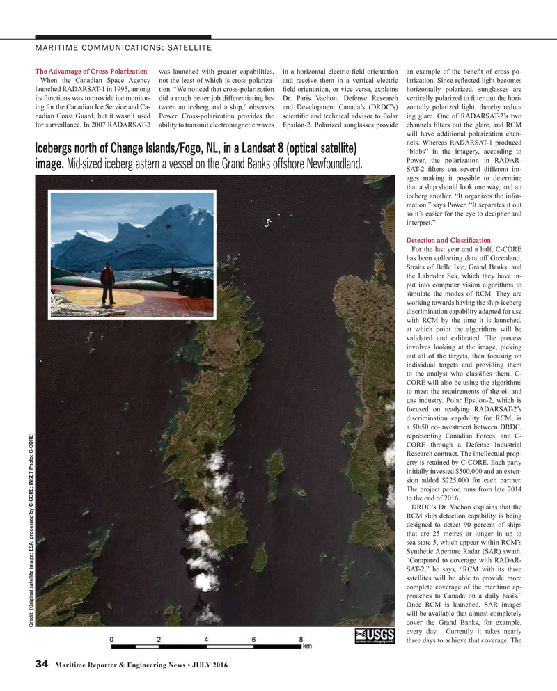
Icebergs north of Change Islands/Fogo, NL, in a Landsat 8 (optical satellite) “blobs” in the imagery, according to
Power, the polarization in RADAR- image. Mid-sized iceberg astern a vessel on the Grand Banks offshore Newfoundland.
SAT-2 ? lters out several different im- ages making it possible to determine that a ship should look one way, and an iceberg another. “It organizes the infor- mation,” says Power. “It separates it out so it’s easier for the eye to decipher and interpret.”
Detection and Classi? cation
For the last year and a half, C-CORE has been collecting data off Greenland,
Straits of Belle Isle, Grand Banks, and the Labrador Sea, which they have in- put into computer vision algorithms to simulate the modes of RCM. They are working towards having the ship-iceberg discrimination capability adapted for use with RCM by the time it is launched, at which point the algorithms will be validated and calibrated. The process involves looking at the image, picking out all of the targets, then focusing on individual targets and providing them to the analyst who classi? es them. C-
CORE will also be using the algorithms to meet the requirements of the oil and gas industry. Polar Epsilon-2, which is focused on readying RADARSAT-2’s discrimination capability for RCM, is a 50/50 co-investment between DRDC, representing Canadian Forces, and C-
CORE through a Defense Industrial
Research contract. The intellectual prop- erty is retained by C-CORE. Each party initially invested $500,000 and an exten- sion added $225,000 for each partner.
The project period runs from late 2014 to the end of 2016.
DRDC’s Dr. Vachon explains that the
RCM ship detection capability is being designed to detect 90 percent of ships that are 25 metres or longer in up to sea state 5, which appear within RCM’s
Synthetic Aperture Radar (SAR) swath. “Compared to coverage with RADAR-
SAT-2,” he says, “RCM with its three satellites will be able to provide more complete coverage of the maritime ap- proaches to Canada on a daily basis.”
Once RCM is launched, SAR images will be available that almost completely cover the Grand Banks, for example,
Credit: (Original satellite image: ESA; processed by C-CORE; INSET Photo: C-CORE) every day. Currently it takes nearly three days to achieve that coverage. The 34 Maritime Reporter & Engineering News • JULY 2016
MR #7 (34-41).indd 34 7/6/2016 11:07:46 AM
