
Page 41: of Maritime Reporter Magazine (September 2018)
Maritime Port & Ship Security
Read this page in Pdf, Flash or Html5 edition of September 2018 Maritime Reporter Magazine
 40
40
 42
42
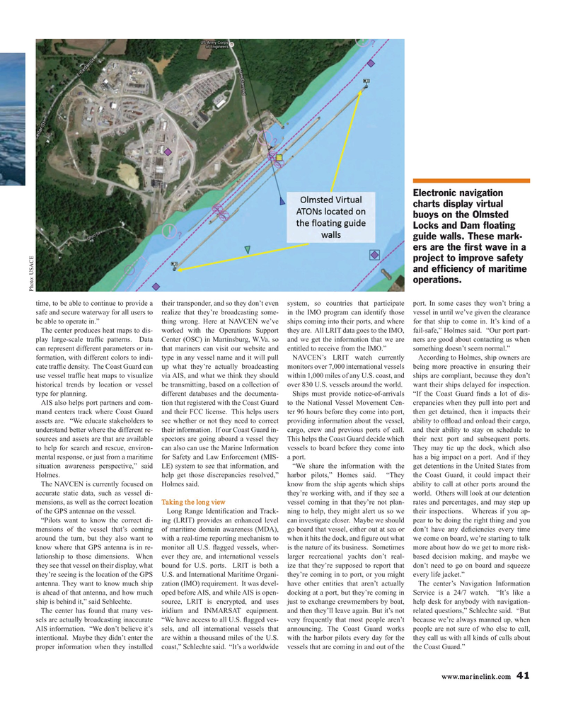
Electronic navigation charts display virtual buoys on the Olmsted
Locks and Dam ? oating guide walls. These mark- ers are the ? rst wave in a project to improve safety and ef? ciency of maritime operations.
Photo: USACE time, to be able to continue to provide a their transponder, and so they don’t even system, so countries that participate port. In some cases they won’t bring a safe and secure waterway for all users to realize that they’re broadcasting some- in the IMO program can identify those vessel in until we’ve given the clearance be able to operate in.” thing wrong. Here at NAVCEN we’ve ships coming into their ports, and where for that ship to come in. It’s kind of a
The center produces heat maps to dis- worked with the Operations Support they are. All LRIT data goes to the IMO, fail-safe,” Holmes said. “Our port part- play large-scale traf? c patterns. Data Center (OSC) in Martinsburg, W.Va. so and we get the information that we are ners are good about contacting us when can represent different parameters or in- that mariners can visit our website and entitled to receive from the IMO.” something doesn’t seem normal.” formation, with different colors to indi- type in any vessel name and it will pull NAVCEN’s LRIT watch currently According to Holmes, ship owners are cate traf? c density. The Coast Guard can up what they’re actually broadcasting monitors over 7,000 international vessels being more proactive in ensuring their use vessel traf? c heat maps to visualize via AIS, and what we think they should within 1,000 miles of any U.S. coast, and ships are compliant, because they don’t historical trends by location or vessel be transmitting, based on a collection of over 830 U.S. vessels around the world. want their ships delayed for inspection. type for planning. different databases and the documenta- Ships must provide notice-of-arrivals “If the Coast Guard ? nds a lot of dis-
AIS also helps port partners and com- tion that registered with the Coast Guard to the National Vessel Movement Cen- crepancies when they pull into port and mand centers track where Coast Guard and their FCC license. This helps users ter 96 hours before they come into port, then get detained, then it impacts their assets are. “We educate stakeholders to see whether or not they need to correct providing information about the vessel, ability to of? oad and onload their cargo, understand better where the different re- their information. If our Coast Guard in- cargo, crew and previous ports of call. and their ability to stay on schedule to sources and assets are that are available spectors are going aboard a vessel they This helps the Coast Guard decide which their next port and subsequent ports. to help for search and rescue, environ- can also can use the Marine Information vessels to board before they come into They may tie up the dock, which also mental response, or just from a maritime for Safety and Law Enforcement (MIS- a port. has a big impact on a port. And if they situation awareness perspective,” said LE) system to see that information, and “We share the information with the get detentions in the United States from
Holmes. help get those discrepancies resolved,” harbor pilots,” Homes said. “They the Coast Guard, it could impact their
The NAVCEN is currently focused on Holmes said. know from the ship agents which ships ability to call at other ports around the accurate static data, such as vessel di- they’re working with, and if they see a world. Others will look at our detention mensions, as well as the correct location Taking the long view vessel coming in that they’re not plan- rates and percentages, and may step up of the GPS antennae on the vessel. Long Range Identi? cation and Track- ning to help, they might alert us so we their inspections. Whereas if you ap- “Pilots want to know the correct di- ing (LRIT) provides an enhanced level can investigate closer. Maybe we should pear to be doing the right thing and you mensions of the vessel that’s coming of maritime domain awareness (MDA), go board that vessel, either out at sea or don’t have any de? ciencies every time around the turn, but they also want to with a real-time reporting mechanism to when it hits the dock, and ? gure out what we come on board, we’re starting to talk know where that GPS antenna is in re- monitor all U.S. ? agged vessels, wher- is the nature of its business. Sometimes more about how do we get to more risk- lationship to those dimensions. When ever they are, and international vessels larger recreational yachts don’t real- based decision making, and maybe we they see that vessel on their display, what bound for U.S. ports. LRIT is both a ize that they’re supposed to report that don’t need to go on board and squeeze they’re seeing is the location of the GPS U.S. and International Maritime Organi- they’re coming in to port, or you might every life jacket.” antenna. They want to know much ship zation (IMO) requirement. It was devel- have other entities that aren’t actually The center’s Navigation Information is ahead of that antenna, and how much oped before AIS, and while AIS is open- docking at a port, but they’re coming in Service is a 24/7 watch. “It’s like a ship is behind it,” said Schlechte. source, LRIT is encrypted, and uses just to exchange crewmembers by boat, help desk for anybody with navigation-
The center has found that many ves- iridium and INMARSAT equipment. and then they’ll leave again. But it’s not related questions,” Schlechte said. “But sels are actually broadcasting inaccurate “We have access to all U.S. ? agged ves- very frequently that most people aren’t because we’re always manned up, when
AIS information. “We don’t believe it’s sels, and all international vessels that announcing. The Coast Guard works people are not sure of who else to call, intentional. Maybe they didn’t enter the are within a thousand miles of the U.S. with the harbor pilots every day for the they call us with all kinds of calls about proper information when they installed coast,” Schlechte said. “It’s a worldwide vessels that are coming in and out of the the Coast Guard.” www.marinelink.com 41
MR #9 (34-41).indd 41 MR #9 (34-41).indd 41 9/5/2018 11:47:16 AM9/5/2018 11:47:16 AM
