
Page 50: of Offshore Engineer Magazine (Sep/Oct 2013)
Read this page in Pdf, Flash or Html5 edition of Sep/Oct 2013 Offshore Engineer Magazine
 49
49
 51
51
Geology & Geophysics
Full-waveform inversion clarifes geology
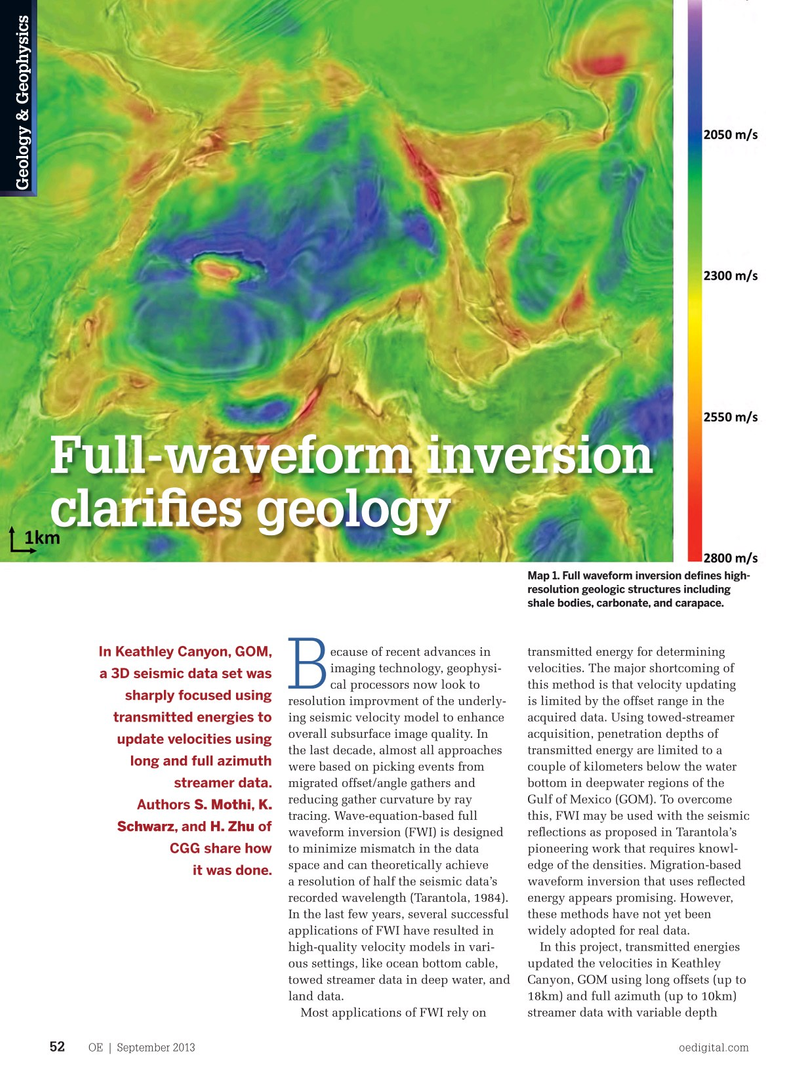
Map 1. Full waveform inversion defnes high- resolution geologic structures including shale bodies, carbonate, and carapace.
ecause of recent advances in transmitted energy for determining
In Keathley Canyon, GOM, imaging technology, geophysi- velocities. The major shortcoming of a 3D seismic data set was cal processors now look to this method is that velocity updating
B sharply focused using resolution improvment of the underly- is limited by the offset range in the ing seismic velocity model to enhance acquired data. Using towed-streamer transmitted energies to overall subsurface image quality. In acquisition, penetration depths of update velocities using the last decade, almost all approaches transmitted energy are limited to a long and full azimuth were based on picking events from couple of kilometers below the water migrated offset/angle gathers and bottom in deepwater regions of the streamer data. reducing gather curvature by ray Gulf of Mexico (GOM). To overcome
Authors S. Mothi, K. tracing. Wave-equation-based full this, FWI may be used with the seismic
Schwarz, and H. Zhu of waveform inversion (FWI) is designed refections as proposed in Tarantola’s to minimize mismatch in the data pioneering work that requires knowl-
CGG share how space and can theoretically achieve edge of the densities. Migration-based it was done.
a resolution of half the seismic data’s waveform inversion that uses refected recorded wavelength (Tarantola, 1984). energy appears promising. However,
In the last few years, several successful these methods have not yet been applications of FWI have resulted in widely adopted for real data. high-quality velocity models in vari- In this project, transmitted energies ous settings, like ocean bottom cable, updated the velocities in Keathley towed streamer data in deep water, and Canyon, GOM using long offsets (up to land data. 18km) and full azimuth (up to 10km)
Most applications of FWI rely on streamer data with variable depth
OE | September 2013 oedigital.com 52 052_OE0913_G&G1_CGG.indd 52 8/20/13 2:35 PM