
Page 8: of Offshore Engineer Magazine (Dec/Jan 2013)
Read this page in Pdf, Flash or Html5 edition of Dec/Jan 2013 Offshore Engineer Magazine
 7
7
 9
9
Editor’s Column Colloquy
Nina RachNina Rach
Waiting on Weather lot of time and money JPSS-2) and one experimental
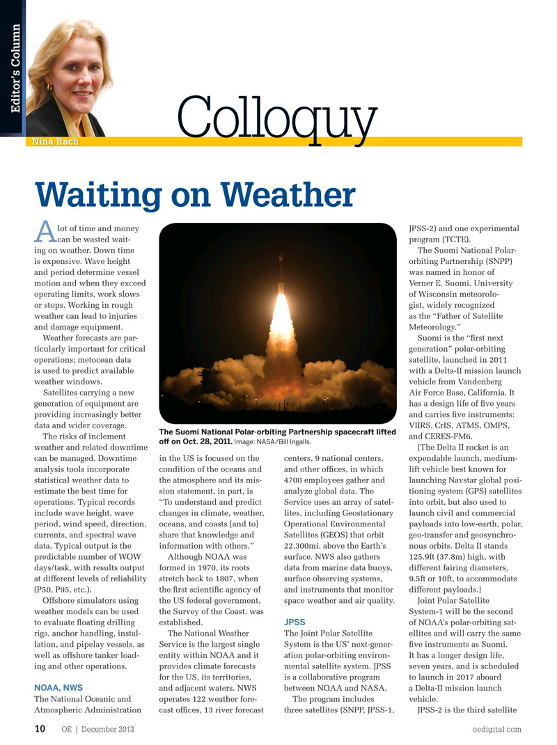
A can be wasted wait- program (TCTE). ing on weather. Down time The Suomi National Polar- is expensive. Wave height orbiting Partnership (SNPP) and period determine vessel was named in honor of motion and when they exceed Verner E. Suomi, University operating limits, work slows of Wisconsin meteorolo- or stops. Working in rough gist, widely recognized weather can lead to injuries as the “Father of Satellite and damage equipment. Meteorology.”
Weather forecasts are par- Suomi is the “frst next ticularly important for critical generation” polar-orbiting operations; metocean data satellite, launched in 2011 is used to predict available with a Delta-II mission launch weather windows. vehicle from Vandenberg Satellites carrying a new Air Force Base, California. It generation of equipment are has a design life of fve years providing increasingly better and carries fve instruments: data and wider coverage. VIIRS, CrIS, ATMS, OMPS,
The Suomi National Polar-orbiting Partnership spacecraft lifted
The risks of inclement and CERES-FM6. of on Oct. 28, 2011. Image: NASA/Bill Ingalls.
weather and related downtime [The Delta II rocket is an can be managed. Downtime in the US is focused on the centers, 9 national centers, expendable launch, medium- analysis tools incorporate condition of the oceans and and other offces, in which lift vehicle best known for statistical weather data to the atmosphere and its mis- 4700 employees gather and launching Navstar global posi- estimate the best time for sion statement, in part, is analyze global data. The tioning system (GPS) satellites operations. Typical records “To understand and predict Service uses an array of satel- into orbit, but also used to include wave height, wave changes in climate, weather, lites, including Geostationary launch civil and commercial period, wind speed, direction, oceans, and coasts [and to] Operational Environmental payloads into low-earth, polar, currents, and spectral wave share that knowledge and Satellites (GEOS) that orbit geo-transfer and geosynchro- data. Typical output is the information with others.” 22,300mi. above the Earth’s nous orbits. Delta II stands predictable number of WOW Although NOAA was surface. NWS also gathers 125.9ft (37.8m) high, with days/task, with results output formed in 1970, its roots data from marine data buoys, different fairing diameters, at different levels of reliability stretch back to 1807, when surface observing systems, 9.5ft or 10ft, to accommodate (P50, P95, etc.). the frst scientifc agency of and instruments that monitor different payloads.]
Offshore simulators using the US federal government, space weather and air quality. Joint Polar Satellite weather models can be used the Survey of the Coast, was System-1 will be the second
JPSS to evaluate foating drilling established. of NOAA’s polar-orbiting sat- rigs, anchor handling, instal- The National Weather The Joint Polar Satellite ellites and will carry the same lation, and pipelay vessels, as Service is the largest single System is the US’ next-gener- fve instruments as Suomi. well as offshore tanker load- entity within NOAA and it ation polar-orbiting environ- It has a longer design life, ing and other operations. provides climate forecasts mental satellite system. JPSS seven years, and is scheduled for the US, its territories, is a collaborative program to launch in 2017 aboard
NOAA, NWS and adjacent waters. NWS between NOAA and NASA. a Delta-II mission launch
The National Oceanic and operates 122 weather fore- The program includes vehicle.
Atmospheric Administration cast offces, 13 river forecast three satellites (SNPP, JPSS-1, JPSS-2 is the third satellite
OE | December 2013 oedigital.com 10 011_OE1213_Colloquy.indd 10 11/22/13 7:52 PM