
Page 114: of Offshore Engineer Magazine (May/Jun 2014)
Read this page in Pdf, Flash or Html5 edition of May/Jun 2014 Offshore Engineer Magazine
 113
113
 115
115
Surveying Brazil’s equatorial margin
Brazil
CGG’s vessel. Oceanic Endeavour Photo from CGG
Brazilian correspondent
Claudio Paschoa , visited
CGG’s Rio Technology Center, and spoke with Luiz Braga,
CGG Vice President and Latin
American Geomarket Director, about the basin’s formation and results of seismic surveys in the equatorial margin. razil has made headlines due to its large deepwater
B presalt discoveries off the country’s southeast coast. Plays like
Lula and Libra have helped attract investors and service providers. th
After Brazil’s 11 bidding round, which offered areas along the north and north- east coasts, new exploration frontiers opened, and the most exciting is along
Brazil’s north coast, known as the equato- rial margin (EM).
Tectonic origins
The South Atlantic rift system devel- oped during the mid-Mesozoic breakup of Africa and South America, which
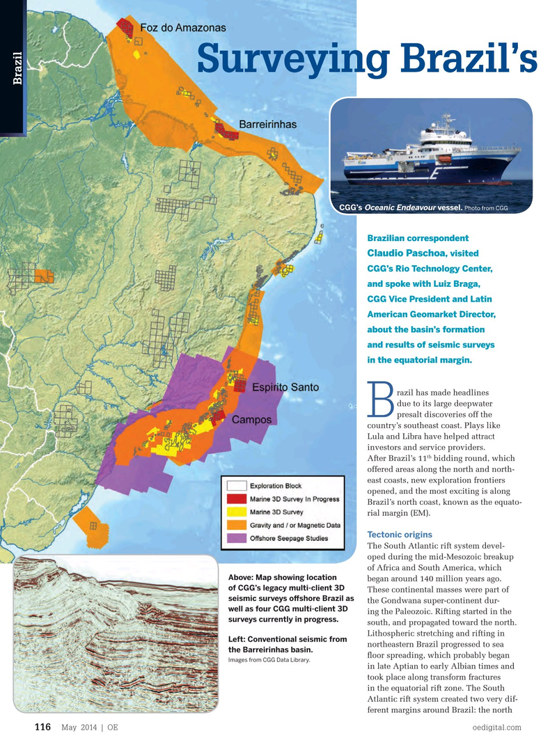
Above: Map showing location began around 140 million years ago. of CGG’s legacy multi-client 3D
These continental masses were part of seismic surveys ofshore Brazil as the Gondwana super-continent dur- well as four CGG multi-client 3D ing the Paleozoic. Rifting started in the surveys currently in progress. south, and propagated toward the north.
Lithospheric stretching and rifting in
Left: Conventional seismic from northeastern Brazil progressed to sea the Barreirinhas basin. foor spreading, which probably began
Images from CGG Data Library.
in late Aptian to early Albian times and took place along transform fractures in the equatorial rift zone. The South
Atlantic rift system created two very dif- ferent margins around Brazil: the north
May 2014 | OE oedigital.com 116 116_OE0513_Brazil1_EqMargins.indd 116 4/19/14 10:04 AM