Page 29: of Marine Technology Magazine (Nov/Dec 2006)
Deep Ocean Exploration
Read this page in Pdf, Flash or Html5 edition of Nov/Dec 2006 Marine Technology Magazine
 28
28
 30
30
www.seadiscovery.com Marine Technology Reporter 29
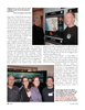
Every year University of New Hampshire hosts a GIS day to bring students and teachers, and representatives of industry and government together to share information about the field of geographic information systems. The 8th annual GIS day was focused on ocean mapping and exploration vehicle models. Past years' GIS days have fea- tured collaborations with National Aeronautical Space
Agency (NASA), United States Geological Survey (USGS), and urban planners. According to the event coordinator, Micheal Routhier, "without the "marine" orientation provided by event co-organizers at Woods
Hole Oceanographic Institution (WHOI), National
Oceanic and Atmospheric Administration (NOAA) and at the UNH Center for Coastal Ocean Mapping/Joint
Hydrographic Center (CCOM/JHC) the event this year would not have occurred."
Key note speaker, NOAA, Captain Maureen Kenny pre- sented a brief history of bathymetric methods to map the sea floor to an audience of over 300. Kenny explained that the need to understand water depth was first driven by our desire to bring goods from one place to the next over water. We had to know what the harbor bottom depth was so we could determine where to land cargo. Soundings in those days, which were documented to be around 1415
BC, were done with sounding poles and lead lines, tech- nologies that have not been completely abandoned to this day.
Chart making as a function of government was started officially in the 1500s (AD) and was greatly enhanced and accelerated by all the oceanic exploring that was being done by the early Europeans in search of new territory and riches. In 1807, Thomas Jefferson created the Coast
Survey agency, which was the predecessor to NOAA.
NOAA will be celebrating its 200th anniversary the entire year of 2007.
Fast forward to the early 1900s and the introduction to the use of acoustics to determine water depth. At the beginning of World War I, with the prospect of attack submarines threatening U.S. shores, the U.S. Navy collab- orated with NOAA to map the coastal regions for strate- gic purposes. As the study of underwater acoustics advanced, so did the ability to gather even more precise and fine resolution data of the sea floor. Single beam and multi beam echo sounders were used and then side scan sonar was utilized to "mow the lawn." That is hydrogra- pher-speak for towing sonar devices behind a ship or on an ROV dangling well below a ship to take wide swath sonar shots of the sea floor beneath. That process requires the ship to run survey lines miles long. The data must then be "cleaned and crunched" to display all of the fea- tures seen in the many images adorning the walls of
UNH's Morse Center. The processed data also shows any targets of interest that would require a closer look using more precise equipment.
Recent advancements in remote sensing technologies have introduced new and efficient methods to acquire information about the earth and about the sea floor.
According to www.NOAA.gov, LIDAR, Light Detection and Ranging is an active remote sensing system that can be operated in either a profiling or scanning mode using pulses of light to illuminate the terrain on shore and it can penetrate clear water (up to 50 m) to provide sea floor heights as well. LIDAR data collection involves mounting an airborne laser scanning system onboard an aircraft
GIS Day ‘06 8th Annual Geo-Spatial Science Conference and College Fair
University of New Hampshire, Durham, NH
By Maggie L. Merrill
MTR#9 (17-32).qxd 11/13/2006 4:48 PM Page 29