Page 30: of Marine Technology Magazine (Nov/Dec 2006)
Deep Ocean Exploration
Read this page in Pdf, Flash or Html5 edition of Nov/Dec 2006 Marine Technology Magazine
 29
29
 31
31
30 MTR November 2006 along with a Global Positioning System (GPS) receiver to locate an x, y, z posi- tion and an inertial navigation system to monitor the pitch, roll, and heading of the aircraft. By accurately measuring the round trip travel time of the laser pulse from the aircraft to the ground, a highly accurate spot elevation can be calculated.
LIDAR has been tested in a wide variety of oceanic applications including assess- ing post storm damage to beaches and mapping the Greenland ice sheet.
Another useful and powerful tool for ocean mapping was developed by Dr.
Walter Smith of NOAA and Dr. David
Sandwell of Scripps Institution of
Oceanography about 10 years ago. They developed a method to represent global seafloor topography from measured and estimated gravity data derived from satellite altimetry and shipboard depth soundings. Gravity anomolies are areas of the ocean surface that actually depress or expand in response to the gravitational forces of what lay beneath. This method of ocean mapping has greatly augmented the sparse coverage of seafloor map- ping, especially in the southern ocean. Using satellite altimetry for seafloor mapping does not offer the level of detail of what a side scan sonar can produce, but it can produce extremely useful maps of lesser known trenches, ridges and volcanoes that can then be investigated more precisely using different tools.
Captain Kenny joined NOAA as Corps Officer in 1975. She has pursued a career in the nautical charting field including survey data acquisition aboard several
NOAA survey ships. She graduated from the University of
Michigan with a major in
Mathematics and obtained a Masters of Science in Oceanography and
Hydrography in 1983 from the Naval
Postgraduate School. Most recently
Kenny was Commanding Officer of the NOAA ship, Whiting. Captain
Kenny retired from the NOAA Corps in 2003. She is now serving as deputy chief of NOAA Coast Survey
Development Laboratory of the
National Ocean Service, which is
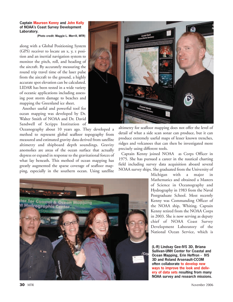
Captain Maureen Kenny and John Kelly of NOAA's Coast Survey Development
Laboratory. (Photo credit: Maggie L. Merrill, MTR) (L-R) Lindsay Gee-IVS 3D, Briana
Sullivan-UNH Center for Coastal and
Ocean Mapping, Erin Heffron - IVS 3D and Roland Arsenault-CCOM often collaborate to develop new ways to improve the look and deliv- ery of data sets resulting from many
NOAA survey and research missions.
MTR#9 (17-32).qxd 11/13/2006 4:49 PM Page 30