
Page 17: of Marine Technology Magazine (Jun/Jul 2011)
Hydrographic Survey
Read this page in Pdf, Flash or Html5 edition of Jun/Jul 2011 Marine Technology Magazine
 16
16
 18
18
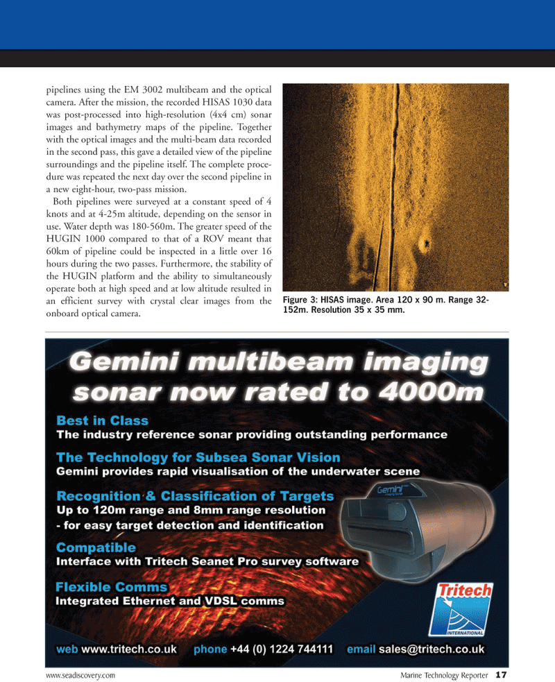
www.seadiscovery.com Marine Technology Reporter 17 pipelines using the EM 3002 multibeam and the optical camera. After the mission, the recorded HISAS 1030 data was post-processed into high-resolution (4x4 cm) sonar images and bathymetry maps of the pipeline. Together with the optical images and the multi-beam data recorded in the second pass, this gave a detailed view of the pipeline surroundings and the pipeline itself. The complete proce- dure was repeated the next day over the second pipeline in a new eight-hour, two-pass mission.
Both pipelines were surveyed at a constant speed of 4 knots and at 4-25m altitude, depending on the sensor in use. Water depth was 180-560m. The greater speed of the
HUGIN 1000 compared to that of a ROV meant that 60km of pipeline could be inspected in a little over 16 hours during the two passes. Furthermore, the stability of the HUGIN platform and the ability to simultaneously operate both at high speed and at low altitude resulted in an efficient survey with crystal clear images from the onboard optical camera.
Figure 3: HISAS image. Area 120 x 90 m. Range 32- 152m. Resolution 35 x 35 mm.