Page 50: of Marine Technology Magazine (Jun/Jul 2014)
Hydrographic Survey
Read this page in Pdf, Flash or Html5 edition of Jun/Jul 2014 Marine Technology Magazine
 49
49
 51
51
Fugro
Expands Fleet
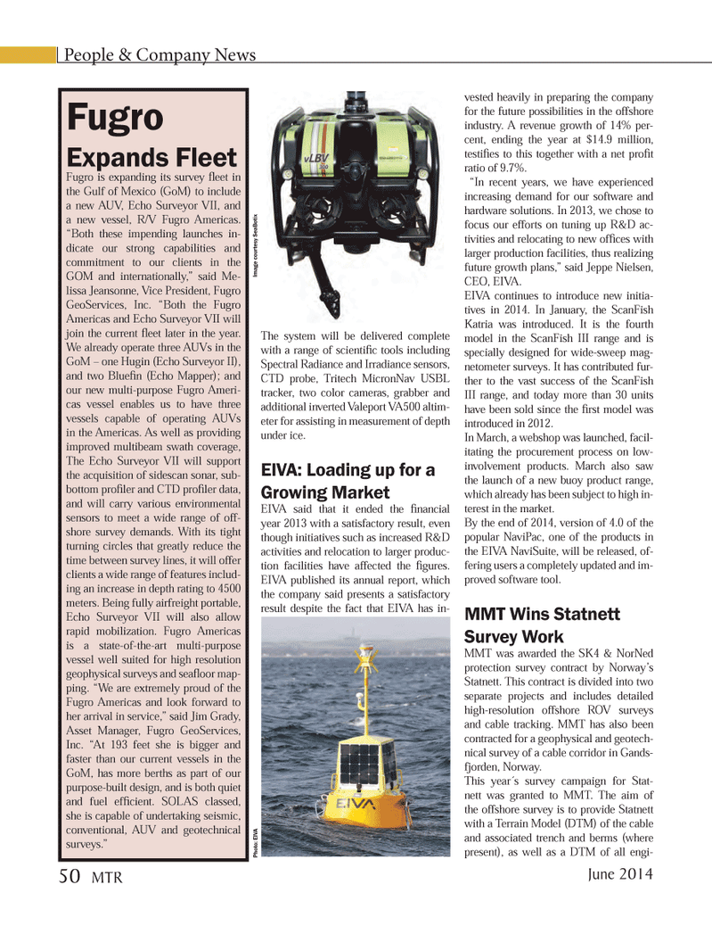
Fugro is expanding its survey fl eet in the Gulf of Mexico (GoM) to include a new AUV, Echo Surveyor VII, and a new vessel, R/V Fugro Americas. “Both these impending launches in- dicate our strong capabilities and commitment to our clients in the
GOM and internationally,” said Me- lissa Jeansonne, Vice President, Fugro
GeoServices, Inc. “Both the Fugro
Americas and Echo Surveyor VII will join the current fl eet later in the year.
We already operate three AUVs in the
GoM – one Hugin (Echo Surveyor II), and two Bluefi n (Echo Mapper); and our new multi-purpose Fugro Ameri- cas vessel enables us to have three vessels capable of operating AUVs in the Americas. As well as providing improved multibeam swath coverage,
The Echo Surveyor VII will support the acquisition of sidescan sonar, sub- bottom profi ler and CTD profi ler data, and will carry various environmental sensors to meet a wide range of off- shore survey demands. With its tight turning circles that greatly reduce the time between survey lines, it will offer clients a wide range of features includ- ing an increase in depth rating to 4500 meters. Being fully airfreight portable,
Echo Surveyor VII will also allow rapid mobilization. Fugro Americas is a state-of-the-art multi-purpose vessel well suited for high resolution geophysical surveys and seafl oor map- ping. “We are extremely proud of the
Fugro Americas and look forward to her arrival in service,” said Jim Grady,
Asset Manager, Fugro GeoServices,
Inc. “At 193 feet she is bigger and faster than our current vessels in the
GoM, has more berths as part of our purpose-built design, and is both quiet and fuel effi cient. SOLAS classed, she is capable of undertaking seismic, conventional, AUV and geotechnical surveys.”
People & Company News
The system will be delivered complete with a range of scientifi c tools including
Spectral Radiance and Irradiance sensors,
CTD probe, Tritech MicronNav USBL tracker, two color cameras, grabber and additional inverted Valeport VA500 altim- eter for assisting in measurement of depth under ice.
EIVA: Loading up for a
Growing Market
EIVA said that it ended the fi nancial year 2013 with a satisfactory result, even though initiatives such as increased R&D activities and relocation to larger produc- tion facilities have affected the fi gures.
EIVA published its annual report, which the company said presents a satisfactory result despite the fact that EIVA has in- vested heavily in preparing the company for the future possibilities in the offshore industry. A revenue growth of 14% per- cent, ending the year at $14.9 million, testifi es to this together with a net profi t ratio of 9.7%. “In recent years, we have experienced increasing demand for our software and hardware solutions. In 2013, we chose to focus our efforts on tuning up R&D ac- tivities and relocating to new offi ces with larger production facilities, thus realizing future growth plans,” said Jeppe Nielsen,
CEO, EIVA.
EIVA continues to introduce new initia- tives in 2014. In January, the ScanFish
Katria was introduced. It is the fourth model in the ScanFish III range and is specially designed for wide-sweep mag- netometer surveys. It has contributed fur- ther to the vast success of the ScanFish
III range, and today more than 30 units have been sold since the fi rst model was introduced in 2012.
In March, a webshop was launched, facil- itating the procurement process on low- involvement products. March also saw the launch of a new buoy product range, which already has been subject to high in- terest in the market.
By the end of 2014, version of 4.0 of the popular NaviPac, one of the products in the EIVA NaviSuite, will be released, of- fering users a completely updated and im- proved software tool.
MMT Wins Statnett
Survey Work
MMT was awarded the SK4 & NorNed protection survey contract by Norway’s
Statnett. This contract is divided into two separate projects and includes detailed high-resolution offshore ROV surveys and cable tracking. MMT has also been contracted for a geophysical and geotech- nical survey of a cable corridor in Gands- fjorden, Norway.
This year´s survey campaign for Stat- nett was granted to MMT. The aim of the offshore survey is to provide Statnett with a Terrain Model (DTM) of the cable and associated trench and berms (where present), as well as a DTM of all engi-
Image cour tesy SeaBotix
Photo: EIV
A
June 2014 50 MTR
MTR #5 (50-64).indd 50 6/9/2014 10:58:15 AM