Page 22: of Marine Technology Magazine (Apr/May 2018)
Offshore Geophysical
Read this page in Pdf, Flash or Html5 edition of Apr/May 2018 Marine Technology Magazine
 21
21
 23
23
they try to ? nd an alternative way of capturing the survey data Bathymetry data along with other geospatial marine products. requested by the client, which may include putting a smaller The ESA grant required TCarta and DHI to include exist- boat in the water. But that option presents its own risks. ing clients in the development of the portal, and MG3 gladly “During the tender stage, we can go back to the client and served that role, offering its insights into how the online data convey the risk of near-shore operations [in speci? c areas],” should be packaged, formatted and delivered.
said Jackson. Until then, the custom-produced bathymetry products were “In some areas, we have suggested the client rely on the used mostly by government agencies, energy exploration
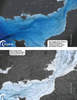
Satellite Derived Bathymetry instead of the ship.” companies, infrastructure engineering consultancies and other
In the shallow coastal waters of the Caribbean, MG3 was large organizations with interest in near-shore coastal areas. able to navigate the entire near-shore area requested by the As TCarta generated products for customers operating in the client without incident. No equipment was lost, and the MG3 Red Sea and Arabian Gulf, it began to build an impressive vessel successfully avoided the submerged reefs identi? ed in archive of highly accurate Satellite Derived Bathymetry that the satellite data. The project was completed on schedule and could be sold as off-the-shelf data sets.
on budget. “We set our sights on making our marine products avail- able more affordably to smaller organizations by selling on- demand data sets in small tiles on a per-kilometer basis,” said
ACCESSING THE SATELLITE DATA
According to Jackson, the accuracy of TCarta marine prod- Flemmings.
ucts has compelled his team to acquire them for numerous The Bathymetrics Data Portal went live in 2017 providing projects in recent years. And now MG3 has played a role in users the ability to search for data availability through a map making these and products more readily accessible to a wider or coordinate-entry interface, preview the bathymetric data group of end users in the marine community. onscreen and then pay for just the area-of-interest they need
In 2016, TCarta and DHI won a grant from the European via an e-commerce module. The product streams directly into
Space Agency to help pay for development of an online portal common GIS or mapping software package used by the cus- to support direct sales of the off-the-shelf Satellite Derived tomer.
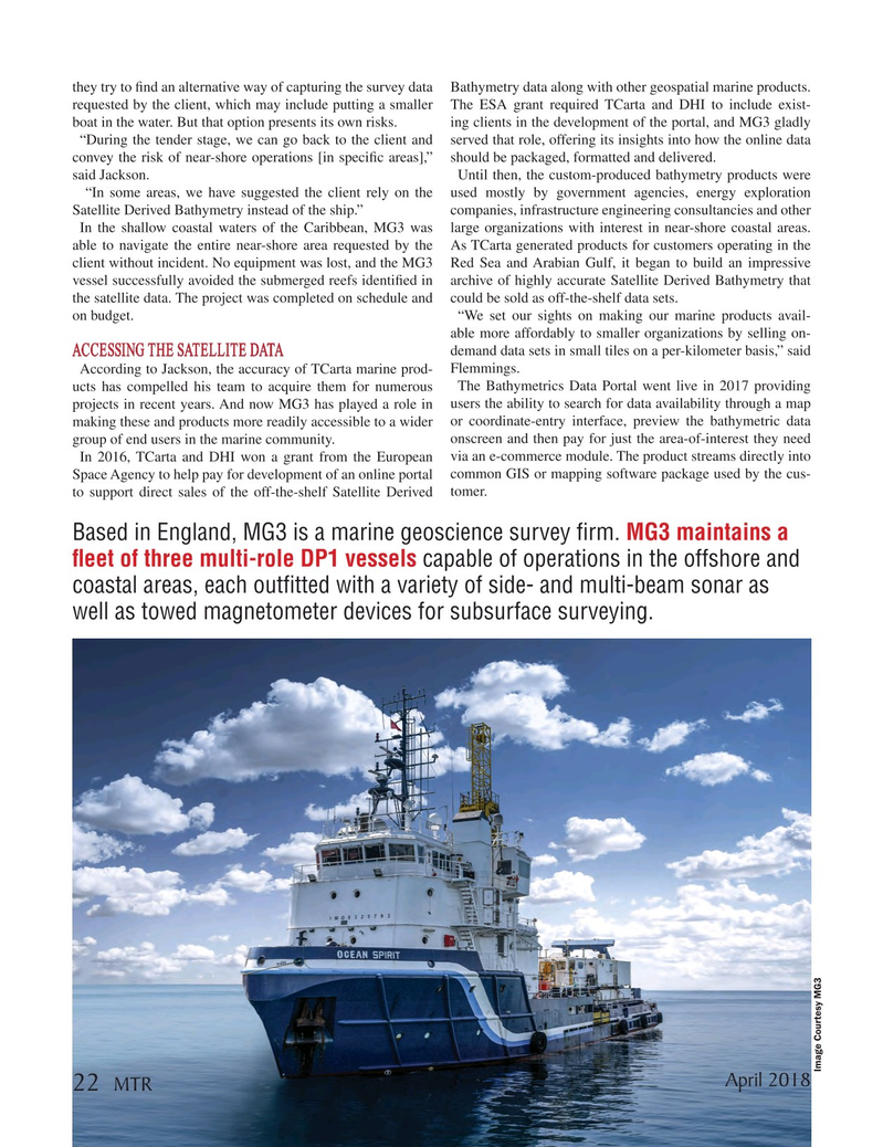
Based in England, MG3 is a marine geoscience survey ? rm. MG3 maintains a ? eet of three multi-role DP1 vessels capable of operations in the offshore and coastal areas, each out? tted with a variety of side- and multi-beam sonar as well as towed magnetometer devices for subsurface surveying.
Image Courtesy MG3
April 2018 22 MTR
MTR #3 (18-33).indd 22 MTR #3 (18-33).indd 22 4/6/2018 8:14:44 PM4/6/2018 8:14:44 PM