Page 52: of Marine Technology Magazine (Apr/May 2019)
Ocean Energy: Oil, Wind & Tidal
Read this page in Pdf, Flash or Html5 edition of Apr/May 2019 Marine Technology Magazine
 51
51
 53
53
ver the past 20 years, great strides have been made Sea? oor geodesy projects are underway across the globe, all in the ability to observe and monitor the worlds’ in pursuit of scienti? c advances that will help us crack the ocean. Just think that less than two decades ago, one code on earthquake and tsunami risk. The importance of this
Oof the ? rst global ocean observation networks, The research is to better understand and measure the offshore geo-
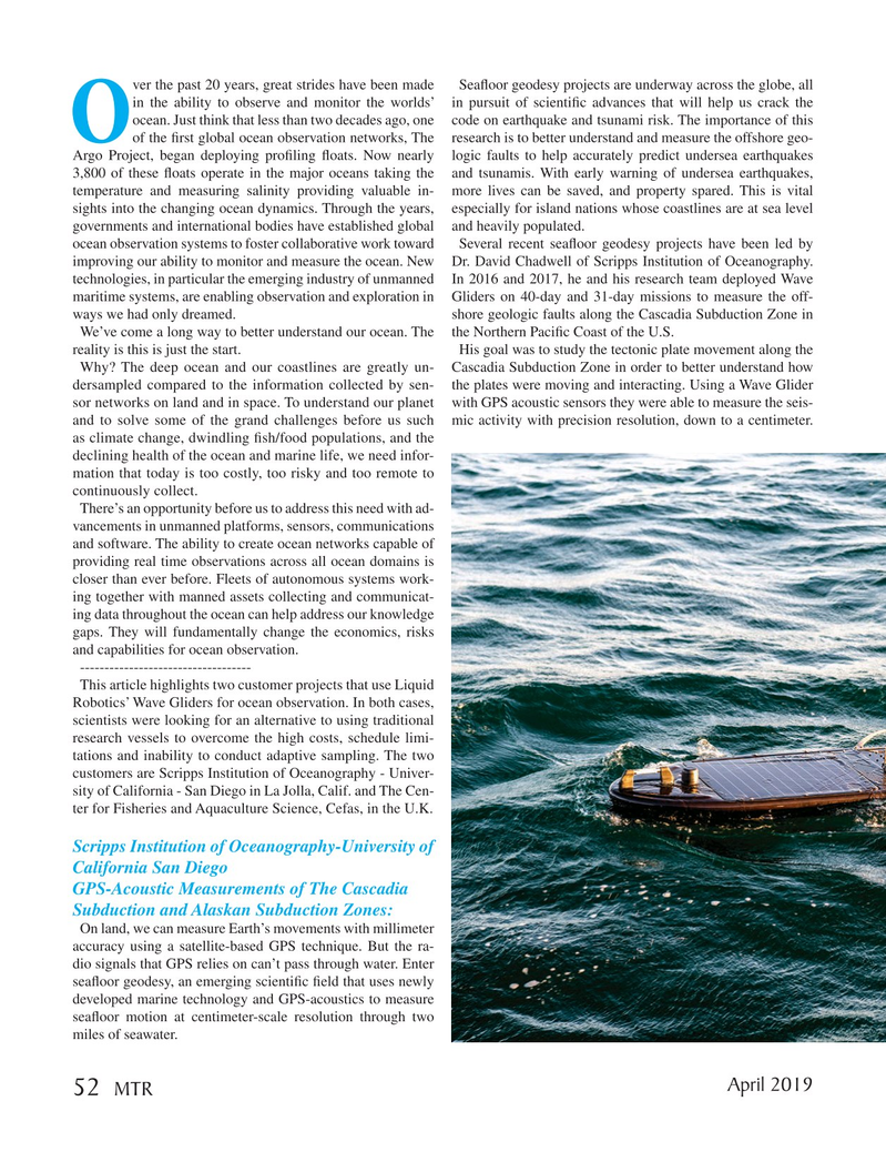
Argo Project, began deploying pro? ling ? oats. Now nearly logic faults to help accurately predict undersea earthquakes 3,800 of these ? oats operate in the major oceans taking the and tsunamis. With early warning of undersea earthquakes, temperature and measuring salinity providing valuable in- more lives can be saved, and property spared. This is vital sights into the changing ocean dynamics. Through the years, especially for island nations whose coastlines are at sea level governments and international bodies have established global and heavily populated. ocean observation systems to foster collaborative work toward Several recent sea? oor geodesy projects have been led by improving our ability to monitor and measure the ocean. New Dr. David Chadwell of Scripps Institution of Oceanography. technologies, in particular the emerging industry of unmanned In 2016 and 2017, he and his research team deployed Wave maritime systems, are enabling observation and exploration in Gliders on 40-day and 31-day missions to measure the off- ways we had only dreamed. shore geologic faults along the Cascadia Subduction Zone in
We’ve come a long way to better understand our ocean. The the Northern Paci? c Coast of the U.S. reality is this is just the start. His goal was to study the tectonic plate movement along the
Why? The deep ocean and our coastlines are greatly un- Cascadia Subduction Zone in order to better understand how dersampled compared to the information collected by sen- the plates were moving and interacting. Using a Wave Glider sor networks on land and in space. To understand our planet with GPS acoustic sensors they were able to measure the seis- and to solve some of the grand challenges before us such mic activity with precision resolution, down to a centimeter. as climate change, dwindling ? sh/food populations, and the declining health of the ocean and marine life, we need infor- mation that today is too costly, too risky and too remote to continuously collect.
There’s an opportunity before us to address this need with ad- vancements in unmanned platforms, sensors, communications and software. The ability to create ocean networks capable of providing real time observations across all ocean domains is closer than ever before. Fleets of autonomous systems work- ing together with manned assets collecting and communicat- ing data throughout the ocean can help address our knowledge gaps. They will fundamentally change the economics, risks and capabilities for ocean observation.
-----------------------------------
This article highlights two customer projects that use Liquid
Robotics’ Wave Gliders for ocean observation. In both cases, scientists were looking for an alternative to using traditional research vessels to overcome the high costs, schedule limi- tations and inability to conduct adaptive sampling. The two customers are Scripps Institution of Oceanography - Univer- sity of California - San Diego in La Jolla, Calif. and The Cen- ter for Fisheries and Aquaculture Science, Cefas, in the U.K.
Scripps Institution of Oceanography-University of
California San Diego
GPS-Acoustic Measurements of The Cascadia
Subduction and Alaskan Subduction Zones:
On land, we can measure Earth’s movements with millimeter accuracy using a satellite-based GPS technique. But the ra- dio signals that GPS relies on can’t pass through water. Enter sea? oor geodesy, an emerging scienti? c ? eld that uses newly developed marine technology and GPS-acoustics to measure sea? oor motion at centimeter-scale resolution through two miles of seawater.
April 2019 52
MTR
MTR #3 (50-63).indd 52 4/11/2019 2:26:23 PM