Page 14: of Marine Technology Magazine (Jun/Jul 2019)
Hydrographic Survey: Single & Multibeam Sonar
Read this page in Pdf, Flash or Html5 edition of Jun/Jul 2019 Marine Technology Magazine
 13
13
 15
15
Case Study Great Barrier Reef
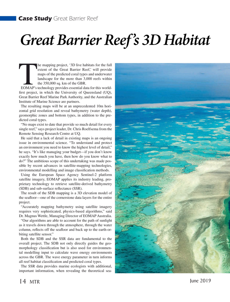
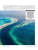
Great Barrier Reef’s 3D Habitat he mapping project, ‘3D live habitats for the full extent of the Great Barrier Reef,’ will provide maps of the predicted coral types and underwater landscape for the more than 3,000 reefs within
Tthe 350,000 sq. km of the GBR.
EOMAP’s technology provides essential data for this world- ? rst project, in which the University of Queensland (UQ),
Great Barrier Reef Marine Park Authority, and the Australian
Institute of Marine Science are partners.
The resulting maps will be at an unprecedented 10m hori- zontal grid resolution and reveal bathymetry (water depth), geomorphic zones and bottom types, in addition to the pre- dicted coral types.
“No maps exist to date that provide so much detail for every single reef,” says project leader, Dr. Chris Roelfsema from the
Remote Sensing Research Centre at UQ.
He said that a lack of detail in existing maps is an ongoing issue in environmental science. “To understand and protect an environment you need to know the highest level of detail,” he says. “It’s like managing your budget—if you don’t know exactly how much you have, then how do you know what to do?” The ambitious scope of this undertaking was made pos- sible by recent advances in satellite-mapping technologies, environmental modelling and image classi? cation methods.
Using the European Space Agency Sentinel-2 platform satellite imagery, EOMAP applies its industry leading, pro- prietary technology to retrieve satellite-derived bathymetry (SDB) and sub-surface re? ectance (SSR).
The result of the SDB mapping is a 3D elevation model of the sea? oor—one of the cornerstone data layers for the entire project.
“Accurately mapping bathymetry using satellite imagery requires very sophisticated, physics-based algorithms,” said
Dr. Magnus Wettle, Managing Director of EOMAP Australia.
“Our algorithms are able to account for the path of sunlight as it travels down through the atmosphere, through the water column, re? ects off the sea? oor and back up to the earth-or- biting satellite sensor.”
Both the SDB and the SSR data are fundamental to the overall project. The SDB not only directly guides the geo- morphology classi? cation but is also used for environmen- tal modelling input to calculate wave energy environments across the GBR. The wave energy parameter in turn informs all reef habitat classi? cation and predicted coral types.
The SSR data provides marine ecologists with additional, important information, when revealing the theoretical sea- June 2019 14
MTR
MTR #5 (1-17).indd 14 5/24/2019 9:38:43 AM