
Page 39: of Marine Technology Magazine (May/Jun 2024)
Read this page in Pdf, Flash or Html5 edition of May/Jun 2024 Marine Technology Magazine
 38
38
 40
40
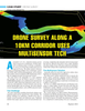
Visualization of the photogrammetry data of the corridor, processed with QGIS software.
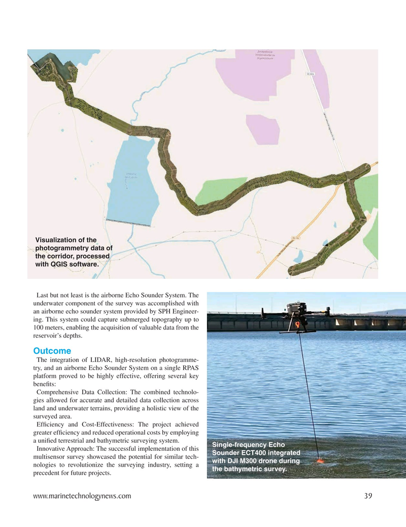
Last but not least is the airborne Echo Sounder System. The underwater component of the survey was accomplished with an airborne echo sounder system provided by SPH Engineer- ing. This system could capture submerged topography up to 100 meters, enabling the acquisition of valuable data from the reservoir’s depths.
Outcome
The integration of LIDAR, high-resolution photogramme- try, and an airborne Echo Sounder System on a single RPAS platform proved to be highly effective, offering several key bene? ts:
Comprehensive Data Collection: The combined technolo- gies allowed for accurate and detailed data collection across land and underwater terrains, providing a holistic view of the surveyed area.
Ef? ciency and Cost-Effectiveness: The project achieved greater ef? ciency and reduced operational costs by employing a uni? ed terrestrial and bathymetric surveying system.
Single-frequency Echo
Innovative Approach: The successful implementation of this
Sounder ECT400 integrated multisensor survey showcased the potential for similar tech- with DJI M300 drone during nologies to revolutionize the surveying industry, setting a the bathymetric survey. precedent for future projects.
www.marinetechnologynews.com 39
MTR #4 (34-47).indd 39 6/2/2024 11:47:30 AM