Page 51: of Maritime Logistics Professional Magazine (Q2 2014)
Maritime Risk & Shipping Finance
Read this page in Pdf, Flash or Html5 edition of Q2 2014 Maritime Logistics Professional Magazine
Navigation: an Evolving Landscape
At a recent meeting of maritime professionals, a Coast
Guard senior manager casually inquired as to what mariners thought were the most signifi cant changes on the waterways over the past 20 years. We thought the answer would be the introduction of GPS and other advances in electronic naviga- tion technology. To the contrary, the overwhelming response was that today’s ships are larger and beamier than 20 years ago, but the channel dimensions are the same, resulting in less maneuvering room and less margin for error. Overhead clear- ance, referred to at times as “air draft,” also has become more critical when transiting under bridges and overhead obstruc- tions – larger ships reducing draft for bottom clearance in- creases the vessel’s air draft. Traffi c volume has increased in some ports, particularly in larger ports and on the Mississippi
River System. Much of this increased traffi c involves hazard- ous cargo. The USATONS must keep pace with these changes and continue to keep our waterways safe for navigation by mitigating transit risks.
To meet these 21st century challenges, the Coast Guard, in consultation with our waterway partners and stakeholders, plans to enhance our current system with electronic aids to naviga- tion (ATON), improve the maintenance and logistics support, and improve our risk analysis. This will increase the reliability, availability, and effectiveness of the USATONS by continuing to employ the latest technology, such as e-Navigation compo- nents and improved maintenance procedures and tools.
Electronic navigation — also known as e-Navigation — technology is advancing at a remarkable pace.
All kinds of data are readily available on today’s bridge equipment on all size of vessels. By leveraging existing Na- tional Automatic Identifi cation System (NAIS) infrastructure, the Coast Guard is able to disseminate the most critical marine safety information directly to the mariner through existing nav- igation tools, such as Electronic Chart Display and Information
Systems (ECDIS) and AIS enhanced radar. There is also the possibility of web-based tools for less time-critical information.
Other types of NAIS delivered marine information include synthetic and virtual aids to navigation. A synthetic AIS
ATON is information transmitted from a remote base station
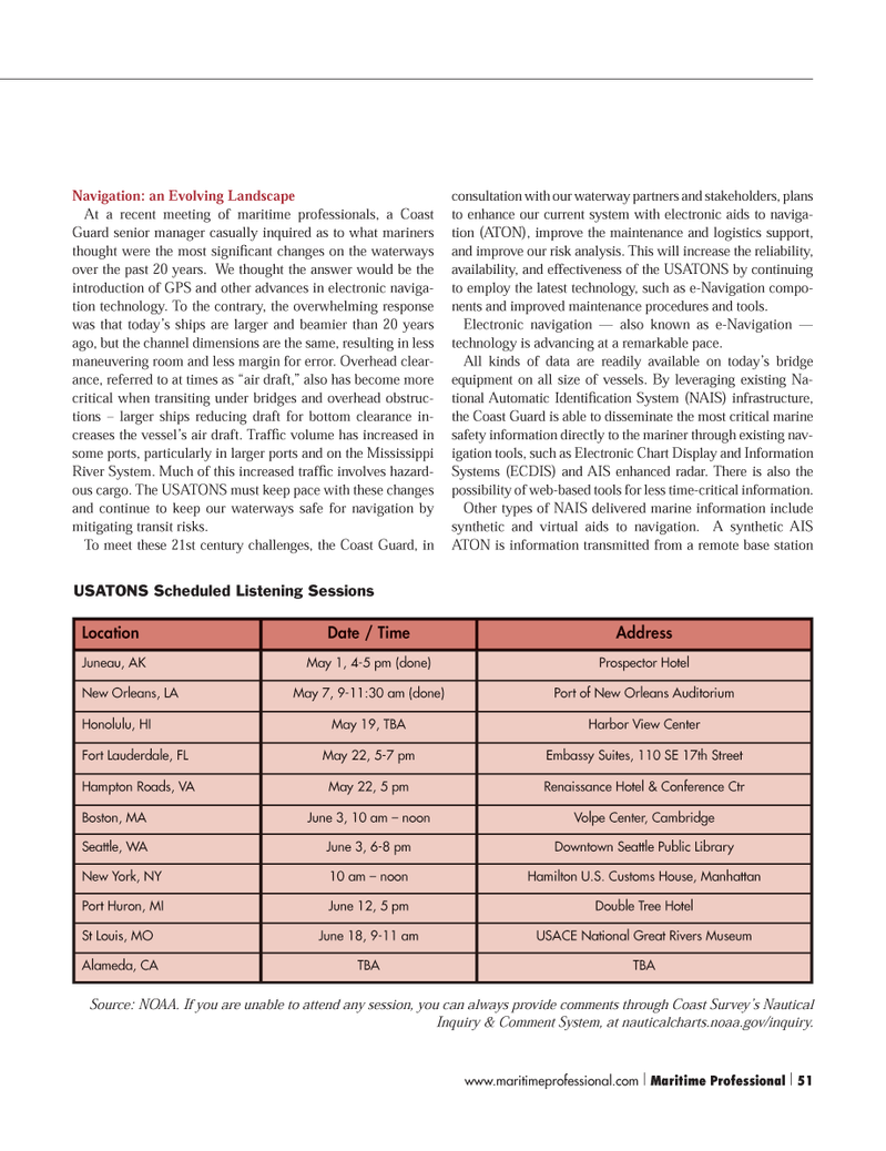
Location Date / Time Address
Juneau, AK May 1, 4-5 pm (done) Prospector Hotel
New Orleans, LA May 7, 9-11:30 am (done) Port of New Orleans Auditorium
Honolulu, HI May 19, TBA Harbor View Center
Fort Lauderdale, FL May 22, 5-7 pm Embassy Suites, 110 SE 17th Street
Hampton Roads, VA May 22, 5 pm Renaissance Hotel & Conference Ctr
Boston, MA June 3, 10 am – noon Volpe Center, Cambridge
Seattle, WA June 3, 6-8 pm Downtown Seattle Public Library
New York, NY 10 am – noon Hamilton U.S. Customs House, Manhattan
Port Huron, MI June 12, 5 pm Double Tree Hotel
St Louis, MO June 18, 9-11 am USACE National Great Rivers Museum
Alameda, CA TBA TBA
Source: NOAA. If you are unable to attend any session, you can always provide comments through Coast Survey’s Nautical
Inquiry & Comment System, at nauticalcharts.noaa.gov/inquiry.
USATONS Scheduled Listening Sessions www.maritimeprofessional.com | Maritime Professional | 51 50-63 Q2 MP2014.indd 51 5/16/2014 2:59:31 PM

 50
50

 52
52
