
Page 44: of Offshore Engineer Magazine (Sep/Oct 2014)
Read this page in Pdf, Flash or Html5 edition of Sep/Oct 2014 Offshore Engineer Magazine
 43
43
 45
45
Geology & Geophysics
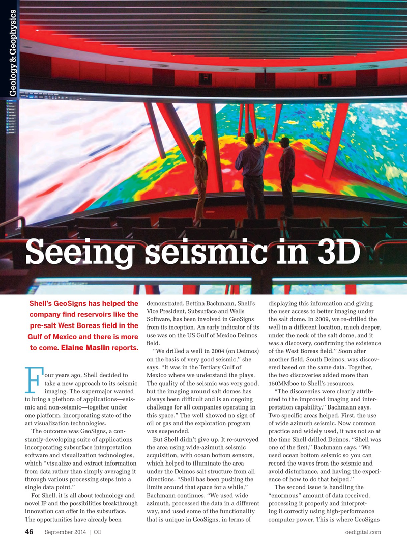
Seeing seismic in 3D demonstrated. Bettina Bachmann, Shell’s displaying this information and giving
Shell’s GeoSigns has helped the
Vice President, Subsurface and Wells the user access to better imaging under company fnd reservoirs like the
Software, has been involved in GeoSigns the salt dome. In 2009, we re-drilled the pre-salt West Boreas feld in the from its inception. An early indicator of its well in a different location, much deeper, use was on the US Gulf of Mexico Deimos under the neck of the salt dome, and it
Gulf of Mexico and there is more feld. was a discovery, confrming the existence to come. reports. Elaine Maslin “We drilled a well in 2004 (on Deimos) of the West Boreas feld.” Soon after on the basis of very good seismic,” she another feld, South Deimos, was discov- says. “It was in the Tertiary Gulf of ered based on the same data. Together, our years ago, Shell decided to Mexico where we understand the plays. the two discoveries added more than take a new approach to its seismic The quality of the seismic was very good, 150MMboe to Shell’s resources.
F “The discoveries were clearly attrib- but the imaging around salt domes has imaging. The supermajor wanted comes into its own, Bachmann says. “The uted to the improved imaging and inter- always been diffcult and is an ongoing to bring a plethora of applications—seis- challenge for us is the sheer amount of pretation capability,” Bachmann says. challenge for all companies operating in mic and non-seismic—together under data, which is diffcult to handle. An
Two specifc areas helped. First, the use this space.” The well showed no sign of one platform, incorporating state of the awful lot of it you don’t even want to of wide azimuth seismic. Now common oil or gas and the exploration program art visualization technologies. look at because it doesn’t add any value.” practice and widely used, it was not so at was suspended. The outcome was GeoSigns, a con- Through processing, about 60-70% of the time Shell drilled Deimos. “Shell was But Shell didn’t give up. It re-surveyed stantly-developing suite of applications the seismic data is discarded, with the one of the frst,” Bachmann says. “We the area using wide-azimuth seismic incorporating subsurface interpretation remainder worked into a fnal processed used ocean bottom seismic so you can acquisition, with ocean bottom sensors, software and visualization technologies, picture to hand over to the seismic record the waves from the seismic and which helped to illuminate the area which “visualize and extract information interpreters. avoid disturbance, and having the experi- under the Deimos salt structure from all from data rather than simply averaging it Selecting what data you want and ence of how to do that helped.” directions. “Shell has been pushing the through various processing steps into a then utilizing it and displaying it is key,
The second issue is handling the limits around that space for a while,” single data point.” Bachmann says. For example, GeoSigns
For Shell, it is all about technology and “enormous” amount of data received, Bachmann continues. “We used wide is able to display butterfy gathers so that novel IP and the possibilities breakthrough processing it properly and interpret- azimuth, processed the data in a different a viewer can look at different azimuths innovation can offer in the subsurface. ing it correctly using high-performance way, and used some of the functionality while keeping the view of the gathers
The opportunities have already been computer power. This is where GeoSigns that is unique in GeoSigns, in terms of intact, she says, giving the viewer access
September 2014 | OE oedigital.com 46 046_OE0914_G&G_Shell.indd 46 8/21/14 3:27 PM