Page 34: of Marine Technology Magazine (June 2006)
The MTR 200
Read this page in Pdf, Flash or Html5 edition of June 2006 Marine Technology Magazine
 33
33
 35
35
34 MTR June 2006 a Dynamically Focused Side Scan
System for C&C Technologies'
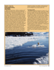
Hugin AUV, a Buried Object
Scanning Sonar (BOSS) System in conjunction with Florida Atlantic
University for the U.S. Navy, a com- bined Side Scan/Sub-Bottom System for SeaRobotics' USV-2600
Unmanned Surface Vehicle, and a side scan sonar system outfitted onto a U.S. Navy submarine for ice keel mapping.
ESRI (Environmental Systems
Research Insitute) 380 New York St., Redlands, CA 92373-8100
Tel: 909-798-1260 1-2641; Fax: 909-307-3051
E-mail: [email protected]
Internet: www.esri.com
President: Jack Dangermond
Vice President: Laura Dangermond
Marketing Director: Linda Hecht
Annual Sales (US$): $610 million
With annual sales of more than $600 million and offices in more than 80 countries, ESRI has been a leader in the geographic information system (GIS) software industry for more than 35 years.
ESRI offers innovative mapping technology solutions for a multitude of industries including maritime, from oceanography to hydrography, navigation to exploration, and from coastal shoreline to the bathymetric bottom. ESRI's software has been adapted and used to assist organiza- tions worldwide to achieve their goals.
Hydrographic mapping services use
GIS for complex projects such as charting seafloor topography.
ESRI has developed GIS software for mapping, charting and 3D visual- ization that allows for spatial analysis, modeling and ocean management.
ESRI's ArcGiOS software is capable of processing many types of data to create a wide range of representations.
Working with professionals in oceans, shoreline, and waterways industries, ESRI has joined in the development of data models for marine objects and phenomena data.
The ArcGIS marine Data Model rep- resents a new approach to spatial modeling that promotes better inte- gration of natural and manmade ocean features.
Farsounder 95 Hathaway Center, Suite 5 - Providence, RI 02907
Tel: 401-784-6700; Fax: 401-78-.6708
E-mail: [email protected]
Internet: www.farsounder.com
FarSounder looks ahead and dis- plays the seafloor and in-water obsta- cles in three dimensions. The entire 3-D image is created with a single ping, and is updated every 2 seconds.
Know the range, bearing and depth of all the obstacles ahead and to the side.
Technology Profile
The FS-3 is its flagship product, a 3D forward looking sonar designed as a surface ship navigation device capa- ble of detecting whales, shipping con- tainers, and other obstacles. The FS-3 is capable of generating a 3D depth map over its entire field-of-view with a single ping. The FS-3 operates at 60 kHz and has an accuracy of about 1.6 degrees. The FS-3 DT is one of
FarSounder's newest product which uses Dual Transmission technology.
Like the FS-3, it provides a 90 degree field-of-view depth map with a single ping. However, the FS-3 DT also includes a narrow beam 1/4 range mode. This Dual Transmission design can be configured to automatically switch between the standard 90 degree ping and the long range nar- row beam ping.
Falmouth Scientific, Inc.
Contact: Frances Lewis-Souza, Marketing Manager 1400 Route 28A. PO Box 315, Cataumet MA 02534 • Tel: 508-564-7640; Fax: 508-564-7643 * E-mail: [email protected]
CEO: John Baker Vice President: Rick Babicz Sales Manager: Jeff Bartkowski
Number of Employees: 28
Since 1989, Falmouth Scientific, Inc. has been a leader in the development and manufacturing of precision oceanographic instrumentation. FSI's full range of products is used around the world, in environments ranging from estuarine to full ocean depths. Core products include current meters, CTDs, profiling CTDs, wave gauges, AUVs and other oceanographic sensors. FSI also offers offshore acoustic instrumentation and leading edge special engineering capabilities to address a wide array of underwater applications.
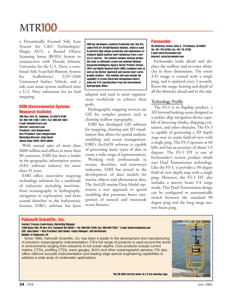
The 2D ACM current meter in a 5 ton mooring cage.
ESRI has developed a nautical Production Line Tool Set, called PLTS for ArcGIS-Nautical Solution, which is used to perform high volume production and maintenance of standard digital nautical chart databases from a vari- ety of sources. The solution includes desktop produc- tion tools to efficiently create and maintain National
Geospatial-Intelligence Agency Vector Product Format (VPF) and Digital Nautical Chart (DNC) compliant data as well as the Harbor Approach and Coastal chart carto- graphic product. This solution will soon include the capability to create Electronic Navigational Charts using the S-57 specifications from the International
Hydrographic Office.
MTR#5 (17-35)2.qxd 6/16/2006 11:22 AM Page 34