
Page 14: of Marine Technology Magazine (Jul/Aug 2007)
The MTR 100
Read this page in Pdf, Flash or Html5 edition of Jul/Aug 2007 Marine Technology Magazine
 13
13
 15
15
MTR100MTR100MTR100MTR100MTR100MTR100
CARIS 115 Waggoners Lane
Fredericton, NB
Canada E3B 2L4
Tel: 1-506-458-8533
Fax: 1-506-459-3849 www.caris.com
Email: [email protected]
CARIS develops and supports rig- orous, technologically advanced geo- matics software. Its systems give value to spatial data and empower cus- tomers with information that is meaningful. Providing software solu- tions to hydrographic and marine organizations since 1979, CARIS pioneered the use of geomatics tech- nology in this industry. In this time the company has gained a secure understanding of the daily opera- tions, technological needs, and chal- lenges faced by their maritime clien- tele. Their product line enables cus- tomers to input, create and manage, and deliver consistently reliable marine and hydrographic spatial data information and products.
CARIS marine and hydrographic software product line provides a com- plete Ping to Chart solution for all anticipated geospatial data collection, processing and production needs within the broad marine environ- ment. Applications include modules for the processing, presentation and cleaning of bathymetric data through to the creation, management and out- put of IHO S-57 compliant datasets in a database environment.
Some of the benefits of CARIS include but are not limited to hydro- graphic offices, navies, national chart- ing agencies, port and harbor author- ities, research institutions, dredging and underwater mining, exclusive economic zone management, coastal engineering and construction, oil and gas, and cable and pipeline route sur- veys. The company has grown to include offices in The Netherlands,
United States and Australia. CARIS employs more than 160 engineers, technologists, skilled technicians and trades people engaged in forward research, current development and support of its innovative products and systems. Expansion plans contin- ue as our client list continues to grow.
There are also more than 30 resellers bringing sales and support of CARIS brand software to more than 75 countries.
Technology Profile: The CARIS product line provides a complete 'Ping-to-Chart' solution from post- processing of bathymetric data to chart production, to spatial database management and production, through to Internet distribution.
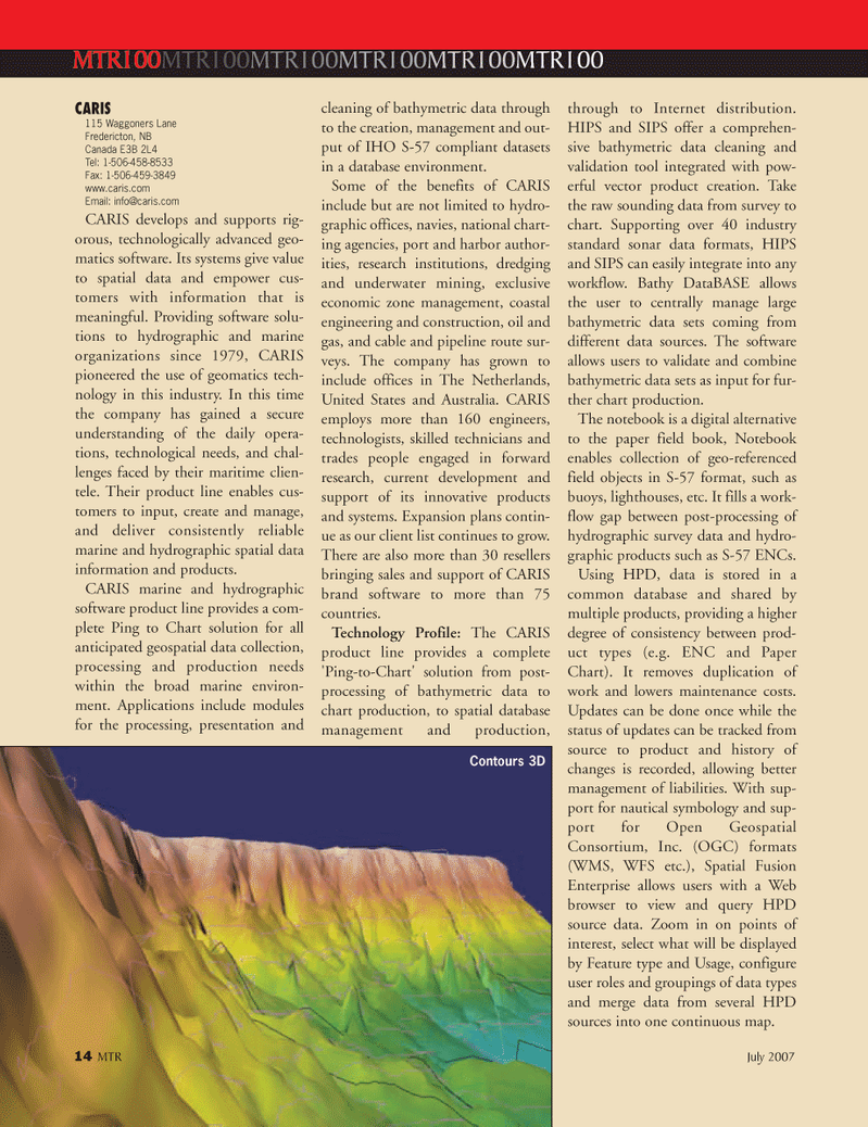
HIPS and SIPS offer a comprehen- sive bathymetric data cleaning and validation tool integrated with pow- erful vector product creation. Take the raw sounding data from survey to chart. Supporting over 40 industry standard sonar data formats, HIPS and SIPS can easily integrate into any workflow. Bathy DataBASE allows the user to centrally manage large bathymetric data sets coming from different data sources. The software allows users to validate and combine bathymetric data sets as input for fur- ther chart production.
The notebook is a digital alternative to the paper field book, Notebook enables collection of geo-referenced field objects in S-57 format, such as buoys, lighthouses, etc. It fills a work- flow gap between post-processing of hydrographic survey data and hydro- graphic products such as S-57 ENCs.
Using HPD, data is stored in a common database and shared by multiple products, providing a higher degree of consistency between prod- uct types (e.g. ENC and Paper
Chart). It removes duplication of work and lowers maintenance costs.
Updates can be done once while the status of updates can be tracked from source to product and history of changes is recorded, allowing better management of liabilities. With sup- port for nautical symbology and sup- port for Open Geospatial
Consortium, Inc. (OGC) formats (WMS, WFS etc.), Spatial Fusion
Enterprise allows users with a Web browser to view and query HPD source data. Zoom in on points of interest, select what will be displayed by Feature type and Usage, configure user roles and groupings of data types and merge data from several HPD sources into one continuous map. 14 MTR July 2007
Contours 3D
MTR#6 (1-16).qxd 7/16/2007 10:38 AM Page 16