
Page 41: of Marine Technology Magazine (July 2012)
MTR 100
Read this page in Pdf, Flash or Html5 edition of July 2012 Marine Technology Magazine
 40
40
 42
42
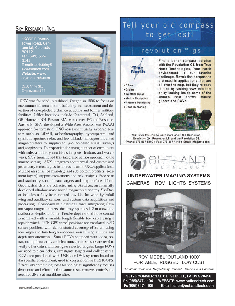
CAMERAS ROVLIGHTS SYSTEMS ROV, MODEL OUTLAND 1000? PORTABLE, RUGGED, LOW COST Thrusters: Brushless, Magnetically Coupled. Color & B&W Cameras38190 COMMERCIAL CT., SLIDELL, LA USA 70458 Ph (985)847-1104 WEBSITE: www.outlandtech.com Fx (985)847-1106 Email: [email protected] UNDERWATER IMAGING SYSTEMS SKY was founded in Ashland, Oregon in 1995 to focus on environmental remediation including the assessment and de- tection of unexploded ordnance at active and former military facilities. OfÞ ce locations include Centennial, CO, Ashland, OR, Hanover, NH, Boston, MA, Vancouver, BC and Brisbane, Australia. SKY developed a Wide Area Assessment (WAA) approach for terrestrial UXO assessment using airborne sen-sors such as LiDAR, orthophotography, hyperspectral and synthetic aperture radar, and low-altitude helicopter-mounted magnetometers to supplement ground-based visual surveys and geophysics. To respond to the rising number of encounters with subsea military munitions in ports, harbors and water- ways, SKY transitioned this integrated sensor approach to the marine setting. SKY integrates commercial and customized proprietary technologies to address marine UXO applications. Multibeam sonar (bathymetry) and sub-bottom proÞ lers (sedi- ment layers) support excavations and risk analysis. Side scan and stationary sonar locate targets and map surface debris. Geophysical data are collected using SkyDiver, an internally developed ultralow-noise towed magnetometer array. SkyDiv- er includes a fully-instrumented tow kit, 4m wide hydrofoil wing and auxiliary sensors, and custom data acquisition and processing. Composed of closed-cell foam integrating Cesi- um-vapor magnetometers, the array operates 1-2 m above the seaß oor at depths to 35 m. Precise depth and altitude control is achieved with a variable length ß exible tow cable using a topside winch. RTK-GPS vessel positions are translated to 3D sensor positions with demonstrated accuracy of 25 cm using tow angle and line length encoders, vessel/wing attitude and depth measurements. Small ROVs equipped with video, so- nar, manipulator arms and electromagnetic sensors are used to verify other data and investigate selected targets. Large ROVs are used to clear debris, investigate targets and collect items. ROVs are positioned with USBL or DVL systems based on the speciÞ c environment, used in conjunction with RTK-GPS. Effectively combining these technologies signiÞ cantly focuses diver time and effort, and in some cases removes entirely the need for divers at munitions sites. SKY RESEARCH, INC.SKY RESEARCH, INC.12850 E Control 12850 E Control Tower Road, Cen- Tower Road, Cen- tennial, Colorado tennial, Colorado 80112 80112 Tel: (541) 552- Tel: (541) 552- 5141 5141 E-mail: Jack.foley@ E-mail: Jack.foley@ skyresearch.com skyresearch.com Website: www. Website: www. skyresearch.com skyresearch.com CEO: Anne Sky Employees: 144 www.seadiscovery.com MTR #6 (34-49).indd 41MTR #6 (34-49).indd 418/1/2012 3:21:40 PM8/1/2012 3:21:40 PM