
Page 41: of Marine Technology Magazine (April 2013)
Offshore Energy Report
Read this page in Pdf, Flash or Html5 edition of April 2013 Marine Technology Magazine
 40
40
 42
42
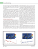
inside the strongest wind zones as possible. A standard pilot- ing procedure is to decide a destiny waypoint and a corridor width that depends on the sea and wind conditions. The cor- ridor width is the SailBuoy?s horizontal deviation along the ideal straight line track.A standard value of 10 km radius is used allowing SB02 to sail diagonally from the ideal track, having space to manoeu- vre and not forcing her to tackle so often, saving power. This value should be reduced when crossing a dangerous zone, to keep tight the path. On daily basis, checking the SailBuoys status (GPS location and sensors output values), wind forecast maps and marine traf c are the must-do tasks. The wind maps will give an ap- proximation of how SailBuoy will behave, and if the Way- point should change according to wind forecast. Sometimes is not possible to avoid shipping lanes, but one should try to predict traf c densities and cross the lane in the hours when there is the least amount of traf c. If it is necessary to change the waypoint or the radius, the commands are also sent via this web interface. Finally, data is displayed on a table for NRT analysis, but it can be easily downloaded and imported to any data processing software tool. ConclusionsA SailBuoy unit has been tested for rst time in subtropical latitudes with successful results in operational and scienti c terms. Sea-state conditions along the mission were highly variable, from calm to Beaufort 7 and Douglas 5, enabling to test the vehicle in different work-sailing scenarios. Biofouling effect was an issue to consider only in few and speci c hull places. Piloting tasks were easy and successfully performed despite marine traf c density at certain times and opposite sea-state conditions when calm. Gathered scienti c data al- lowed to clearly identify the startup of the decline in the an- nual temperature pattern, while identify monitoring synergies between autonomous platforms in ocean observatories as is ESTOC, with special relevance in terms of surface and un- derwater unmanned vehicles. SailBuoy can be considered an ef cient, rugged and affordable device for autonomous in-situ and real-time surface ocean monitoring. Baseline partnership collaboration between CMR and PLOCAN through SB02 mission has been mutually helpful and successful for both sides.Acknowledgments The authors want to truly acknowledge all institutions, companies and people involved in this challenging mission, with special mention to the EU-FP7 Program for funding the GROOM project within this mission has been partially carried out. Also to thank technological partners like Gra nta SA for their support and collaboration. A special mention also to Las Palmas and Tenerife Harbourmasters authorizing the mission performance across to the described Canarian waters. CAMERAS ROVLIGHTS SYSTEMS ROV, MODEL OUTLAND 1000? PORTABLE, RUGGED, LOW COST Thrusters: Brushless, Magnetically Coupled. Color & B&W Cameras38190 COMMERCIAL CT., SLIDELL, LA USA 70458 Ph (985)847-1104 WEBSITE: www.outlandtech.com Fx (985)847-1106 Email: [email protected] UNDERWATER IMAGING SYSTEMS www.seadiscovery.com MTR #3 (34-49).indd 41MTR #3 (34-49).indd 414/4/2013 9:24:46 AM4/4/2013 9:24:46 AM