Page 28: of Marine Technology Magazine (January 2015)
Underwater Vehicle Annual: ROV, AUV, and UUVs
Read this page in Pdf, Flash or Html5 edition of January 2015 Marine Technology Magazine
 27
27
 29
29
Arctic make the process of accurately interpreting the data dif? cult. tists who successfully produced the world’s ? rst detailed, high-
Now, with the rise of Autonomous Underwater Vehicles resolution 3-D maps of Antarctic sea ice using an AUV devel- (AUVs) for polar applications, scientists are able to gain ac- oped and operated by the Woods Hole Oceanography Institution cess to remote areas previously inaccessible. The AUVs abil- (WHOI). While there has been studies mapping ice shelves us- ity to operate autonomously makes them well-suited to the ing AUVs, none before targeting sea-ice. The new technology exploration of extreme environments. provided accurate measurements of ice thickness from areas
Over the last decade, AUVs have been successfully used that were previously too dif? cult to access. The project set the worldwide for long ranging, open ocean data collection mis- pace of research in the Polar Regions aimed at understanding sions. While they would be useful tools for polar scientists, the dramatic sea ice changes in the context of climate change. the use of the technology in these environments come with a “Previous attempts to estimate the thickness of Antarctic sea number of engineering challenges, ? nancial risks and opera- ice relied on visual observations and manual drilling - both of tional dif? culties. which are suspected to be biased to thin ice. The AUV returns “Recovery in open water is pretty straight forward - if there the entire thickness distribution for the sea ice ? oes near the is a problem, send the vehicle to the surface,” explains Dr. ship - and a richness of data on the morphology of the sea ice
Guy Williams, of the Institute of Marine and Antarctic Stud- in unprecedented detail,” said Dr. Williams.
ies. “However, under sea ice, returning to the surface is impos- Operating at 20-30m depth, the AUV was ? tted with an up- sible. In addition, unknown bathymetry, icebergs and ocean ward-looking sonar in order to measure and map the underside currents, are all additional hazards that play on the risk versus of sea ice ? oes. Lines of data in a lawnmower pattern were reward assessment for AUVs in Polar Regions. In addition, merged to form high-resolution 3D bathymetric surveys of the the larger AUV deployments tend to dominate the logistics of underside of the ice. The combination of airborne measure- any voyage they are participating in. When the long range ve- ments of sea-ice surface elevation, ice coring surveys, satellite hicles are in the water, there is often not a lot of other marine observations and data from the AUV (called Jaguar), vastly science that can occur until it has safely returned.” improves scientists’ estimates of ice thickness and total sea
Dr. Williams was part of the international team of polar scien- ice volume.
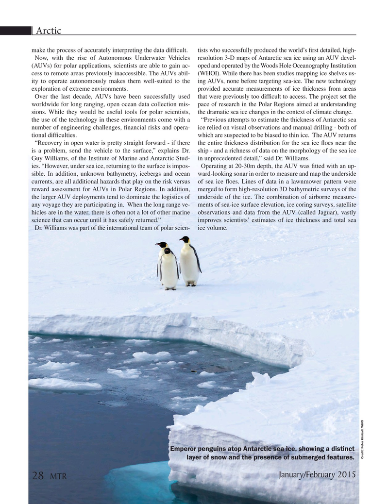
Emperor penguins atop Antarctic sea ice, showing a distinct
Credit: Peter Kimball, WHOI layer of snow and the presence of submerged features.
January/February 2015 28 MTR
MTR #1 (18-33).indd 28 MTR #1 (18-33).indd 28 2/2/2015 3:18:59 PM2/2/2015 3:18:59 PM