
Page 28: of Marine Technology Magazine (March 2016)
Oceanographic Instrumentation: Measurement, Process & Analysis
Read this page in Pdf, Flash or Html5 edition of March 2016 Marine Technology Magazine
 27
27
 29
29
Sea? oor Mapping
Evolution of Ocean Exploration
Mapping the Sea? oor with Geodesy
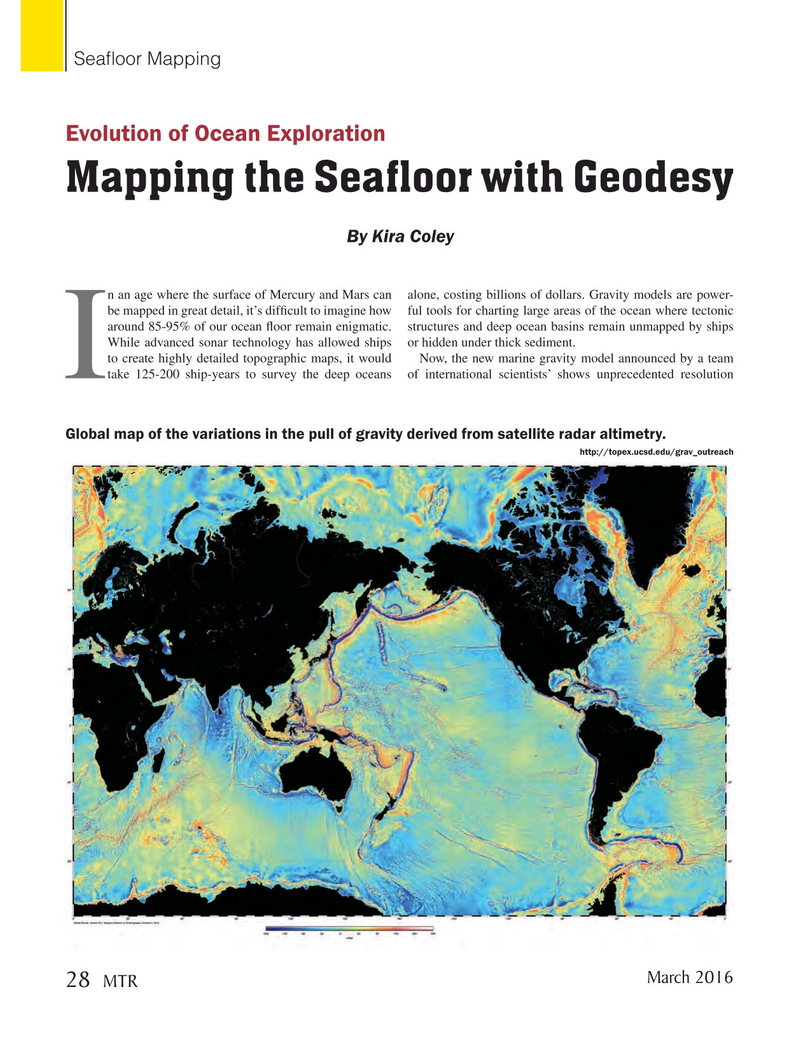
By Kira Coley n an age where the surface of Mercury and Mars can alone, costing billions of dollars. Gravity models are power- be mapped in great detail, it’s dif? cult to imagine how ful tools for charting large areas of the ocean where tectonic around 85-95% of our ocean ? oor remain enigmatic. structures and deep ocean basins remain unmapped by ships
While advanced sonar technology has allowed ships or hidden under thick sediment. to create highly detailed topographic maps, it would Now, the new marine gravity model announced by a team
Itake 125-200 ship-years to survey the deep oceans of international scientists’ shows unprecedented resolution
Global map of the variations in the pull of gravity derived from satellite radar altimetry. http://topex.ucsd.edu/grav_outreach
March 2016 28
MTR
MTR #2 (18-33).indd 28 2/19/2016 11:16:49 AM