Page 12: of Marine Technology Magazine (September 2017)
Ocean Observation: Gliders, Buoys & Sub-Surface Networks
Read this page in Pdf, Flash or Html5 edition of September 2017 Marine Technology Magazine
 11
11
 13
13
Insights
Digital Transformation of
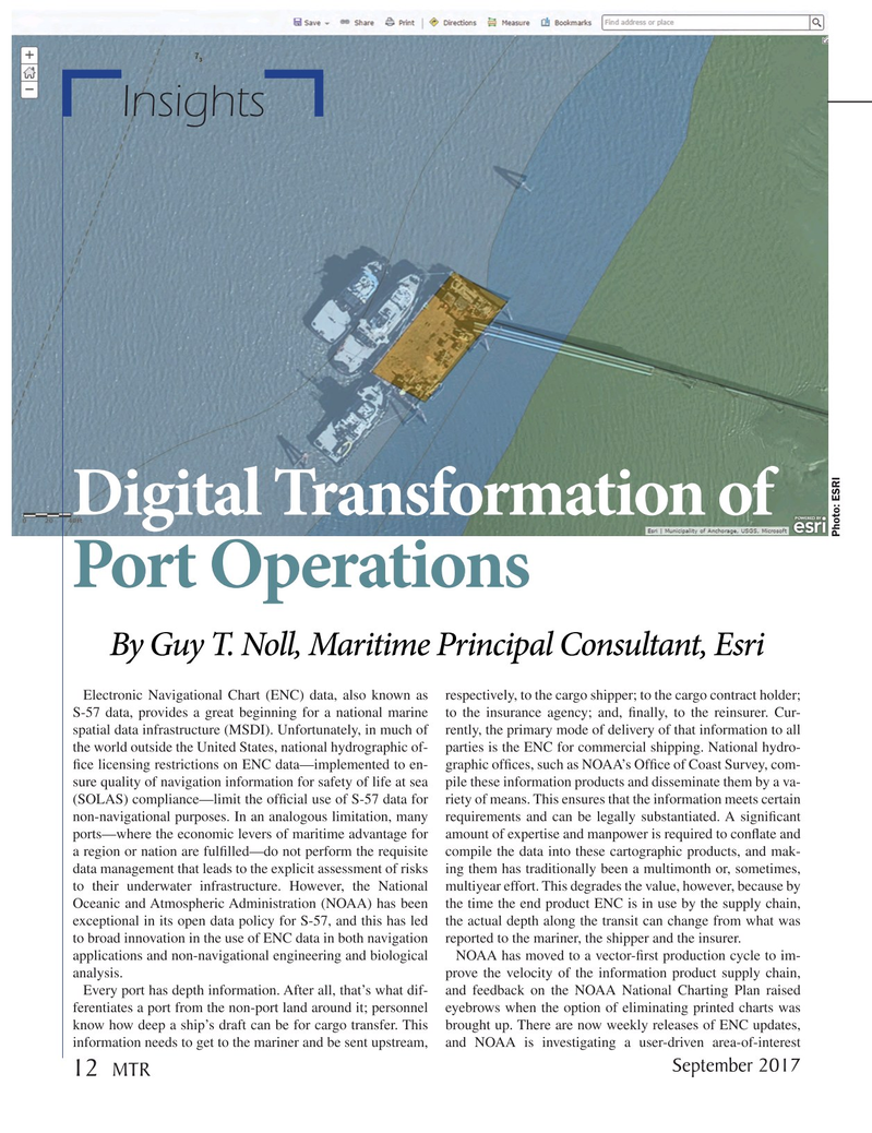
Photo: ESRI
Port Operations
By Guy T. Noll, Maritime Principal Consultant, Esri
Electronic Navigational Chart (ENC) data, also known as respectively, to the cargo shipper; to the cargo contract holder;
S-57 data, provides a great beginning for a national marine to the insurance agency; and, ? nally, to the reinsurer. Cur- spatial data infrastructure (MSDI). Unfortunately, in much of rently, the primary mode of delivery of that information to all the world outside the United States, national hydrographic of- parties is the ENC for commercial shipping. National hydro- ? ce licensing restrictions on ENC data—implemented to en- graphic of? ces, such as NOAA’s Of? ce of Coast Survey, com- sure quality of navigation information for safety of life at sea pile these information products and disseminate them by a va- (SOLAS) compliance—limit the of? cial use of S-57 data for riety of means. This ensures that the information meets certain non-navigational purposes. In an analogous limitation, many requirements and can be legally substantiated. A signi? cant ports—where the economic levers of maritime advantage for amount of expertise and manpower is required to con? ate and a region or nation are ful? lled—do not perform the requisite compile the data into these cartographic products, and mak- data management that leads to the explicit assessment of risks ing them has traditionally been a multimonth or, sometimes, to their underwater infrastructure. However, the National multiyear effort. This degrades the value, however, because by
Oceanic and Atmospheric Administration (NOAA) has been the time the end product ENC is in use by the supply chain, exceptional in its open data policy for S-57, and this has led the actual depth along the transit can change from what was to broad innovation in the use of ENC data in both navigation reported to the mariner, the shipper and the insurer. applications and non-navigational engineering and biological NOAA has moved to a vector-? rst production cycle to im- analysis. prove the velocity of the information product supply chain,
Every port has depth information. After all, that’s what dif- and feedback on the NOAA National Charting Plan raised ferentiates a port from the non-port land around it; personnel eyebrows when the option of eliminating printed charts was know how deep a ship’s draft can be for cargo transfer. This brought up. There are now weekly releases of ENC updates, information needs to get to the mariner and be sent upstream, and NOAA is investigating a user-driven area-of-interest 2017 September 12 MTR
MTR #7 (1-17).indd 12 MTR #7 (1-17).indd 12 8/24/2017 11:48:58 AM8/24/2017 11:48:58 AM