
Page 15: of Marine Technology Magazine (September 2017)
Ocean Observation: Gliders, Buoys & Sub-Surface Networks
Read this page in Pdf, Flash or Html5 edition of September 2017 Marine Technology Magazine
 14
14
 16
16
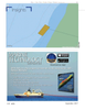
ENC portrayal of dock without imagery—note the lack of mooring “dolphins.” would be updated. This then would afford a competitive ad- vantage to the port’s operational infrastructure. Simultane-
A port may have a few surveys from past dredging proj- ously, it would increase the value of the MSDI that NOAA ects—maybe from pier reconstructions—in formats such contributes to the national Blue Economy along with the river as comma-separated variable (CSV) text, spreadsheets, infrastructure maintained by the U.S. Army Corps of Engi-
ASCII XYZ, AutoCAD or Terramodel format. As foundation- neers, the highway infrastructure maintained by state depart- al datasets, these surveys need some descriptive text— ments of transportation and the aviation infrastructure main- such as the date of data acquisition, who did the survey- tained by the Federal Aviation Administration and airports. ing and what kinds of instrument and positioning were
A centralized geographic information system (GIS) can used—to become informative and retain value over time. share compiled ENC information while maintaining the se-
Of course, vertical and horizontal reference points for the curity of underlying data, thus ensuring that vector informa- data are needed, too. If these points are all converted to tion can be used for nonnavigational purposes and not in chart a point cloud of XYZ and a grid is created from that cloud, compilation. GIS allows the authoritative output of the hy- when this data is combined with the attributed metadata, drographic of