Page 41: of Marine Technology Magazine (September 2017)
Ocean Observation: Gliders, Buoys & Sub-Surface Networks
Read this page in Pdf, Flash or Html5 edition of September 2017 Marine Technology Magazine
Image courtesy of SLB
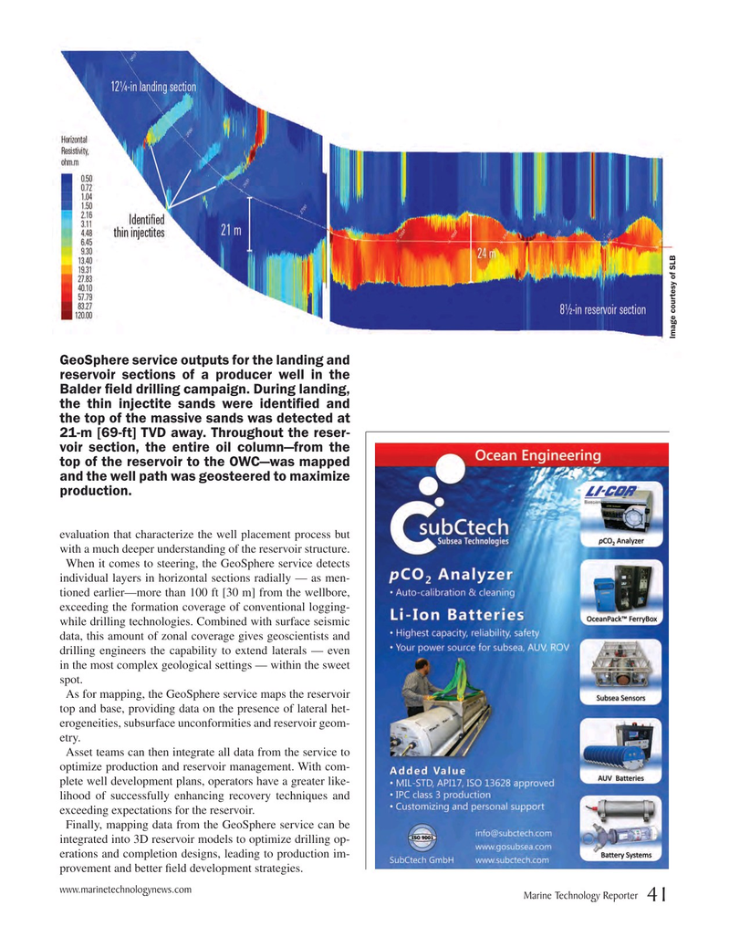
GeoSphere service outputs for the landing and reservoir sections of a producer well in the
Balder ? eld drilling campaign. During landing, the thin injectite sands were identi? ed and the top of the massive sands was detected at 21-m [69-ft] TVD away. Throughout the reser- voir section, the entire oil column—from the top of the reservoir to the OWC—was mapped and the well path was geosteered to maximize production. evaluation that characterize the well placement process but with a much deeper understanding of the reservoir structure.
When it comes to steering, the GeoSphere service detects individual layers in horizontal sections radially — as men- tioned earlier—more than 100 ft [30 m] from the wellbore, exceeding the formation coverage of conventional logging- while drilling technologies. Combined with surface seismic data, this amount of zonal coverage gives geoscientists and drilling engineers the capability to extend laterals — even in the most complex geological settings — within the sweet spot.
As for mapping, the GeoSphere service maps the reservoir top and base, providing data on the presence of lateral het- erogeneities, subsurface unconformities and reservoir geom- etry.
Asset teams can then integrate all data from the service to optimize production and reservoir management. With com- plete well development plans, operators have a greater like- lihood of successfully enhancing recovery techniques and exceeding expectations for the reservoir.
Finally, mapping data from the GeoSphere service can be integrated into 3D reservoir models to optimize drilling op- erations and completion designs, leading to production im- provement and better

 40
40

 42
42
