
Page 21: of Marine Technology Magazine (April 2018)
Offshore Geophysical
Read this page in Pdf, Flash or Html5 edition of April 2018 Marine Technology Magazine
 20
20
 22
22
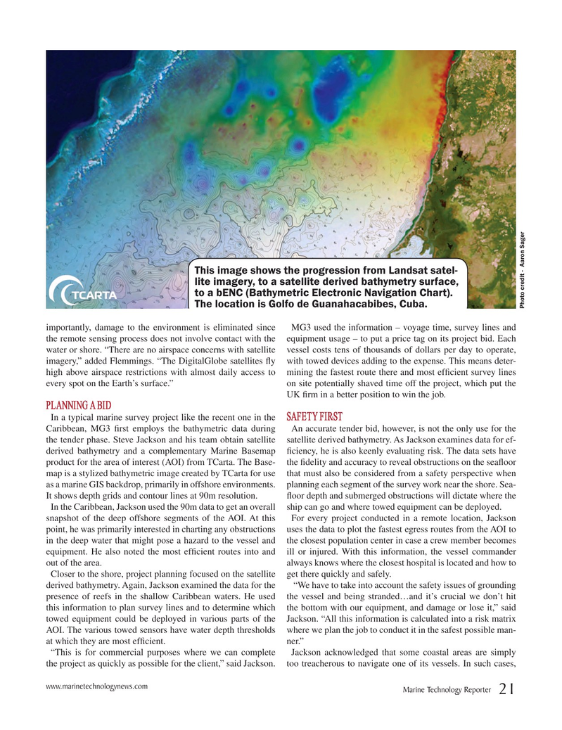
This image shows the progression from Landsat satel- lite imagery, to a satellite derived bathymetry surface, to a bENC (Bathymetric Electronic Navigation Chart).
The location is Golfo de Guanahacabibes, Cuba.
Photo credit - Aaron Sager importantly, damage to the environment is eliminated since MG3 used the information – voyage time, survey lines and the remote sensing process does not involve contact with the equipment usage – to put a price tag on its project bid. Each water or shore. “There are no airspace concerns with satellite vessel costs tens of thousands of dollars per day to operate, imagery,” added Flemmings. “The DigitalGlobe satellites