Page 54: of Marine Technology Magazine (October 2018)
Ocean Observation: Gliders, Buoys & Sub-Surface Networks
Read this page in Pdf, Flash or Html5 edition of October 2018 Marine Technology Magazine
 53
53
 55
55
New Tech
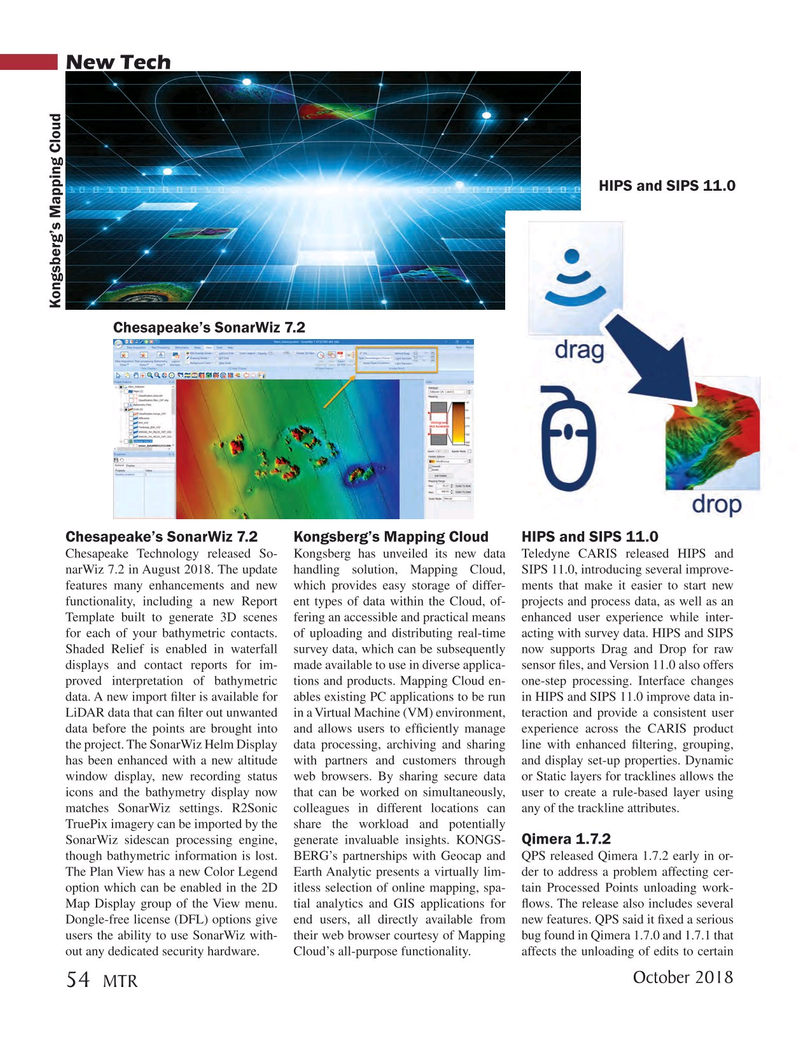
HIPS and SIPS 11.0
Kongsberg’s Mapping Cloud
Chesapeake’s SonarWiz 7.2
Chesapeake’s SonarWiz 7.2 Kongsberg’s Mapping Cloud HIPS and SIPS 11.0
Chesapeake Technology released So- Kongsberg has unveiled its new data Teledyne CARIS released HIPS and narWiz 7.2 in August 2018. The update handling solution, Mapping Cloud, SIPS 11.0, introducing several improve- features many enhancements and new which provides easy storage of differ- ments that make it easier to start new functionality, including a new Report ent types of data within the Cloud, of- projects and process data, as well as an
Template built to generate 3D scenes fering an accessible and practical means enhanced user experience while inter- for each of your bathymetric contacts. of uploading and distributing real-time acting with survey data. HIPS and SIPS
Shaded Relief is enabled in waterfall survey data, which can be subsequently now supports Drag and Drop for raw displays and contact reports for im- made available to use in diverse applica- sensor ? les, and Version 11.0 also offers proved interpretation of bathymetric tions and products. Mapping Cloud en- one-step processing. Interface changes data. A new import ? lter is available for ables existing PC applications to be run in HIPS and SIPS 11.0 improve data in-
LiDAR data that can ? lter out unwanted in a Virtual Machine (VM) environment, teraction and provide a consistent user data before the points are brought into and allows users to ef? ciently manage experience across the CARIS product the project. The SonarWiz Helm Display data processing, archiving and sharing line with enhanced ? ltering, grouping, has been enhanced with a new altitude with partners and customers through and display set-up properties. Dynamic window display, new recording status web browsers. By sharing secure data or Static layers for tracklines allows the icons and the bathymetry display now that can be worked on simultaneously, user to create a rule-based layer using matches SonarWiz settings. R2Sonic colleagues in different locations can any of the trackline attributes.
TruePix imagery can be imported by the share the workload and potentially
SonarWiz sidescan processing engine, generate invaluable insights. KONGS- Qimera 1.7.2 though bathymetric information is lost. BERG’s partnerships with Geocap and QPS released Qimera 1.7.2 early in or-
The Plan View has a new Color Legend Earth Analytic presents a virtually lim- der to address a problem affecting cer- option which can be enabled in the 2D itless selection of online mapping, spa- tain Processed Points unloading work-
Map Display group of the View menu. tial analytics and GIS applications for ? ows. The release also includes several
Dongle-free license (DFL) options give end users, all directly available from new features. QPS said it ? xed a serious users the ability to use SonarWiz with- their web browser courtesy of Mapping bug found in Qimera 1.7.0 and 1.7.1 that out any dedicated security hardware. Cloud’s all-purpose functionality. affects the unloading of edits to certain
October 2018 54
MTR
MTR #8 (50-63).indd 54 MTR #8 (50-63).indd 54 9/26/2018 4:52:34 PM9/26/2018 4:52:34 PM